Centreville in Queen Anne's County, Maryland — The American Northeast (Mid-Atlantic)
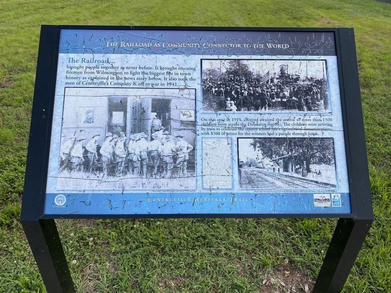
The Railroad as Community Connector to the World
Centreville Heritage Trail
Inscription.
The Railroad
brought people together as never before. It brought rescuing firemen from Wilmington to fight the biggest fire in town history as explained in the news story below. It also took the men of Centreville's Company K off to war in 1941.
On this spot in 1914, citizens awaited the arrival of more than 1500 children from across the Delmarva region. The children were arriving by train to celebrate the county school fair's agricultural demonstrations, with $500 in prizes for the winners and a parade through town.
Erected by Town of Centreville.
Topics. This historical marker is listed in these topic lists: Agriculture • Disasters • Railroads & Streetcars • War, World II.
Location. 39° 2.572′ N, 76° 3.763′ W. Marker is in Centreville, Maryland, in Queen Anne's County. Marker is on E Water Street (Maryland Route 304), on the left when traveling west. Touch for map. Marker is at or near this postal address: 210 E Water Street, Centreville MD 21617, United States of America. Touch for directions.
Other nearby markers. At least 8 other markers are within walking distance of this marker. Connecting Centreville to the Worlds of Commerce Beyond the Eastern Shore (here, next to this marker); Carmichael House (about 400 feet away, measured in a direct line); Site of Goldsborough House (about 500 feet away); The Railroad as the Backbone of Centreville's 20th Century Commerce (about 700 feet away); Wright’s Chance (approx. 0.2 miles away); Centrally Located (approx. 0.2 miles away); a different marker also named Wright's Chance (approx. 0.2 miles away); William Harper, Sr. Houses (approx. 0.2 miles away). Touch for a list and map of all markers in Centreville.
Regarding The Railroad as Community Connector to the World. Modern news article about the 1902 fire mentioned on the marker:
https://www.cecildaily.com/news/state_news/remembering-the-great-centreville-fire-of-1902/article_1de4654a-3b11-11e2-9a94-001a4bcf887a.html
Credits. This page was last revised on June 30, 2022. It was originally submitted on June 27, 2022, by Pete Skillman of Townsend, Delaware. This page has been viewed 67 times since then and 8 times this year. Photos: 1, 2. submitted on June 27, 2022, by Pete Skillman of Townsend, Delaware. • Bill Pfingsten was the editor who published this page.

