Centreville in Queen Anne's County, Maryland — The American Northeast (Mid-Atlantic)
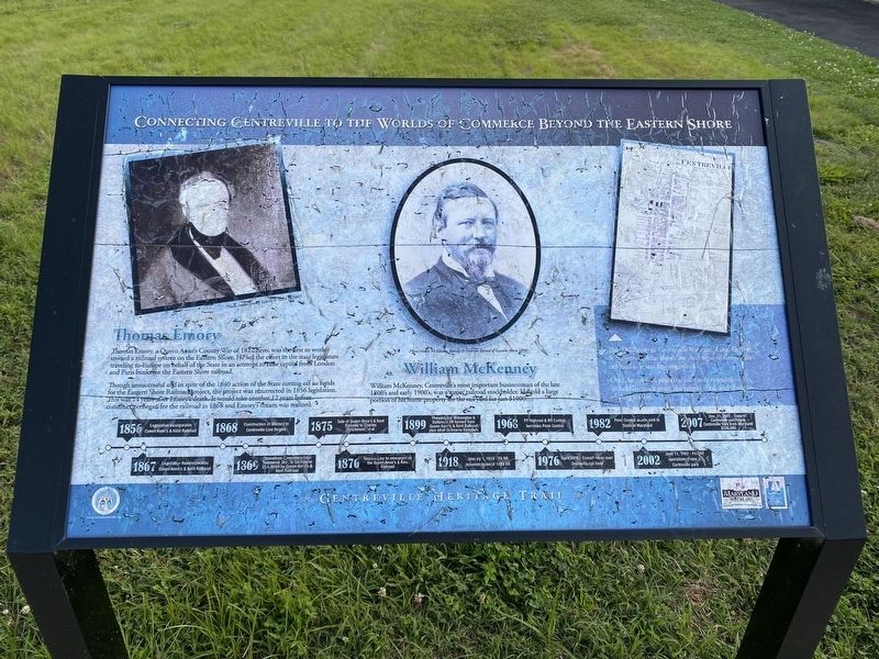
Connecting Centreville to the Worlds of Commerce Beyond the Eastern Shore
Centreville Heritage Trail
Inscription.
Thomas Emory
Thomas Emory, a Queen Anne's County War of 1812 hero, was the first to work toward a railroad system on the Eastern Shore. He led the effort in the state legislature traveling to Europe on behalf of the State in an attempt to raise capital from London and Paris banks for the Eastern Shore railroad.
Though unsuccessful and in spite of the 1840 action of the State cutting off all funds for the Eastern Shore Railroad project, the project was resurrected in 1856 legislation. This was 14 years after Emory's death. It would take another 12 years before construction began for the railroad in 1868 and Emory's dream was realized.
William McKenney
William McKenney, Centreville's most important businessman of the late 1800's and early 1900's, was a major railroad stockholder. He sold a large portion of his home property for the rail yard for just $1000.
Caption on the right:
This 1877 map of Centreville from the Lake, Griffing & Stevenson Atlas shows the first signs of Centreville's rail yard as it was first organized.
Over the next 40 years the rail yard expanded to include livestock pens, the freight shed, and the dairy cooling station.
Timeline on the bottom:
1856 - Legislation Incorporates Queen Anne's & Kent Railroad
1867 - Legislation Reincorporates Queen Anne's & Kent Railroad
1868 - Construction of Massey to Centreville Line Begins
1869 - Operations Commence from Townsend, Del. to Centreville 25.9 Miles by Queen Anne's & Kent Railroad
1875 - Sale of Queen Anne's & Kent Railroad to Charles Hutchinson, et al
1876 - Session Law to reincorporate the Queen Anne's & Kent Railroad
1899 - Philadelphia, Wilmington & Baltimore RR formed from Queen Anne's & Kent Railroad plus other Delmarva Railroads
1918 - January 1, 1918 - PA RR assumes lease of 1899 RR
1968 - PA Railroad & NY Central becomes Penn Central
1976 - April 1976 - Conrail takes over Delmarva rail lines
1982 - Penn Central assets sold to State of Maryland
2002 - June 11, 2002 - Freight operations cease at Centreville yard
2007 - Dec. 21, 2007 - Town of Centreville purchases Centreville Yard from Maryland $336,000
Erected by Town of Centreville.
Topics. This historical marker is listed in this topic list: Railroads & Streetcars.
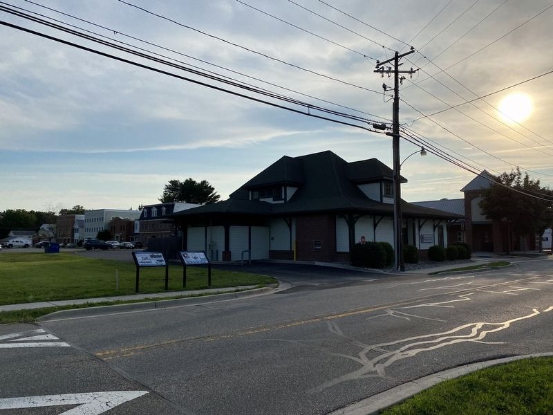
Location. 39° 2.574′ N, 76° 3.763′ W. Marker is in Centreville, Maryland, in Queen Anne's County. Marker is on E Water Street (Maryland Route 304), on the left when traveling west. Touch for map. Marker is at or near this postal address: 210 E Water Street, Centreville MD 21617, United States of America. Touch for directions.
Other nearby markers. At least 8 other
markers are within walking distance of this marker. The Railroad as Community Connector to the World (here, next to this marker); Carmichael House (about 400 feet away, measured in a direct line); Site of Goldsborough House (about 500 feet away); The Railroad as the Backbone of Centreville's 20th Century Commerce (about 700 feet away); Wright’s Chance (approx. 0.2 miles away); Centrally Located (approx. 0.2 miles away); a different marker also named Wright's Chance (approx. 0.2 miles away); William Harper, Sr. Houses (approx. 0.2 miles away). Touch for a list and map of all markers in Centreville.
Credits. This page was last revised on June 30, 2022. It was originally submitted on June 27, 2022, by Pete Skillman of Townsend, Delaware. This page has been viewed 98 times since then and 8 times this year. Photos: 1, 2. submitted on June 27, 2022, by Pete Skillman of Townsend, Delaware. • Bill Pfingsten was the editor who published this page.

