Near Chidester in Ouachita County, Arkansas — The American South (West South Central)
Federal Forage Party Departs Camden April 17, 1864
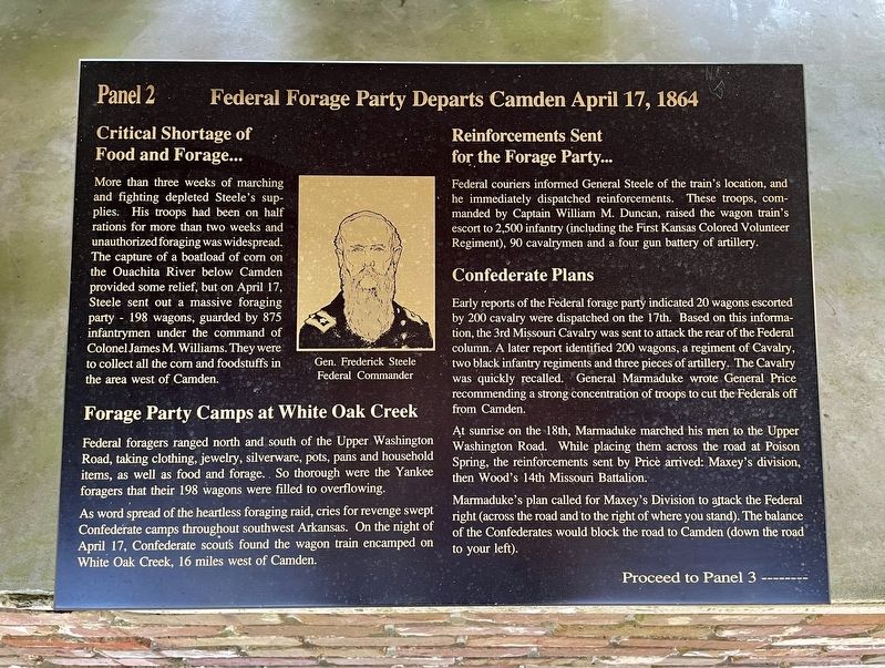
— Panel 2 —
Inscription.
Critical Shortage of Food and Forage...
More than three weeks of marching and fighting depleted Steele's sup- plies. His troops had been on half rations for more than two weeks and unauthorized foraging was widespread. The capture of a boatload of corn on the Ouachita River below Camden provided some relief, but on April 17, Steele sent out a massive foraging party 198 wagons, guarded by 875 infantrymen under the command of Colonel James M. Williams. They were to collect all the corn and foodstuffs in the area west of Camden.
Forage Party Camps at White Oak Creek
Federal foragers ranged north and south of the Upper Washington Road, taking clothing, jewelry, silverware, pots, pans and household items, as well as food and forage.. So thorough were the Yankee foragers that their 198 wagons were filled to overflowing.
As word spread of the heartless foraging raid, cries for revenge swept Confederate camps throughout southwest Arkansas. On the night of April 17, Confederate scouts found the wagon train encamped on White Oak Creek, 16 miles west of Camden.
Reinforcements Sent for the Forage Party...
Federal couriers informed General Steele of the train's location, and he immediately dispatched reinforcements. These troops, commanded by Captain William M. Duncan, raised the wagon train's escort to 2,500 infantry (including the First Kansas Colored Volunteer Regiment), 90 cavalrymen and a four gun battery of artillery.
Confederate Plans
Early reports of the Federal forage party indicated 20 wagons escorted by 200 cavalry were dispatched on the 17th. Based on this information, the 3rd Missouri Cavalry was sent to attack the rear of the Federal column. A later report identified 200 wagons, a regiment of Cavalry, two black infantry regiments and three pieces of artillery. The Cavalry was quickly recalled. General Marmaduke wrote General Price recommending a strong concentration of troops to cut the Federals off from Camden.
At sunrise on the 18th, Marmaduke marched his men to the Upper Washington Road. While placing them across the road at Poison Spring, the reinforcements sent by Price arrived: Maxey's division, then Wood's 14th Missouri Battalion.
Marmaduke's plan called for Maxey's Division to attack the Federal right (across the road and to the right of where you stand). The balance of the Confederates would block the road to Camden (down the road to your left).
Proceed to Panel 3 -------
Topics and series. This historical marker is listed in this topic list: War, US Civil. In addition, it is included
in the National Historic Landmarks series list. A significant day of the year for for this entry is April 17.
Location. 33° 38.333′ N, 93° 0.26′ W. Marker is near Chidester, Arkansas, in Ouachita County. Marker can be reached from Arkansas Route 76, 1.2 miles west of County Road 100, on the right when traveling west. Located in Poison Springs Battleground State Park. Touch for map. Marker is at or near this postal address: 665 Hwy 76, Chidester AR 71726, United States of America. Touch for directions.
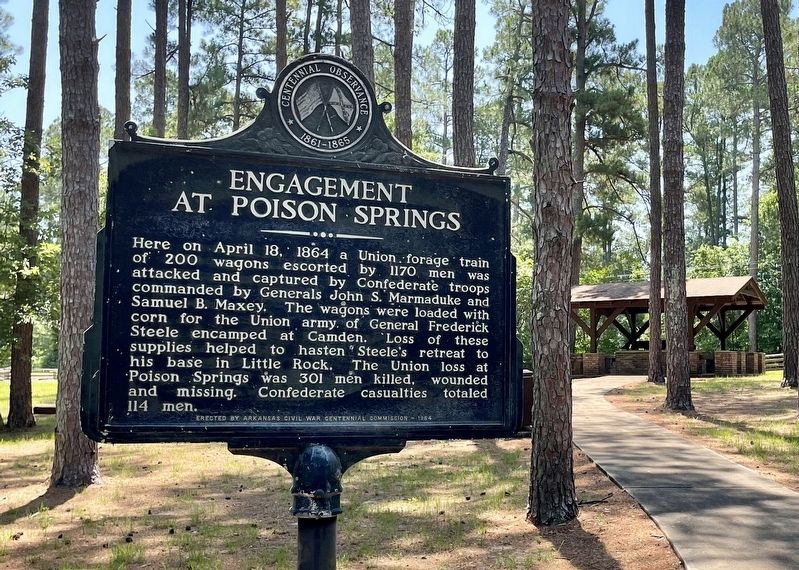
Other nearby markers. At least 8 other markers are within walking distance of this marker. The First Kansas (here, next to this marker); Forage Party Routed! (here, next to this marker); The Civil War Battle of Poison Spring - April 18, 1864 (here, next to this marker); Confederate and Federal Forces Engage (here, next to this marker); Order of Battle (here, next to this marker); The Battle of Poison Springs. (a few steps from this marker); Ouachita County Poison Springs Battlefield (within shouting distance of this marker); Engagement at Poison Springs (within shouting distance of this marker). Touch for a list and map of all markers in Chidester.
Also see . . . Wikipedia article on the Poison Springs Battleground State Park. A Part of the Camden Expedition Sites National Historic Landmark. (Submitted on June 30, 2022, by Mark Hilton of Montgomery, Alabama.)
Credits. This page was last revised on June 30, 2022. It was originally submitted on June 30, 2022, by Mark Hilton of Montgomery, Alabama. This page has been viewed 80 times since then and 6 times this year. Photos: 1, 2, 3. submitted on June 30, 2022, by Mark Hilton of Montgomery, Alabama.


