Sterling in Loudoun County, Virginia — The American South (Mid-Atlantic)
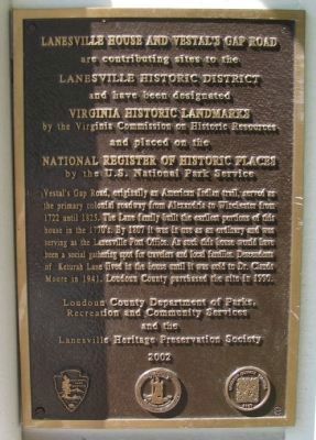
Lanesville House and Vestal's Gap Road
are contributing sites to the
Lanesville Historic District
and have been designated
Virginia Historic Landmarks
by the Virginia Commission on Historic Resources
and placed on the
National Register of Historic Places
by the U.S. National Park Service
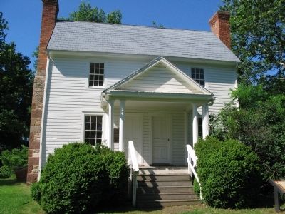
Vestal's Gap Road, originally an American Indian trail, served as the primary colonial roadway from Alexandria to Winchester from 1722 until 1825. The Lane family built the earliest portions of this house in the 1770's. By 1807 it was in use as an ordinary and was serving as the Lanesville Post Office. As such this house would have been a social gathering spot for travelers and local families. Descendants of Keturah Lane lived in the house until it was sold to Dr. Claude Moore in 1941. Loudoun County purchased the site in 1990.
Erected 2002 by Loudoun County Department of Parks, Recreation and Community Services and the Lanesville Heritage Preservation Society.
Topics. This historical marker is listed in this topic list: Roads & Vehicles. A significant historical year for this entry is 1722.
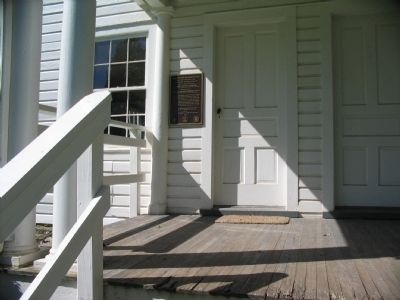
Location. 39° 1.067′ N, 77° 24.232′ W. Marker is in Sterling, Virginia, in Loudoun County. Marker is on Old Vestals Gap Road, on the right when traveling west. Located at the front door of the Lanesville House, along a foot path over the Old Vestal's Gap Road trace in Claude Moore Park. Touch for map. Marker is in this post office area: Sterling VA 20164, United States of America. Touch for directions.
Other nearby markers. At least 8 other markers are within walking distance of this marker. Lanesville Historic Area (here, next to this marker); Lanesville Architecture (a few steps from this marker); Lanesville Outbuildings (a few steps from this marker); Lanesville Families (a few steps from this marker); Vestal's Gap Road (a few steps from this marker); The Braddock Campaign (within shouting distance of this marker); Vestal's Gap Road in the 1800s (about 300 feet away, measured in a direct line); Guilford Signal Station (about 500 feet away). Touch for a list and map of all markers in Sterling.
Also see . . . Vestal's Gap Road and Lanesville Historic District. (PDF) National Register documentation for the site. (Submitted on June 20, 2009, by Craig Swain of Leesburg, Virginia.)
Credits. This page was last revised on June 16, 2016. It was originally submitted on June 20, 2009, by Craig Swain of Leesburg, Virginia. This page has been viewed 1,391 times since then and 46 times this year. Photos: 1, 2, 3. submitted on June 20, 2009, by Craig Swain of Leesburg, Virginia.


