Near West Alton in St. Charles County, Missouri — The American Midwest (Upper Plains)
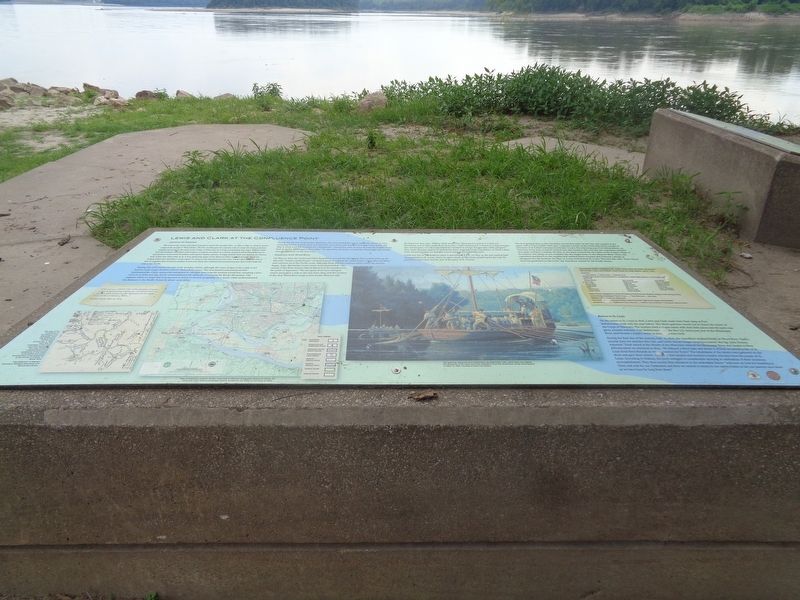
Lewis and Clark at the Confluence Point
Preparation for Departure
The crew of the Lewis and Clark Expedition spent five months (Dec. 12, 1803 to May 14, 1804) in winter camp at the mouth of Wood River. The five months gave the captains time to ready the boats, purchase supplies and prepare the men of the Corps of Discovery for a long and grueling trip. Capt. William Clark had the keelboat retrofitted with lockers, a cannon mounted on a swivel, and two swivel blunderbusses in anticipation of potential hostilities with upriver Indian nations. A single jointed mast was fitted to the boat as well. Lewis was often away in St. Louis, gathering maps of the Missouri River and information about the Indian tribes the expedition could expect to meet as they journeyed up the river. Clark's field notes are full of lists of supplies that would be needed. Lewis and Clark also selected the permanent party that would make the trek to the Pacific.
During this cold winter, the men built wooden cabins, although the exact design of the camp is not known (only rough sketches exist in Clark's field notes). The men hunted and practiced their marksmanship. Clark, meanwhile attempted to calculate how long the journey would last, assuming a pace of 10 or 12 miles per day, but he underestimated the difficulty of crossing the Rocky Mountains. The captains relied on maps that only guessed at much of western geography. As a result, Clark underestimated the distance to the Pacific Ocean by about 1,000 miles.
During the last two weeks before departure, the men packed the cargo - probably almost 30 tons, including barrels of pork, flour and parched corn, along with bundles of Indian trade goods. On May 8, Clark took the keelboat for a shakedown: "maned her with 20 oares & went the middle of the river & up the Mississippi a few miles." Six days later, the boats crossed the Mississippi and turned into the Missouri on the way west.
Departure from Wood River
On May 14, 1804, the Lewis and Clark Expedition crossed the Mississippi River and headed up the Missouri "Under a jentle brease" on their journey to explore the entire length of the Missouri River and continue on the Pacific coast. Although lively debates continue about where the journey began, Capt. Meriwether Lewis wrote in his journal that "The mouth of the River Dubois [Wood River] is to be considered as the point of departure." The two great rivers have changed course more than a mile to the east since 1804, and the location of the 1804 Wood River camp is now on the Missouri side.
On departure day, Capt. William Clark wrote that "the Party Consisted of 2, self one frenchman and 22 Men in the Boat of 20 ores, 1 Serjt. [sergeant] & 7 french
in a large Perogue [the red pirogue], a Corp [corporal] and 6 Soldiers in a large Perogue [the white pirogue]." This count does not appear to include the three sergeants of the expedition, or Clark's slave, York. Around 42 men are thought to have been in the departing party
Lewis was not on the keelboat when it launched at 4 p.m. on May 14. He was making final arrangements in St. Louis, where he spent much of the winter preparing for the trip. He planned to join Clark and the rest of the party in St. Charles.
The first evening, May 14, the expedition moved four miles up the river and camped at the upper end of Green Island. They were "opposite a Creek on the South side, below a ledge of limestone rock Called Colewater [Coldwater Creek]. The following year, Fort Bellefontaine, an American Army post, would be erected near this location. The next day, the expedition travelled nine miles to Piper's Landing. On May 16, the party covered the nine miles to the French village of St. Charles. The village of 400 residents was the largest town on the Missouri River. There, the expedition purchased its last supplies and enlisted Pierre Cruzatte and Francois Labiche as navigators for the keelboat. On May 20, Lewis arrived from St. Louis. The next day, with "three Cheers, from the gentlemen on the bank," the expedition started for the Pacific Ocean.
Return to St. Louis
On the return to St. Louis in 1806, Lewis and Clark made their final camp at Fort Bellefontaine, built only the year before. The whole garrison turned out to honor the return of the Corps of Discovery. The soldiers fired a 17-gun salute with their field pieces and the party was given a hearty welcome. Fort Bellefontaine was the first U.S. Army post west of the Mississippi River, and became a supply center as more forts were built.
During the final day of the journey, Sept. 23, 1806, the expeditions stopped briefly at Wood River. Clark's journal does not mention this visit, and Lewis was no longer keeping a journal. But Sgt. John Ordway reported: "Sooh arrived at the Mouth of the Missourie entered the Mississippi River and landed at River deboise where we wintered in 1804…We delayed a Short time and about 12 oClock we arived in Site of St. Louis fired three Rounds as we approached the Town." The inhabitants of the whole town gathered on the shore and gave three cheers. The party then landed and received a hearty welcome from the people of St. Louis. According to Ordway, the party indulged in considerable rejoicing in celebration of their enormous accomplishment. They then turned their attention to the immediate future: "and now we look for boarding in Town and wait for our Settlement and then we extend to return to our native homes to See our parents once more as we have been So long from them."
(photo caption:)
This map of the confluence of the Missouri and Mississippi rivers was sketched by William Clark around Jan. 3, 1804. Clark was the mapmaker of the Lewis and Clark Expedition. This map reveals his understanding of the geography of the region surrounding the winter encampment of the expedition at the mouth of Dubois, or Wood, River.
Erected by National Park Service and Missouri Lewis and Clark Bicentennial Commission.
Topics and series. This historical marker is listed in these topic lists: Exploration • Waterways & Vessels. In addition, it is included in the Lewis & Clark Expedition series list. A significant historical date for this entry is May 14, 1803.
Location. 38° 48.987′ N, 90° 7.179′ W. Marker is near West Alton, Missouri, in St. Charles County. Marker can be reached from Trail to Confluence south of Riverlands Way. For information on how to access this marker, see "Regarding". Touch for map. Marker is at or near this postal address: 1000 Riverlands Way, West Alton MO 63386, United States of America. Touch for directions.
Other nearby markers. At least 8 other markers are within 2 miles of this marker, measured as the crow flies. American Indian Nations of Missouri (here, next to this marker); Lewis and Clark (approx. 0.4 miles away); Lewis and Clark Expedition (approx. 0.8 miles away in Illinois); The Journey Begins Here (approx. 0.9 miles away in Illinois); "fixed on a place to build huts" (approx. 1.4 miles away in Illinois); The Lewis & Clark Expedition (approx. 1.4 miles away in Illinois); The Lewis and Clark Expedition in Illinois: A Bicentennial Tribute (approx. 1.4 miles away in Illinois); The Village of Hartford (approx. 1.6 miles away in Illinois).
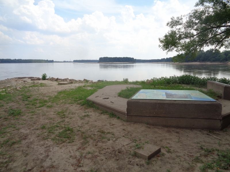
Regarding Lewis and Clark at the Confluence Point. Accessing the marker: From U.S. 67, turn at the gas station (last one before leaving Missouri) and keep driving on Riverlands Way. Be sure to follow signs as Riverlands Way will make a sharp right before going into Maple Island Access point. Riverlands Way will become a rock-gravel road, and keep following it for 4.3 miles until you get to the parking lot. The lot will have restrooms and a shelter/kiosk with markers. Follow the trail (part of it is a sidewalk) which will lead you to the Mississippi/Missouri rivers confluence point for .3 miles.
Please keep in mind that access to this area is limited at times. It is usually closed during the Winter and on times when high waters arise. Throughout most of 2020 and 2021 this was not open to the public because of the pandemic. Sometimes after heavy storms they do not open the roads that lead to the park. It is best to check the website (see link below) before making a visit to the park.
Also see . . . Edward "Ted" and Pat Jones Confluence Point State Park. Opened in 2004, the park was named for Edward Jones, who was the son of the founder of Edward Jones Investments (a St. Louis company). (Submitted on July 4, 2022, by Jason Voigt of Glen Carbon, Illinois.)
Credits. This page was last revised on July 4, 2022. It was originally submitted on July 4, 2022, by Jason Voigt of Glen Carbon, Illinois. This page has been viewed 424 times since then and 119 times this year. Photos: 1, 2. submitted on July 4, 2022, by Jason Voigt of Glen Carbon, Illinois.

