Caldwell in Burleson County, Texas — The American South (West South Central)
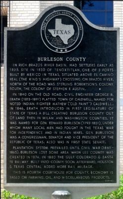
Burleson County
In rich Brazos River basin; had settlers early as 1825. Site in 1830 of Tenoxtitlan, one of 3 forts built by Mexico in Texas, situated above El Camino Real (The King's Highway) crossing on Brazos River. North of the road was Sterling Robertson's Colony; south, the colony of Stephen F. Austin.
In 1840 on the Old Road, Civil Engineer George B. Erath (1813-1891) platted town of Caldwell, named for noted Indian fighter Mathew ("Old Paint") Caldwell. In 1846, Erath introduced in First Legislature of State of Texas a bill creating Burleson County out of land then in Milam and Washington counties. It was named for Gen. Edward Burleson (1793-1851), under whom many local men had fought in the Texas War for Independence and in Indian Wars. Gen. Burleson was a congressman, senator and vice president of the Republic of Texas; also was in first State Senate.
Plantation system prevailed until Civil War (1861-1865). Burleson lost some area when Lee County was created in 1874. In 1880 the Gulf, Colorado & Santa Fe Railway built into county; soon afterward, Houston & Texas Central added more rail mileage.
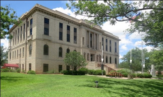
This is fourth courthouse for county. Economy is based on farming, oil, and miscellaneous products.
Erected 1970 by State Historical Survey Committee. (Marker Number 7554.)
Topics. This historical marker is listed in this topic list: Settlements & Settlers. A significant historical year for this entry is 1825.
Location. 30° 31.917′ N, 96° 41.582′ W. Marker is in Caldwell, Texas, in Burleson County. Marker is on West Buck Street south of South Main Street (Loop State Highway 83), on the right when traveling west. Touch for map. Marker is at or near this postal address: 100 West Buck Street, Caldwell TX 77836, United States of America. Touch for directions.
Other nearby markers. At least 8 other markers are within walking distance of this marker. John Mitchell (here, next to this marker); City of Caldwell (a few steps from this marker); Burleson County in World War II (a few steps from this marker); Burleson County, C.S.A. (within shouting distance of this marker); Early Settlers of Burleson County in the Texas War for Independence (within shouting distance of this marker); Caldwell National Bank (within shouting distance of this marker); Warren Lodge No. 56, A.F. & A.M. (about 400 feet away, measured in a direct line); First United Methodist Church (approx. 0.2 miles away). Touch for a list and map of all markers in Caldwell.
Also see . . .
1. Burleson County Website. (Submitted on June 11, 2014, by Jim Evans of Houston, Texas.)
2. Burleson County - The Handbook of Texas Online. Texas State Historical Association (TSHA) (Submitted on October 30, 2018, by Brian Anderson of Humble, Texas.)
Credits. This page was last revised on July 15, 2022. It was originally submitted on June 10, 2014, by Jim Evans of Houston, Texas. This page has been viewed 632 times since then and 22 times this year. Last updated on July 11, 2022, by Joe Lotz of Denton, Texas. Photos: 1, 2. submitted on June 10, 2014, by Jim Evans of Houston, Texas. • J. Makali Bruton was the editor who published this page.

