Kirbyville in Jasper County, Texas — The American South (West South Central)
Town of Kirbyville
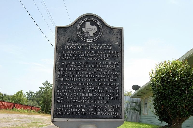
Site of Town Lot Auction, May 1, 1895 for Town of Kirbyville
Named for John Henry Kirby, attorney, railroad builder, and timber, lumber, and oil king.
With R. P. Allen, Kirby founded the town when their railroad-- Gulf, Beaumont, & Kansas City-- reached this point. Since 1904 city has also been terminus of the Jasper & Eastern Railroad.
A major business, Kirby Lumber Co. Sawmill (acquired in 1903), burned in 1917. City has been an area of timber conservation work since 1926; State Forest No. 1 is located 3 miles east.
Today city is a trade center for Jasper and Newton counties and has electric power concerns.
Erected 1968 by State Historical Survey Committee. (Marker Number 10456.)
Topics. This historical marker is listed in these topic lists: Industry & Commerce • Railroads & Streetcars • Settlements & Settlers. A significant historical date for this entry is May 1, 1895.
Location. 30° 39.631′ N, 93° 53.435′ W. Marker is in Kirbyville, Texas, in Jasper County. Marker is at the intersection of East Main Street and South Kaysee Avenue, on the right on East Main Street. Touch for map. Marker is in this post office area: Kirbyville TX 75956, United States of America. Touch for directions.
Other nearby markers. At least 8 other markers are within 15 miles of this marker, measured as the crow flies. Site of the First Kirbyville Church (about 700 feet away, measured in a direct line); Call Church of God in Christ (approx. 4.3 miles away); Trout Creek Missionary Baptist Church (approx. 5˝ miles away); Trout Creek Cemetery (approx. 5.6 miles away); Swift Cemetery (approx. 8˝ miles away); Zion Hill Missionary Baptist Church and Cemetery (approx. 13.1 miles away); Ford Chapel, Cemetery, and School (approx. 14.6 miles away); Newton County (approx. 14.8 miles away).
Credits. This page was last revised on July 13, 2022. It was originally submitted on July 18, 2019, by Cajun Scrambler of Assumption, Louisiana. This page has been viewed 362 times since then and 53 times this year. Last updated on July 11, 2022, by Joe Lotz of Denton, Texas. Photos: 1, 2. submitted on July 18, 2019. • J. Makali Bruton was the editor who published this page.

