Godfrey in Morgan County, Georgia — The American South (South Atlantic)
WWII B-25C Airplane Crash
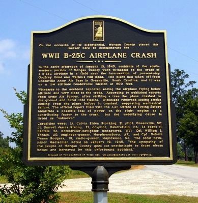
WW II B-25C Airplane Crash
Witnesses to the accident reported seeing the airplane flying below altitude and very close to the trees. According to published reports from Army Air Forces, after striking a tree the plane crashed to the ground and burst into flames. Witnesses reported seeing smoke coming from the plane before it crashed, suggesting mechanical failure. The official report filed with the AAF Office of Flying Safety identifies a possible loss of power on right engine as a contributing factor to the crash, but the underlying cause is listed as “unknown.”
Casualties were: Lt. Calvin Elden Stocking, 21, pilot, Greenville, SC; Lt. Samuel James Strong, 21, co-pilot, Bakersfield, CA; Lt. Frank H. Bartels, 25, bombardier-navigator, Ronceverte, WV; Cpl. William E. Thrash, 20, engineer gunner, Murphreesboro, AK, and Cpl. Robert Deana Rogers, 19, radio-gunner, Maplewood, NJ. The local newspaper Madisonian noted on January 19, 1945, "the sympathy of the people of Morgan County goes out unstintingly to those whose homes are bereaved by this unfortunate accident."
Erected 2009 by Morgan County Bicentennial Committee.
Topics. This historical marker is listed in these topic lists: Air & Space • War, World II. A significant historical date for this entry is January 10, 1714.
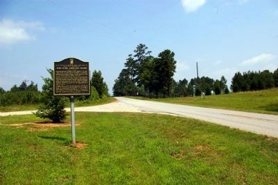
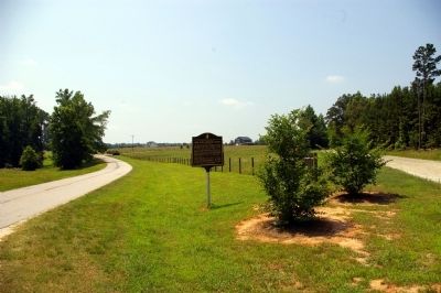
Location. 33° 28.565′ N, 83° 30.823′ W. Marker is in Godfrey, Georgia, in Morgan County. Marker is at the intersection of Godfrey Road and Walton's Mill Road, on the left when traveling north on Godfrey Road. Touch for map. Marker is in this post office area: Rutledge GA 30663, United States of America. Touch for directions.
Other nearby markers. At least 8 other markers are within 7 miles of this marker, measured as the crow flies. Godfrey (approx. 1.2 miles away); Antioch Baptist Church (approx. 2.6 miles away); Pennington (approx. 3.1 miles away); Seven Islands Road (approx. 4½ miles away); Fairview (approx. 4.6 miles away); Springfield (approx. 5.6 miles away); Bethany (approx. 6.4 miles away); Brownwood-Centennial (approx. 6.4 miles away).
Additional commentary.
1. Hometowns of the Pilot and Co-Pilot.
Much research of military records shows the pilot and co-pilots home towns incorrectly listed. Their correct home towns are:
Lt. Calvin Elden Stocking, 21, pilot, Salt Lake City, UT
Lt. Samuel James Strong, 21, co-pilot, Columbus, OH
The rest of the crew is verified correct. Note To Editor only visible by Contributor and editor
— Submitted August 26, 2010, by Ben Cannon of Social Circle, Ga..
Credits. This page was last revised on May 31, 2023. It was originally submitted on June 23, 2009, by David Seibert of Sandy Springs, Georgia. This page has been viewed 4,823 times since then and 79 times this year. Photos: 1, 2, 3. submitted on June 23, 2009, by David Seibert of Sandy Springs, Georgia. • Syd Whittle was the editor who published this page.


