Social Circle in Walton County, Georgia — The American South (South Atlantic)
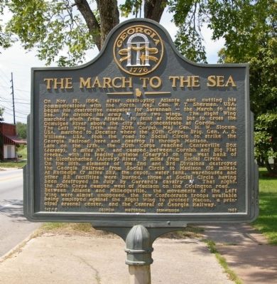
The March to the Sea
The Left Wing (14 and 20th Corps), Maj. Gen. H. W. Slocum, USA, marched to Decatur where the 20th Corps, Brig. Gen. A. S. Williams, USA, took the road to Social Circle to strike the Georgia Railroad here and destroy it through Madison.
Late on the 17th, the 20th Corps reached Centreville Box (Jersey), 6 miles NW, and camped between Cornish and Big Flat creeks, with its leading division (Geary’s) on the west bank of the Ulcofauhachee (Alcovy) River, 3 miles from Social Circle.
On the 18th, elements of the 2nd and 3rd Divisions destroyed the Georgia Railroad from Social Circle to Madison (16 miles). At Rutledge (7 miles SE), the depot, water tank, warehouses and other RR facilities were burned, those at Social Circle having been destroyed in July by Garrard’s cavalry [US]. That night the 20th Corps camped west of Madison on the Covington road.
Between Atlanta and Milledgeville, the movements of the Left Wing were almost unopposed, the few Confederate troops available being employed against the Right Win to protect Macon, a principal arsenal center, and the Central of Georgia Railway.
Erected 1957 by Georgia Historical Commission. (Marker Number 147-5.)
Topics and series. This historical marker is listed in this topic list: War, US Civil. In addition, it is included in the Georgia Historical Society, and the Sherman’s March to the Sea series lists. A significant historical month for this entry is October 1714.
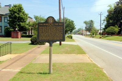
Location. 33° 39.228′ N, 83° 43.23′ W. Marker is in Social Circle, Georgia, in Walton County. Marker is on South Cherokee Road (Georgia Route 11) 0 miles south of Memorial Street, on the right when traveling south. Touch for map. Marker is at or near this postal address: 261 S Cherokee Road, Social Circle GA 30025, United States of America. Touch for directions.
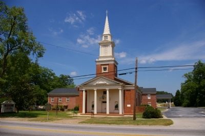
Other nearby markers. At least 8 other markers are within 7 miles of this marker, measured as the crow flies. The Church Bell (within shouting distance of this marker); Dr. Brown's Townhouse (within shouting distance of this marker); In Memory of Emma Sansom (approx. 0.2 miles away); Hightower Trail (approx. 0.2 miles away); Social Circle (approx. 0.2 miles away); Brick Store (approx. 3.9 miles away); Sherman at Harris’ Quarters (approx. 6.1 miles away); Centreville (approx. 6.3 miles away). Touch for a list and map of all markers in Social Circle.
Credits. This page was last revised on June 16, 2016. It was originally submitted on June 23, 2009, by David Seibert of Sandy Springs, Georgia. This page has been viewed 1,636 times since then and 33 times this year. Photos: 1, 2, 3. submitted on June 23, 2009, by David Seibert of Sandy Springs, Georgia. • Craig Swain was the editor who published this page.


