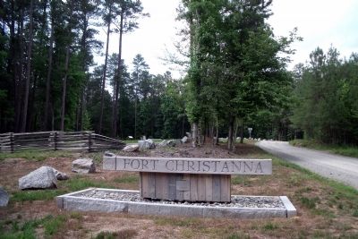
Near Lawrenceville in Brunswick County, Virginia — The American South (Mid-Atlantic)
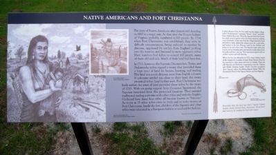
Native Americans and Fort Christanna
In 1713, however, the Saponie, Occoneechee, Totaro, and Stukanocks tribes signed a treaty that provided them a large tract of land for homes, hunting, and trading. This land was a safe distance away from English colonists. If colonists settled too close to their land, the treaty promised tribes land farther west. Fort Christanna was built within the tract of land provided these tribes by the treaty of 1713. With on-going support from Governor Spotswood, the Saponie benefited from this protected location. They pursued traditional trading activities with other tribes and with the English. Gathered here these four tribes all became known as “Saponie.” As many as 15 other tribes came to trade and to make treaties at Fort Christanna. Inside the fort, children of the Saponie and other tribes were educated in a European fashion at a school for Indians.
A short distance from the fort itself was the Indian village called “Junkatapurse,” meaning “Horse's Head” (probably from a bend in the river). There the Apomnie built their houses in a circle joined together with only three entrances, making a sort of palisade. Indian men from the village hunted for food and pelts to trade, helped the rangers scout the countryside, and worked at the fort. Women cared for the children and planted corn and other crops. The Saponie made crafts such as pots, woven sleeping mats, and carved wooden plates both for trade and their own use. They entertained guests with an archery contest and with dancing.
When the fort was disbanded in 1722, many Indians stayed in the vicinity for a number of years. Some Saponie from the fort traveled to other states and even to Canada. There are still Saponie and Meherrin communities near the Virginia and North Carolina border. North Carolina recognizes three Saponie tribes: the Haliwa-Saponi Indian Tribe, the Occaneechi Band of the Saponi Nation, and the Sappony.
Topics. This historical marker is listed in these topic lists: Forts and Castles • Native Americans • Settlements & Settlers. A significant historical year for this entry is 1607.
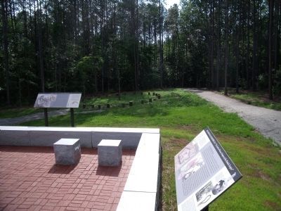
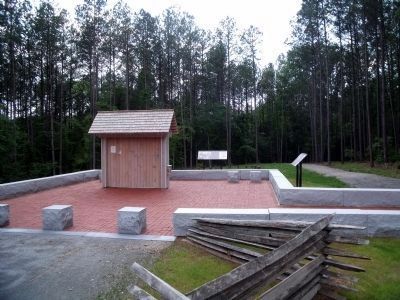
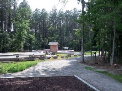
Location. 36° 42.834′ N, 77° 52.248′ W. Marker is near Lawrenceville, Virginia, in Brunswick County. Marker can be reached from Fort Hill Road, 1.1 miles west of Christanna Highway (Virginia Route 46), on the right when traveling west. This marker is located within the Fort Christanna Historic Site. Touch for map. Marker is in this post office area: Brodnax VA 23920, United States of America. Touch for directions.
Other nearby markers. At least 8 other markers are within 4 miles of this marker, measured as the crow flies. Fort Christanna: Established 1714 (a few steps from this marker); Governor Alexander Spotswood (within shouting distance of this marker); The Colonial Dames of America Monument (within shouting distance of this marker); Site of Fort Christanna (within shouting distance of this marker); Fort Christanna Historical Site (about 300 feet away, measured in a direct line); Fort Christanna (approx. 1.3 miles away); Hospital and School of the Good Shepherd (approx. 2.3 miles away); Goronwy Owen (approx. 3.3 miles away). Touch for a list and map of all markers in Lawrenceville.
More about this marker. On the left is a sketch of a “Saponie woman with her child. Saponie miha nikas wakuchka (Saponi-Tutelo).” Rendering, 2006 by John W. Kincheloe, III. The inset is entitled “On the Warriors Path” Ahatkox elutaoe (Saponi-Tutelo).
On the right is a rendering of an “Arrow. Makoi (Saponi-Tutelo)” and “Powderhorn and shot.” The caption reads, “Remember that this land was where the Saponie Indians hunted, traded, farmed, lived, and prayed. Please honor their memory by treating this land with respect.”
Credits. This page was last revised on June 16, 2016. It was originally submitted on June 23, 2009, by Bernard Fisher of Richmond, Virginia. This page has been viewed 2,025 times since then and 55 times this year. Photos: 1, 2, 3, 4, 5. submitted on June 23, 2009, by Bernard Fisher of Richmond, Virginia.
