Empire in Stanislaus County, California — The American West (Pacific Coastal)
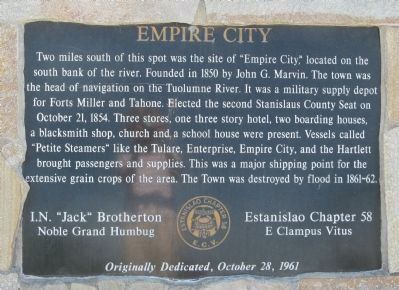
Empire City
I.N. “Jack” Brotherton – Nobel Grand Humbug
Estanislao Chapter 58
E. Clampus Vitus
Erected 1961 by Estanislao Chapter 58, E. Clampus Vitus. (Marker Number 418.)
Topics and series. This historical marker is listed in these topic lists: Government & Politics • Notable Places • Settlements & Settlers. In addition, it is included in the E Clampus Vitus series list. A significant historical month for this entry is October 1897.
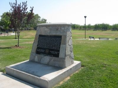
Location. 37° 38.316′ N, 120° 53.894′ W. Marker is in Empire, California, in Stanislaus County. Marker can be reached from First Street near Yosemite Boulevard (California Highway 132). Marker is located at Empire Park, at the eastern end of the parking area. Touch for map. Marker is at or near this postal address: 2 First Street, Empire CA 95319, United States of America. Touch for directions.
Other nearby markers. At least 8 other markers are within 5 miles of this marker, measured as the crow flies. A different marker also named Empire City (approx. ¼ mile away); The Daniel Whitmore House (approx. 4.4 miles away); Ceres War Memorial (approx. 4½ miles away); Ceres Volunteer Fire Department (approx. 4½ miles away); Grand Army of the Republic (approx. 4.6 miles away); Andrew McGinnes (approx. 4.6 miles away); Silent City (approx. 4.6 miles away); Modesto Pioneer Cemetery (approx. 4.7 miles away).
Regarding Empire City. Empire City was designated as California Registered Historical Landmark No. 418 on February 29, 1949.
Empire City served as the county seat from October 1854 to December 1855.
Credits. This page was last revised on June 16, 2016. It was originally submitted on June 23, 2009, by Syd Whittle of Mesa, Arizona. This page has been viewed 1,867 times since then and 60 times this year. Photos: 1, 2. submitted on June 23, 2009, by Syd Whittle of Mesa, Arizona.

