Montjuïc in Barcelona, Catalonia, Spain — Southwestern Europe (Iberian Peninsula)
La torre de guaita / The Watchtower / La torre vigia / La tour de guet
Inscription.
La torre de guaita
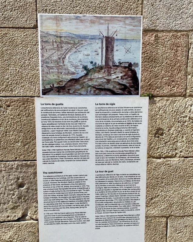
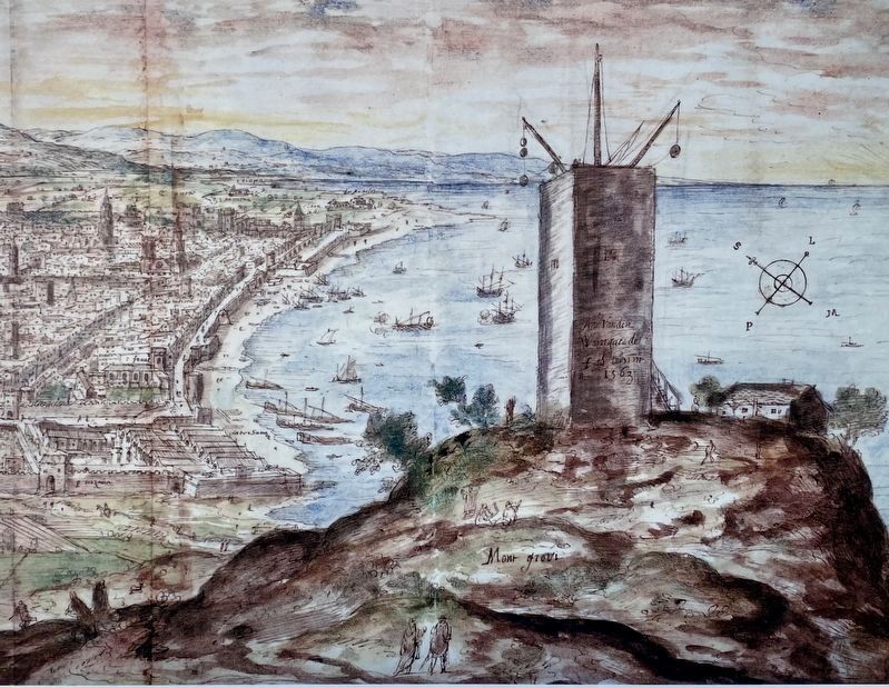
L'arquitectura defensiva de l'edat moderna es caracteritza per edificacions de poca projecció en alçat i n'és poc usual la construcció de torres o altres elements que sobresurtin del parapet. Tanmateix, el Castell de Montjuïc destaca per la presència d'aquesta torre, una reminiscència de la primera construcció defensiva al cim de la muntanya, documentada ja l'any 1073. Es tractava d'una torre de guaita en què els vigies senyalitzaven l'arribada de les naus per mitjà d'un sistema de veles durant el dia i de focs durant la nit. Aquella antiga torre va ser reformada i reconstruïda en diverses ocasions, i, quan l'enginyer militar Juan Martín Cermeño dissenyà la nova fortalesa de Montjuïc, construí de nou una torre de senyals durant la dècada de 1770. Aquesta s'adequà a la nova configuració estructural del Castell i, en conseqüència, no presentava una orientació adient per al càlcul de l'hora solar. Per aquest motiu es decidí dotar l'estructura de dos rellotges solars. L'un, orientat a llevant, dóna l'hora del matí; l'altre, orientat a ponent, dóna l'hora de la tarda.
Entre 1792 i 1793 l'astrònom francès Pierre Méchain va utilitzar aquesta torre per marcar les coordenades geogràfiques de Barcelona i hi va establir el punt geodèsic que serví per amidar l'arc del meridià de Dunkerque. Les dimensions d'aquest arc, que uneix Barcelona, París i Dunkerque, serviren de base per calcular la mesura del metre, fonament de l'actual sistema mètric decimal.
The watchtower
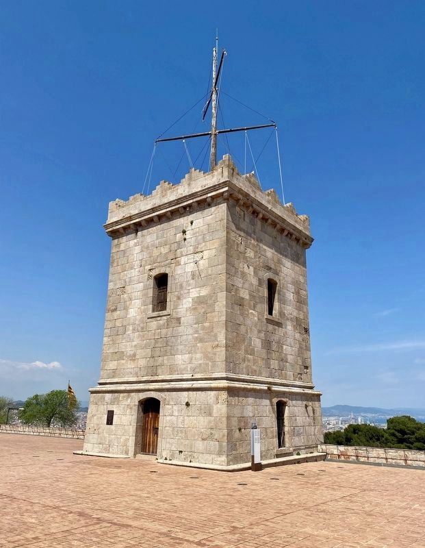
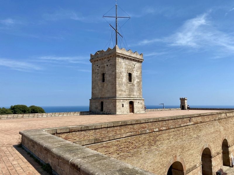
The defensive architecture of the early modern period was characterized by low buildings, and the construction of towers or other features protruding above the parapet was unusual. However, the Montjuïc Castle is notable for the presence of this tower, reminiscent of the first defensive structure on top of the hill, already documented in 1073, This was a lookout tower that signalled the arrival of ships through a system of sails during the day and bonfires at night. This early tower would be modernised and rebuilt several times, and when the military engineer Martín Cermeño designed the new fortress of Montjuïc, he included a new signal tower in his plans, which was built during the 1770s. This was adapted to the new structural layout of the castle and therefore not suitably aligned for calculating solar time. For this reason it was decided to equip the structure with two sundials: one facing east, giving the time in morning; and

Photographed By Andrew Ruppenstein, April 29, 2022
2. The watchtower and marker
The marker is visible here at the base of the tower. Closer scrutiny of the area between the two upper windows reveals not one, but two sundials, one on each of the visible faces of the tower, for both morning and afternoon times.
In 1792 and 1793 the French astronomer Pierre Méchain used this tower to plot the geographical coordinates of Barcelona and establish it as a trig point. This he used to measure the meridian arc from Dunkirk. The length of this arc, which passes through Barcelona, Paris and Dunkirk, was used to calculate the metre, the basic unit in the metric system.
La torre de vigía
La arquitectura defensiva de la Edad Moderna se caracteriza por edificaciones de poco alzado; en este sentido, es poco usual la proyección y construcción de torres u otros elementos que sobresalgan del parapeto. Pese a todo, el Castillo de Montjuïc destaca precisamente por la presencia de esta torre, una reminiscencia de la primera construcción defensiva en la cima de la montaña, documentada ya en 1073. Se trataba de una torre de vigía en la que se señalaba la llegada de las naves mediante un sistema de velas durante el día y de fuegos durante la noche. Aquella antigua torre fue reformada y reconstruida en diversas ocasiones, y, cuando el ingeniero militar Juan Martín Cermeño diseñó la nueva fortaleza de Montjuïc, construyó de nuevo una torre de vigía durante la década de 1770. Ésta se acomodó a la nueva configuración estructural del Castillo y, en consecuencia, no presentaba una orientación adecuada para el cálculo de la hora solar. Por este motivo se decidió dotar a la estructura de dos relojes solares. El primero, orientado hacia levante, daba la hora de la mañana; el segundo, orientado a poniente, la de la tarde.
Entre 1792 y 1793 el astrónomo francés Pierre Méchain utilizó esta torre para marcar las coordenadas geográficas de Barcelona, y determinó el punto geodésico que sirvió para medir el arco del meridiano de Dunkerque. Las dimensiones de este arco, que une Barcelona, París y Dunkerque, sirvieron de base per calcular la medida del metro, fundamento del actual sistema métrico decimal.
La tour de guet
L'architecture défensive de l'âge moderne se caractérise par des bâtiments peu élevés; en ce sens, il est inhabituel de voir la conception et la construction de tours ou d'autres éléments qui dépassent le parapet. Néanmoins, le Château de Montjuïc met justement en relief la présence de cette tour, un rappel de la première construction défensive au sommet de la montagne, déjà documentée en 1073. Il s'agissait d'une tour de guet par laquelle on signalait les arrivées des navires grâce à un système de toile pendant le jour et de feux durant la nuit. Cette vieille tour fût rénovée et reconstruite plusieurs fois, et, quand l'ingénieur militaire Martín Cermeño conçut la nouvelle forteresse de Montjuïc, il construisit à nouveau une tour de guet pendant les années 1770. Cette dernière a été adapté à la nouvelle configuration structurelle du Château et, par conséquent, elle ne présentait pas une orientation adéquate pour le calcul de l'heure solaire. Pour cette raison, il fût décidé de doter la structure de deux cadrans solaires. Le premier, orienté à l'Est, donnant l'heure du matin; le deuxième, orienté à l'Ouest, donnant l'heure de l'après-midi.
Entre 1792 et 1793 l'astronome français Pierre Méchain a utilisé cette tour pour marquer les coordonnées géographiques de Barcelone et détermina le point géodésique qui servit à mesurer l'arc du méridien de Dunkerque. Les dimensions de cet arc, qui relie Barcelone, Paris et Dunkerque, servirent de base pour calculer la mesure du mètre, fondateur du système métrique actuel.
Topics. This historical marker is listed in these topic lists: Forts and Castles • Science & Medicine.
Location. 41° 21.814′ N, 2° 9.995′ E. Marker is in Barcelona, Cataluña (Catalonia). It is in Montjuïc. Marker can be reached from Carretera de Montjuïc. Touch for map. Marker is in this post office area: Barcelona, Cataluña 08038, Spain. Touch for directions.
Other nearby markers. At least 8 other markers are within walking distance of this marker. Méchain Etablí les Coordenades de Barcelona / Méchain Establishes the Coordinates of Barcelona (a few steps from this marker); El juidici del President Lluís Companys / The Trial of President Lluís Companys (a few steps from this marker); El pati d’armes o quadrat / The parade ground or courtyard (within shouting distance of this marker); El Pont d’accés i la façana / The Entrance Bridge and the Façade (within shouting distance of this marker); Montjuic Castle (within shouting distance of this marker); L'antic fortí / The early fort (within shouting distance of this marker); Els calabossos del Castell / The Castle Dungeons / Los Calabozos del Castillo (within shouting distance of this marker); El baluard de Sant Carles / The Sant Carles Bastion / El baluarte de Sant Carles (within shouting distance of this marker). Touch for a list and map of all markers in Barcelona.
Additional keywords. astronomy
Credits. This page was last revised on February 3, 2023. It was originally submitted on July 13, 2022, by Andrew Ruppenstein of Lamorinda, California. This page has been viewed 170 times since then and 17 times this year. Photos: 1, 2, 3, 4. submitted on July 13, 2022, by Andrew Ruppenstein of Lamorinda, California.


