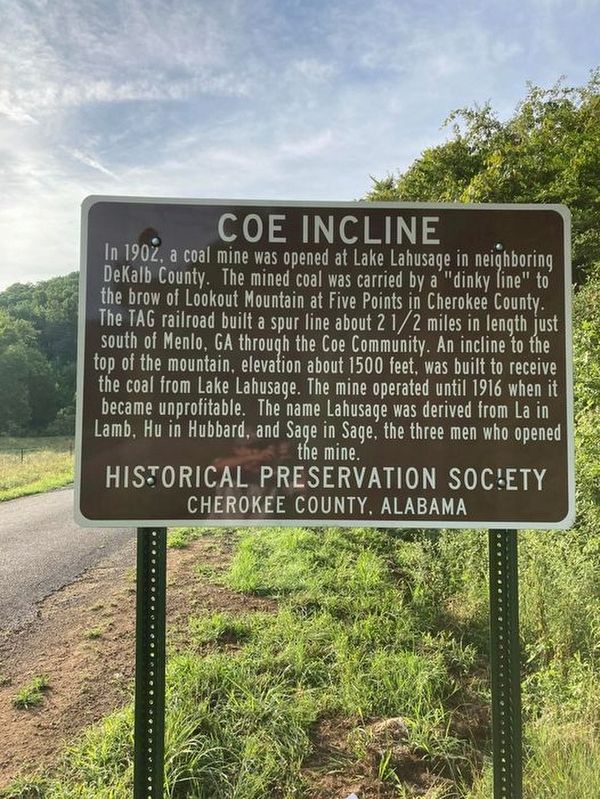
Near Gaylesville in Cherokee County, Alabama — The American South (East South Central)
Coe Incline
Erected 2022 by Historical Preservation Society of Cherokee County, Alabama.
Topics. This historical marker is listed in these topic lists: Industry & Commerce • Railroads & Streetcars. A significant historical year for this entry is 1902.
Location. 34° 28.674′ N, 85° 30.499′ W. Marker is near Gaylesville, Alabama, in Cherokee County. Marker is on Shinbone Valley Road (County Road 127) 2 miles south of Alabama/Georgia State Line when traveling south. Touch for map. Marker is in this post office area: Gaylesville AL 35973, United States of America. Touch for directions.
Other nearby markers. At least 8 other markers are within 9 miles of this marker, measured as the crow flies. Alpine, Georgia (approx. 1.8 miles away in Georgia); Last Indian Agent (approx. 1.8 miles away in Georgia); Barry Springs Indian Stockade (approx. 3.4 miles away); Sally A. Howard Memorial Chapel (approx. 6.4 miles away); The A. A. Miller Dam (approx. 6.8 miles away); Arthur "Tarzan" White (approx. 6.8 miles away); Colonel Charles Rattray (approx. 7.4 miles away); Town Of Mentone (approx. 8.3 miles away). Touch for a list and map of all markers in Gaylesville.
Credits. This page was last revised on July 15, 2022. It was originally submitted on July 14, 2022, by Angela Nichols of Centre, Alabama. This page has been viewed 414 times since then and 76 times this year. Photo 1. submitted on July 14, 2022, by Angela Nichols of Centre, Alabama. • Bernard Fisher was the editor who published this page.
Editor’s want-list for this marker. Wide shot of marker and surrounding area. Accurate GPS coordinates. • Can you help?
