Near Santa Paula in Ventura County, California — The American West (Pacific Coastal)
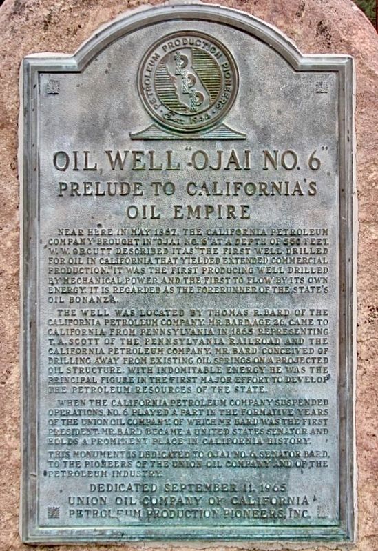
Oil Well Ojai No. 6
Prelude to California's Oil Empire
The well was located by Thomas R. Bard of the California Petroleum Company. Mr. Bard, age 26, came to California from Pennsylvania in 1865 representing T.A. Scott of the Pennsylvania Railroad and the California Petroleum Company. Mr. Bard conceived of drilling away from existing oil springs on a projected oil structure. With indomitable energy he was the principal figure in the first major effort to develop the petroleum resources of the state.
When the California Petroleum Company suspended operations, No. 6 played a part in the formative years of the Union Oil Company, of which Mr. Bard was the first President. Mr. Bard became a United Stated Senator and holds a prominent place in California history.
This monument is dedicated to Ojai No. 6, Senator Bard, to the pioneers of the Union Oil Company and the petroleum industry.
Erected 1965 by Union Oil Company of California, and Petroleum Productions Pioneers Inc.
Topics. This historical marker is listed in these topic lists: Industry & Commerce • Natural Resources. A significant historical year for this entry is 1867.
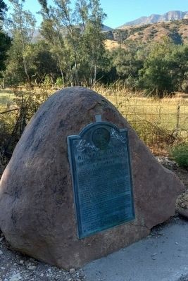
Location. 34° 25.731′ N, 119° 7.127′ W. Marker is near Santa Paula, California, in Ventura County. Marker is on Ojai Road (California Route 150 at milepost 27), 7˝ miles north of Highway 126, on the right when traveling west. The plaque is located on the side of the road between mile markers 26 and 27. Touch for map. Marker is in this post office area: Santa Paula CA 93060, United States of America. Touch for directions.
Other nearby markers. At least 8 other markers are within 6 miles of this marker, measured as the crow flies. The Hardison Estate (approx. 4.9 miles away); St. Francis Dam Disaster (approx. 5.6 miles away); McKevett School (approx. 5.8 miles away); Canyon School (approx. 5.9 miles away); First Christian Church (approx. 6 miles away); Water Well Drilling Rig (approx. 6 miles away); The Depot, Santa Paula (approx. 6 miles away); Saint Francis Dam Disaster Memorial (approx. 6 miles away). Touch for a list and map of all markers in Santa Paula.
Credits. This page was last revised on February 21, 2024. It was originally submitted on July 21, 2022, by Joseph Alvarado of Livermore, California. This page has been viewed 275 times since then and 54 times this year. Photos: 1, 2. submitted on July 23, 2022, by Joseph Alvarado of Livermore, California. • Syd Whittle was the editor who published this page.

