Near Talihina in Le Flore County, Oklahoma — The American South (West South Central)
Deadman Vista
What's in a Name?
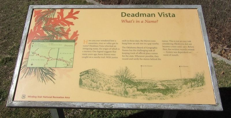
Have you ever wondered how a mountain, river or valley got its name? Deadman Vista inherited an intriguing name, the origin of which is a mystery. One legend suggests that many years ago, horse thieves were caught on a nearby trail. With justice swift in those days, the thieves were hung from an oak tree in a gap nearby.
The Oklahoma Board of Geographic Names has the challenging task of keeping track of official place names for the state. Whenever possible, they record and verify the stories behind the names. This is not an easy task considering Oklahoma did not become a state until 1907. Before then, few written records existed - history was dependent on word of mouth.
Erected by US Forest Service.
Topics. This historical marker is listed in this topic list: Parks & Recreational Areas.
Location. 34° 46.345′ N, 94° 52.545′ W. Marker is near Talihina, Oklahoma, in Le Flore County. Marker is on Talimena National Scenic Byway (State Highway 1) 6 miles east of U.S. 271, on the left when traveling east. Touch for map. Marker is in this post office area: Wister OK 74966, United States of America. Touch for directions.
Other nearby markers. At least 8 other markers are within 5 miles of this marker, measured as the crow flies. On a Clear Day (approx. 1˝ miles away); The Choctaw Nation (approx. 1˝ miles away); Military Road of 1832 (approx. 4.2 miles away); Ft. Smith -- Ft. Towson Military Road (approx. 4.3 miles away); First Military Road (approx. 4.3 miles away); Lenox Mission (approx. 4.4 miles away); A Settling Experience (approx. 4.4 miles away); Mammoth Changes (approx. 4.4 miles away). Touch for a list and map of all markers in Talihina.
Credits. This page was last revised on July 28, 2022. It was originally submitted on July 28, 2022, by Jason Armstrong of Talihina, Oklahoma. This page has been viewed 240 times since then and 97 times this year. Photos: 1, 2. submitted on July 28, 2022, by Jason Armstrong of Talihina, Oklahoma. • J. Makali Bruton was the editor who published this page.

