Zumbrota in Goodhue County, Minnesota — The American Midwest (Upper Plains)
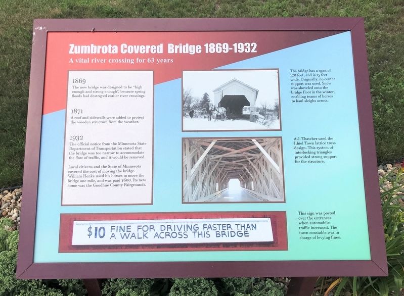
Zumbrota Covered Bridge 1869-1932
1869
The new bridge was designed to be "high enough and strong enough", because spring floods had destroyed earlier river crossings.
1871
A roof and sidewalls were added to protect the wooden structure from the weather.
1932
The official notice from the Minnesota State Department of Transportation stated that the bridge was too narrow to accommodate the flow of traffic, and it would be removed.
Local citizens and the State of Minnesota covered the cost of moving the bridge. William Henke used his horses to move the bridge one mile, and was paid $600. Its new home was the Goodhue County Fairgrounds.
The bridge has a span of 120 feet, and is 15 feet wide. Originally, no center support was used. Snow was shoveled onto the bridge floor in the winter, enabling teams of horses to haul sleighs across.
A.J. Thatcher used the Ithiel Town lattice truss design. This system of interlocking triangles provided strong support for the structure.
"$10 fine for driving faster than a walk across this bridge"
This sign was posted over the entrances when automobile traffic increased. The town constable was in charge of levying fines.
Erected by the City of Zumbrota.
Topics and series. This historical marker is listed in these topic lists: Architecture • Bridges & Viaducts. In addition, it is included in the Covered Bridges series list. A significant historical year for this entry is 1869.
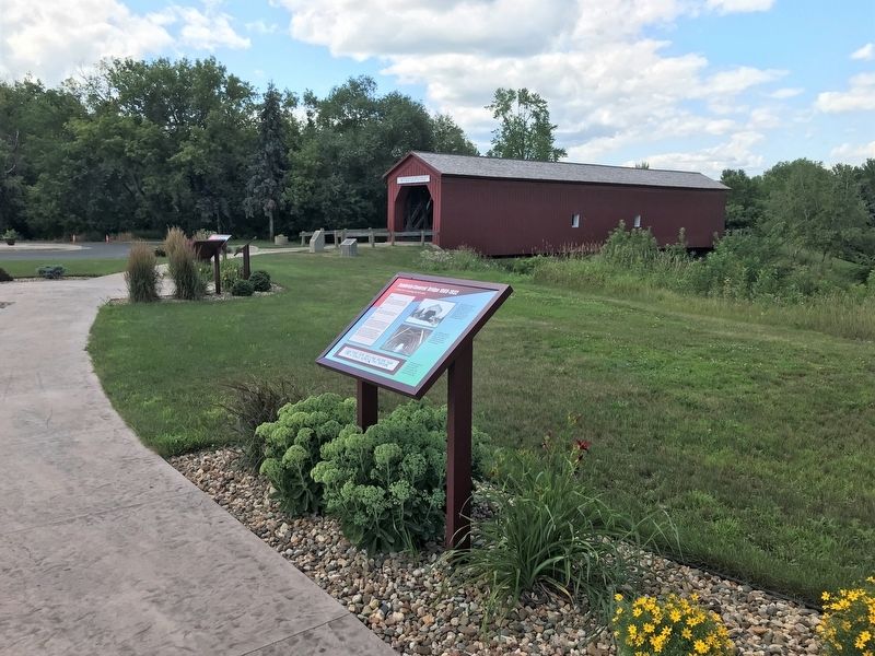
Location. 44° 17.754′ N, 92° 40.195′ W. Marker is in Zumbrota, Minnesota, in Goodhue County. Marker is on West Avenue, 0.1 miles north of West 2nd Street, on the right when traveling north. Located by the Zumbrota Covered Bridge in Zumbrota. Touch for map. Marker is in this post office area: Zumbrota MN 55992, United States of America. Touch for directions.
Other nearby markers. At least 8 other markers are within 11 miles of this marker, measured as the crow flies. Zumbrota Covered Bridge 1932-1969 (a few steps from this marker); Zumbrota Covered Bridge 1970-1997 (a few steps from this marker); Zumbrota Covered Bridge Today (a few steps from this marker); Zumbrota Covered Bridge (within shouting distance of this marker); "The Old Covered Bridge" (within shouting distance of this marker); First Congregational Church (approx. ¼ mile away); Zumbrota (approx. 0.9 miles away); The Claybank Pits (approx. 10.6 miles away). Touch for a list and map of all markers in Zumbrota.
Related markers. Click here for a list of markers that are related to this marker.
Credits. This page was last revised on August 1, 2022. It was originally submitted on August 1, 2022. This page has been viewed 65 times since then and 11 times this year. Photos: 1, 2, 3. submitted on August 1, 2022.


