Williamsport in Washington County, Maryland — The American Northeast (Mid-Atlantic)
The Wagoners’ Fight
Teamsters Help Save the Army
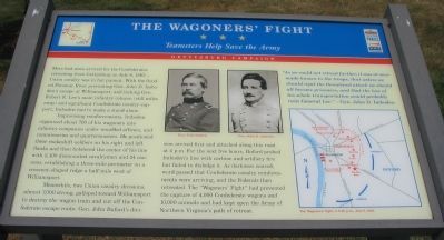
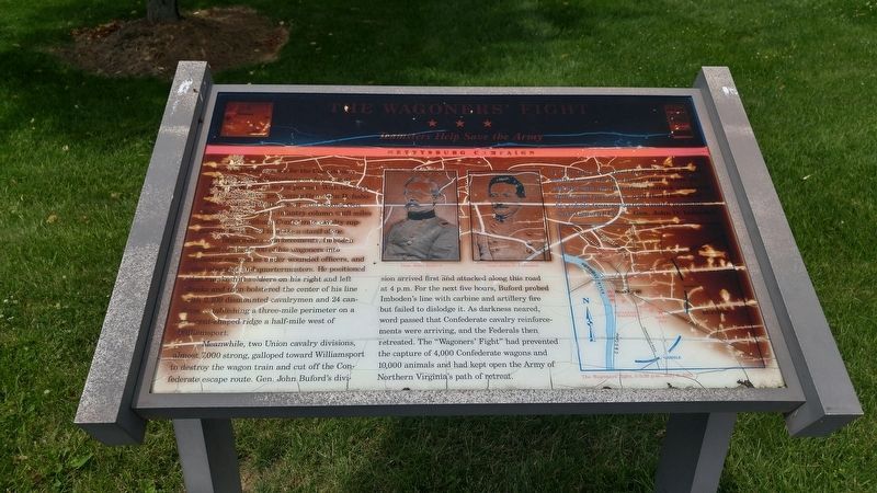
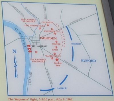
Improvising reinforcements, Imboden organized about 700 of his wagoners into infantry companies under wounded officers, and commissaries and quartermasters. He positioned these makeshift soldiers on his right and left flanks and then bolstered the center of his line with 2,100 dismounted cavalrymen and 24 cannons, establishing a three-mile perimeter on a crescent-shaped ridge a half-mile west of Williamsport.
Meanwhile, two Union cavalry divisions almost 7,000 strong, galloped toward Williamsport to destroy the wagon train and cut off the Confederate escape route. Gen. John Buford’s division arrived first and attacked along this road at 4 p.m. For the next five hours, Buford probed Imboden’s line with carbine and artillery fire but failed to dislodge it. As darkness neared, word passed that Confederate cavalry reinforcements were arriving, and the Federals then retreated. The “Wagoners’ Fight” had prevented the capture of 4,000 Confederate wagons and 10,000 animals and had kept open the Army of Northern Virginia’s path of retreat.
“As we could not retreat further, it was at once made known to the troops, that unless we should repel the threatened attack we should all become prisoners, and that the loss of his whole transportation would probably ruin General Lee” —Gen. John D. Imboden
Topics and series. This historical marker is listed in this topic list: War, US Civil. In addition, it is included in the Maryland Civil War Trails series list. A significant historical month for this entry is July 1877.
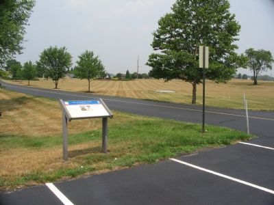
Location. 39° 34.764′ N, 77° 48.492′ W. Marker is in Williamsport, Maryland, in Washington County. Marker can be reached from Lappans Road (Maryland Route 68), on the left. At the entrance to the Williamsport Redmens Club, approximately 750 feet from the road. Touch for map. Marker is at or near this postal address: 16129 Lappans Road, Williamsport MD 21795, United States of America. Touch for directions.
Other nearby markers. At least 8 other markers are within 2 miles of this marker, measured as the crow flies. Rose Hill (approx. 0.4 miles away); WWII (approx. 1.2 miles away); Honor Roll (approx. 1.2 miles away); The Springfield Farm (approx. 1.4 miles away); A Canal Home (approx. 1.4 miles away); At All Hours (approx. 1.4 miles away); Lock 44 (approx. 1.4 miles away); The Wagoner's Fight - July 6, 1863 (approx. 1.4 miles away). Touch for a list and map of all markers in Williamsport.
More about this marker. The marker displays portraits of Gens. Buford and Imboden, and a map of the tactical operations conducted during the battle. During a May 2023 visit, it was seen that the marker had been replaced by a new copy.
Also see . . .
1. Imboden's Report of the Campaign. (Submitted on August 6, 2007, by Craig Swain of Leesburg, Virginia.)
2. An Essay of Buford's Cavalry in the Pursuit from Gettysburg. With a section on the action at Williamsport (Submitted on August 6, 2007, by Craig Swain of Leesburg, Virginia.)
Additional commentary.
1. Battleground Today
Although not entirely erased, the ground contested on July 6, 1863 has changed considerably since the 19th Century. Interstate 81 runs just behind the Confederate positions and an industrial park now dominates the main part of the lines. The historical roadbeds are only traces, as the modern highways have taken paths better suited for motor traffic flow.
— Submitted August 6, 2007, by Craig Swain of Leesburg, Virginia.
Additional keywords. Gettysburg Campaign
Credits. This page was last revised on May 22, 2023. It was originally submitted on August 6, 2007, by Craig Swain of Leesburg, Virginia. This page has been viewed 2,461 times since then and 36 times this year. Last updated on August 2, 2022, by Carl Gordon Moore Jr. of North East, Maryland. Photos: 1. submitted on August 6, 2007, by Craig Swain of Leesburg, Virginia. 2. submitted on July 9, 2016, by F. Robby of Baltimore, Maryland. 3, 4. submitted on August 6, 2007, by Craig Swain of Leesburg, Virginia. • Bill Pfingsten was the editor who published this page.


