Naarden in Gooise Meren, North Holland, Netherlands — Northwestern Europe
De Promerskazerne
⎯⎯⎯
Promers Barracks
Photographed by Andrew Ruppenstein, July 22, 2022
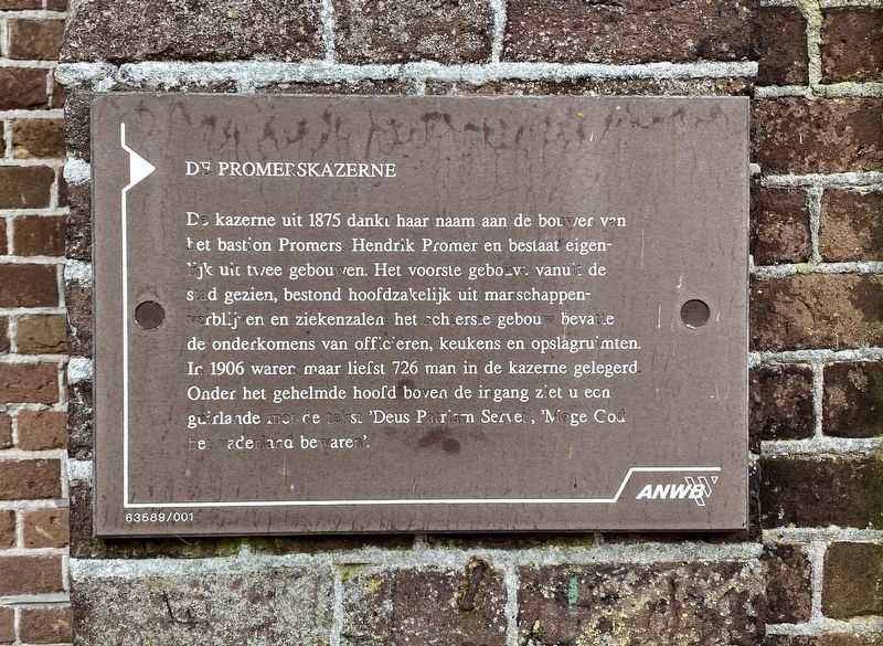
1. De Promerskazerne / Promers Barracks Marker

De kazerne uit 1875 dankt haar naam aan de bouwer van het bastion, Promers Hendrik Promer en bestaat eigenlijk uit twee gebouwen. Het voorste gebouw vanuit de stad gezien, bestond hoofdzakelijk uit manschappenverblijven en ziekenzalen het achterste gebouw bevatte de onderkomens van officieren, keukens en opslagruimten. In 1906 waren maar liefst 726 man in de kazerne gelegerd. Onder het gehelmde hoofd boven de ingang ziet u een guirlande met de tekst 'Deus Patriam Servet,' 'Moge God het vaderland bewaren'.
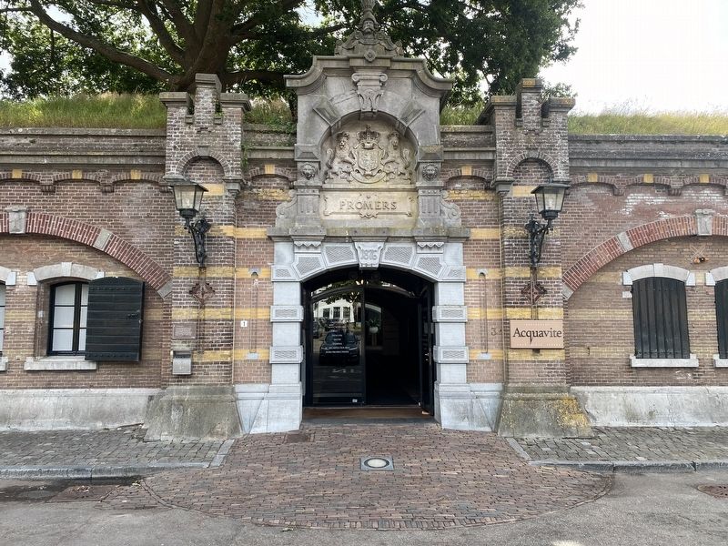
The barracks from 1875 owes its name to the builder of the Promers bastion, Hendrik Promer, and actually consists of two buildings. The front building, seen from the city, consisted mainly of crew quarters and infirmaries, the rear building contained officers' quarters, kitchens and storage rooms. In 1906, as many as 726 men were stationed in the barracks. Under the helmeted head above the entrance you can see a garland that reads 'Deus Patriam Servet (God save the country),' 'May God preserve the fatherland'.
Erected by The ANWB.
Topics. This historical marker is
this page online
Location. 52° 17.649′ N, 5° 9.875′ E. Marker is in Naarden, Noord-Holland (North Holland), in Gooise Meren. It is on Adriaan Dortsmanplein, on the right when traveling north. Touch for map. Marker is at or near this postal address: Adriaan Dortsmanplein 3, Naarden, Noord-Holland 1411 RC, Netherlands. Touch for directions.

Regionally, it is in Europe, the European Union, Atlantic Europe, the Benelux Low Countries, the Schengen Area, Western Europe, and the Western World. Historically, it finds itself in what was once the Holy Roman Empire.
Other nearby markers. At least 8 other markers are within walking distance of this marker: Het Spaanse Huis / The Spanish House (about 120 meters away, measured in a direct line); De Utrechtse Poort / The Utrecht Gate (about 150 meters away); Stadhuis / City Hall (about 180 meters away); Oude Stadehuis / Old City Hall - Marktstraat 22 Naarden (about 180 meters away); Replica van Stadspomp / City Water Pump Replica (about 210 meters away); Kogel / Cannonball (approx. 0.3 kilometers away); Bastion Turfpoort
Photographed by Andrew Ruppenstein, July 22, 2022
2. De Promerskazerne / Promers Barracks Marker - wide view
The marker is visible here to the left of the entrance.

Uitg. Mars Messie, Naarden (courtesy of Trinity College Watkinson Library), circa 1910
3. Naarden Promers Kazerne
Credits. This page was last revised on December 31, 2023. It was originally submitted on August 3, 2022, by Andrew Ruppenstein of Lamorinda, California. This page has been viewed 233 times since then and 24 times this year. Photos: 1, 2, 3. submitted on August 3, 2022, by Andrew Ruppenstein of Lamorinda, California.
