Shelby Park in Louisville in Jefferson County, Kentucky — The American South (East South Central)
Society of St. Vincent de Paul
⎯⎯⎯
Open Hand Kitchen
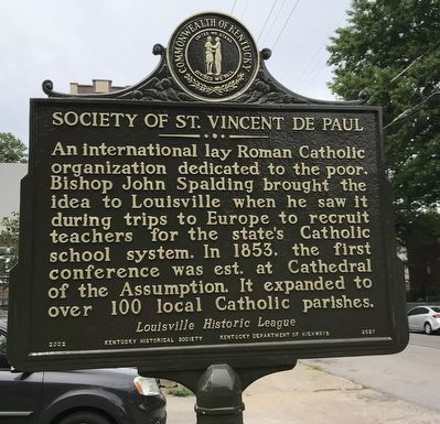
Photographed by Duane and Tracy Marsteller, July 24, 2022
1. Society of St. Vincent de Paul Marker side
Open Hand Kitchen In 1982, Archbishop Thomas Kelly offered St. Paul’s Church, school, & rectory to the Society for the Open Hand Kitchen to provide meals to those in need. The Society grew to include a shelter, housing, kitchen, food pantry, and recovery center, with the campus spanning a block. By the 21st century, 150,000 meals were annually served.
Erected 2022 by Kentucky Historical Society • Kentucky Department of Highways. (Marker Number 2627.)
Topics and series. This historical marker is listed in these topic lists: Charity & Public Work • Religion & Religious Structures. In addition, it is included in the Kentucky Historical Society series list. A significant historical year for this entry is 1853.
Location. 38° 14.157′ N,
this page online

Regionally, this marker is in the American South, specifically in the Upper South, and in the Ohio River Valley. Globally, it is in North America, the Western Hemisphere, the Western World, and the Anglosphere. Historically, it finds itself in what was once the territory of the Mississippian Culture and also the Antebellum South.
Other nearby markers. At least 8 other markers are within walking distance of this marker: Preston and St. Catherine Streets Historic District / Mason Maury (about 600 feet away, measured in a direct line); St. Matthew Church / Act of Compassion (about 700 feet away); Falls City Jeans & Woolen Mills / Kentucky Jeans (approx. 0.2 miles away); Shelby Park Neighborhood / Shelby Park Branch Library (approx. 0.2 miles away); William Shakespeare Caldwell / The Caldwell Sisters
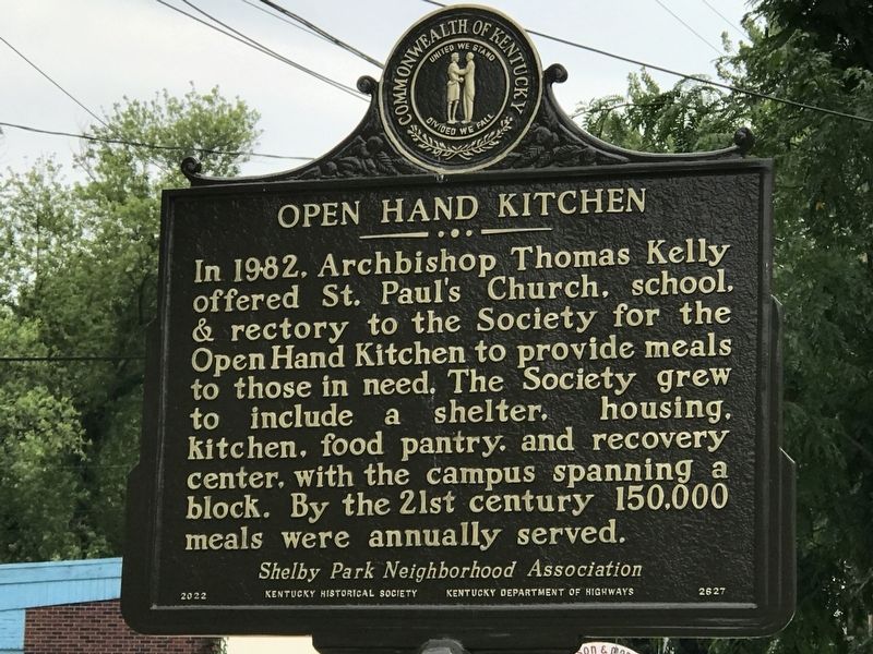
Photographed by Duane and Tracy Marsteller, July 24, 2022
2. Open Hand Kitchen Marker side
Credits. This page was last revised on February 12, 2023. It was originally submitted on August 4, 2022, by Duane and Tracy Marsteller of Murfreesboro, Tennessee. This page has been viewed 389 times since then and 29 times this year. Photos: 1, 2. submitted on August 4, 2022, by Duane and Tracy Marsteller of Murfreesboro, Tennessee.
