Tiburon in Marin County, California — The American West (Pacific Coastal)
US Immigration Station
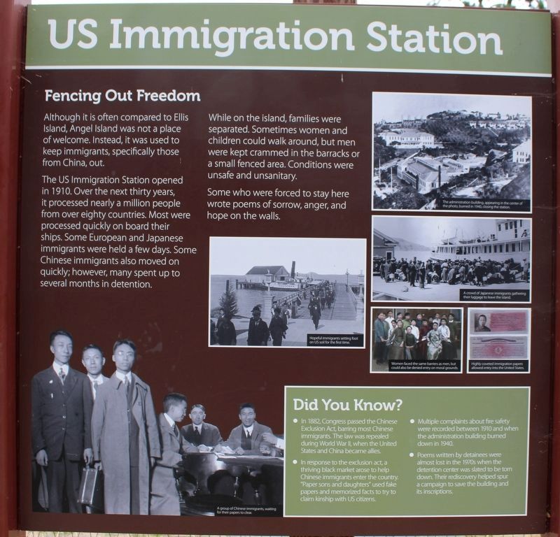
Fencing Out Freedom
Although it is often compared to Ellis Island, Angel Island was not a place of welcome. Instead, it was used to keep immigrants, specifically those from China, out.
The US Immigration Station opened in 1910. Over the next thirty years, it processed nearly a million people from over eighty countries. Most were processed quickly on board their ships. Some European and Japanese immigrants were held a few days. Some Chinese immigrants also moved on quickly; however, many spent up to several months in detention.
While on the island, families were separated. Sometimes women and children could walk around, but men were kept crammed in the barracks or a small fenced area. Conditions were unsafe and unsanitary.
Some who were forced to stay here wrote poems of sorrow, anger, and hope on the walls.
Did You Know?
• In 1882, Congress passed the Chinese Exclusion Act, barring most Chinese immigrants. The law was repealed during World War II, when the United States and China became allies.
• In response to the exclusion act, a thriving black market arose to help Chinese immigrants enter the country. “Paper sons and daughters” used fake papers and memorized facts to try to claim kinship with US citizens.
• Multiple complaints about fire safety were recorded between 1910 and when the administration building burned down in 1940.
• Poems written by detainees were almost lost in the 1970s when the detention center was slated to be torn down. Their rediscovery helped spur a campaign to save the building and its inscriptions.
Right Panel:
Discover
Memories Live On
Much of the original immigration station is gone, but the memories live on in the poems inscribed on the barracks walls and in the hearts of the immigrants’ families.
1 – [Written in Chinese]
2 – Ask older relatives about your family story. Did any of your ancestors pass through Angel Island or Ellis Island?
3 – Listen to a poem in Cantonese inside the barrcks.
4 – Can you find the foundations of the employee cottages designed by Julia Morgan, a famous California architect?
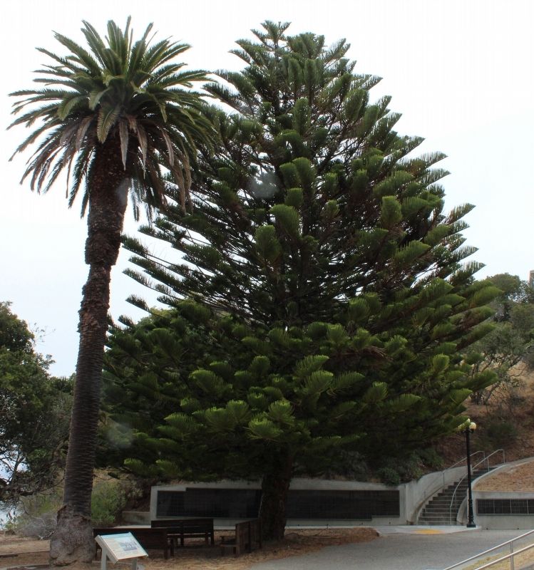
5 – Find the lone Norfolk Island pine and see if you can tell why these trees are often called “living Christmas trees.”
6 – Ring the fog bell on the wharf.
Safety Starts Here
Stay on trails and out of closed buildings to avoid injuries. By following these simple steps, you also help protect the park’s resources.
Left Panel
Angel Island State Park
(map)
Erected by California Department of Parks & Recreation.
Topics. This historical marker is listed in these topic lists: Asian Americans • Parks & Recreational Areas. A significant historical year for this entry is 1910.
Location. 37° 52.057′ N, 122° 25.527′ W. Marker is in Tiburon, California, in Marin County. Angel Island is located north of Alcatraz Island and is the largest island in the San Francisco Bay. It is accessed by ferry, private boat, watercraft, or kayak. Touch for map. Marker is in this post office area: Belvedere Tiburon CA 94920, United States of America. Touch for directions.
Other nearby markers. At least 8 other markers are within walking distance of this marker. Mule Barn (within shouting distance of this marker); Staff Housing (within shouting distance of this marker); A Garden Setting (within shouting distance of this marker); The Post Expands (about 300 feet away, measured in a direct line); Water Reservoir (about 500 feet away); Asian Men's Recreation Yard (about 600 feet away); Hospital (about 700 feet away); Segregation and Separation (about 800 feet away). Touch for a list and map of all markers in Tiburon.
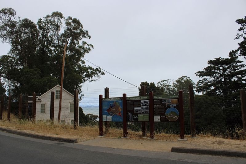
More about this marker. The three resin panels are mounted between four metal poles to the left of the US Immigration Station gates.
Regarding US Immigration Station. The entire island is a state park, except for Point Blunt on the southeastern tip, which is controlled by the U.S. Coast Guard.
Also see . . . Angel Island State Park.
"In 1905, construction of the Immigration Station began in the area then known as North Garrison. Surrounded by public controversy from its inception, the station was finally put into partial operation in 1910. It was designed to process Chinese immigrants whose entry was restricted by the Chinese Exclusion Law of 1882. A rush of immigrants from Europe were expected with the opening of the Panama Canal, but international events after 1914, including the outbreak of World War I, cancelled the expected rush, but Asians continued to arrive on the West Coast and to go through immigration procedures. Though most immigrants processed through the Immigration Station on Angel Island were Chinese, over 80 countries were represented by the influx of immigrants."(Submitted on August 6, 2022, by Joseph Alvarado of Livermore, California.)
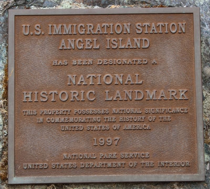
Photographed By Joseph Alvarado, July 30, 2022
5. US Immigration Station Marker
Has been Designated a
National Historic Landmark
’ This property possesses national significance in commemorating the history of the United States of America
1997
National Park Service
United States Department of the Interior
Credits. This page was last revised on August 19, 2022. It was originally submitted on August 6, 2022, by Joseph Alvarado of Livermore, California. This page has been viewed 96 times since then and 17 times this year. Photos: 1, 2, 3, 4, 5, 6. submitted on August 6, 2022, by Joseph Alvarado of Livermore, California. • Syd Whittle was the editor who published this page.
