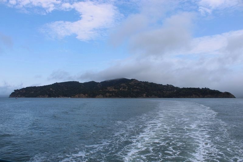
Tiburon in Marin County, California — The American West (Pacific Coastal)
Angel Island Immigration Station
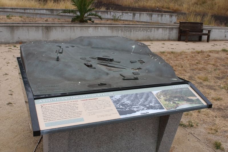
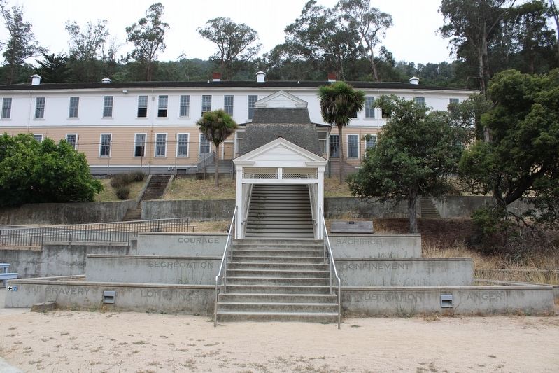
Angel Island was modeled after the Ellis Island Immigration Station in New York Harbor. The hub of operations was the Administration Building. It housed intake and interrogation facilities, staff offices, a records vault, dormitories and dining rooms. Flanking it on the hillsides were the Detention Barracks, Hospital, Central Heating Plant and employee cottages. When the Administration Building burned in 1940, the station was closed and operations were moved to San Francisco.
[The text repeats in Chinese]
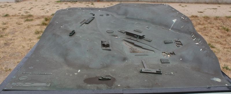
占地 13 英亩的独立设施 天使岛以纽约港的埃利斯岛移民站为蓝本。行动中心是行政大楼。它设有收容和审讯设施、员工办公室、档案库、宿舍和餐厅。山坡上的侧翼是拘留营、医院、中央供热厂和员工小屋。当行政大楼在 1940 年被烧毁时,车站关闭,运营转移到旧金山。 Zhàn de 13 yīngmǔ de dúlì shèshī tiānshǐ dǎo yǐ niǔyuē gǎng de āi lì sī dǎo yímín zhàn wèi lánběn. Xíngdòng zhōngxīn shì xíngzhèng dàlóu. Tā shè yǒu shōuróng hé shěnxùn shèshī, yuángōng bàngōngshì, dǎng'àn kù, sùshè hé cāntīng. Shānpō shàng de cèyì shì jūliú yíng, yīyuàn, zhōngyāng gōng rè chǎng hé yuángōng xiǎowū. Dàng xíngzhèng dàlóu zài 1940 nián bèi shāohuǐ shí, chēzhàn guānbì, yùnyíng zhuǎnyí dào jiùjīnshān. This model shows the immigration station as it was from 1912 to the early 1930s. Additional buildings were built in the 1940s when this station became a World War II POW Camp.
Caption: The Immigration Station in the 1920s (left) and the late 1990s (right).
Topics. This historical marker is listed in these topic lists: Parks & Recreational Areas • War, World II. A significant historical year for this entry is 1940.
Location. 37° 52.201′ N, 122° 25.576′ W. Marker is in Tiburon, California, in Marin County. Angel Island is located north of Alcatraz Island and is the largest island in the San Francisco Bay. It is accessed by ferry, private boat, watercraft, or kayak. Touch for map. Marker is in this post office area: Belvedere Tiburon CA 94920, United States of America. Touch for directions.
Other nearby markers. At least 8 other markers are within walking distance of this marker. Immigrations Hearings (a few steps from this marker); Registration and Screening (a few steps from this marker); First Occupants of the Cove (a few steps from this marker); Intake, Processing and Waiting (a few steps from this marker); a different marker also named Angel Island Immigration Station (a few steps from this marker); Life on the Second Floor (within shouting distance of this marker); Arrivals from Around the World (within shouting distance of this marker); The Wharf / 碼頭 (within shouting distance of this marker). Touch for a list and map of all markers in Tiburon.
More about this marker. The resin marker is mounted to a table with a bronze relief map of the Immigration Station in the courtyard where the Administration Building once stood.
Regarding Angel Island Immigration Station. The entire island is a state park, except for Point Blunt on the southeastern tip, which is controlled by the U.S. Coast Guard.
Also see . . . Immigration Station @ California Dept of Parks & Recreation
Photographed By Joseph Alvarado, July 30, 2022
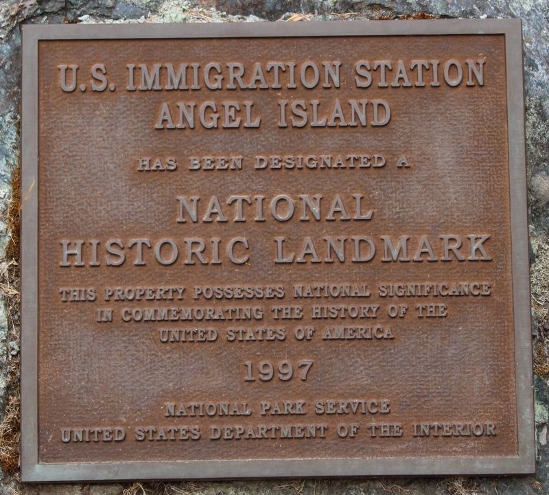
3. Angel Island Immigration Station Marker
Angel Island
Has been designated a
National Historic Landmark
This property possesses national significance in commemorating the history of the United Stated of America
1997
National Park Service
United States Department of the Interior
"In 1905, construction of the Immigration Station began in the area then known as North Garrison. Surrounded by public controversy from its inception, the station was finally put into partial operation in 1910. It was designed to process Chinese immigrants whose entry was restricted by the Chinese Exclusion Law of 1882."(Submitted on August 8, 2022, by Joseph Alvarado of Livermore, California.)
Credits. This page was last revised on August 30, 2022. It was originally submitted on August 8, 2022, by Joseph Alvarado of Livermore, California. This page has been viewed 105 times since then and 12 times this year. Photos: 1, 2. submitted on August 8, 2022, by Joseph Alvarado of Livermore, California. 3. submitted on August 26, 2022, by Joseph Alvarado of Livermore, California. 4, 5, 6, 7. submitted on August 8, 2022, by Joseph Alvarado of Livermore, California. 8. submitted on August 26, 2022, by Joseph Alvarado of Livermore, California. • Syd Whittle was the editor who published this page.

