Roxbury in Northwest Hills Region, Connecticut — The American Northeast (New England)
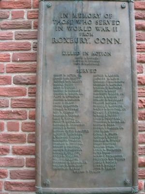
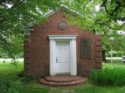
Roxbury WW II Veterans Marker
Photographed by Michael Herrick, June 22, 2009
1. Roxbury WW II Veterans Marker
Inscription.
In memory of those who served in World War II from Roxbury, Conn.
Killed In Action
David A. Barker • Harold C. Collins • Paul C. MacDonald
Served
James M. Acton, Jr. • James McK. Beatty • Harold Beers • John J. Berger • Murray G. Bernays • George W. Booth, Jr. • Floyd R. Byington • George A. Carlson • David G. Clapp • Irving Comstock • Donald K. Conway • Neil H. Conway • William A. Conway • David D. Coyle • Raymond D. Cummings • George S. DeVoe • Herman Peter DeWetter • Albert D. Dickinson • A. Richard Diebold • Henrietta Frantze • Charles W. Frizzell • Robert P. Frizzell • Andrew R. Gardella • Horace D. Gillette • Roger W. Gillette • Willis J. Gillette • Everhard G. Graham, Jr. William B. Hurlburt • Bronislaw Kerski • Arthur H. Larson • Jackson M. Lewis • Zigmund P. Malinowski • Charles P. Mathews • Joseph A. Miles • Danforth Miller, Jr. • Daniel B. Miller • Edward R. Murkland • Frasier McCann • Russell P. McGovern • Wilbur A. McIntyre, Jr. • Edward T. O.Brien • Howard L. Pettit • Louis J. Pokrywka • Theodore K. Quinn, Jr. • Gustaf O. Rehn • George F. Sander, Jr. • Otis Slinn • Donald W. Smith • Arthur E. Spargo •
Click or scan to see this page online
Douglas W. Spargo • Grant Stafford • William Stahl • Leslie W. Thompson • Peter Tripp • Henry G. Trowbridge • Frederick Van Deusen • James P. Wagner • John W. Wagner • John B. Zealor • William F. Zealor
Topics. This historical marker is listed in this topic list: War, World II.
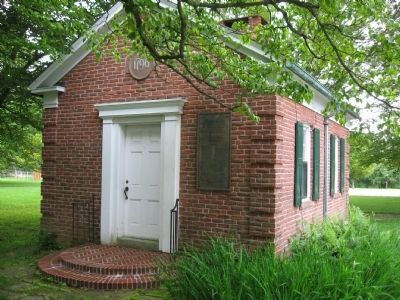
Location. 41° 33.343′ N, 73° 18.546′ W. Marker is in Roxbury in Northwest Hills Region, Connecticut. It is on South Street 0.1 miles south of Wellers Bridge Road, on the right when traveling south. Marker is on the wall of the Roxbury Museum. Touch for map. Marker is at or near this postal address: 9 South Street, Roxbury CT 06783, United States of America. Touch for directions.
Regionally, this marker is in the Berkshire Foothills and in the Litchfield Hills. It is also in the American Northeast and in New England. Globally, it is in North America, the Western Hemisphere, the Western World, and the Anglosphere. Historically, it finds itself in what was once Litchfield County and also one of the original Thirteen Colonies.
Other nearby markers. At least 8 other markers are within 2 miles of this
Credits. This page was last revised on May 19, 2026. It was originally submitted on June 28, 2009, by Michael Herrick of Southbury, Connecticut. This page has been viewed 2,008 times since then and 18 times this year. Photos:1, 2, 3. submitted on June 28, 2009, by Michael Herrick of Southbury, Connecticut. • Bill Pfingsten was the editor who published this page.