Near Frisco in Dare County, North Carolina — The American South (South Atlantic)
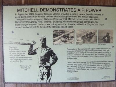
Mitchell Demonstrates Air Power
Photographed by Charles O. Frazier, June 26, 2009
1. Mitchell Demonstrates Air Power Marker
Responding to General Mitchell's urgent call for construction of a temporary airfield, local Hatterasmen used shovels, hoes, and horsedrawn carts alongside a tractor pulling a weighted pallet, to fill holes, tidal pools, and marshy areas and pack level a landing strip. Their quick work helped to ensure the success of Mitchell's demonstration.
Despite the effectiveness of this, and other demonstrations, it would be many years before Mitchell's far-reaching ideas on air power were adopted. Mitchell was posthumously honored in 1946 when he was awarded a special medal of honor "in recognition of his outstanding pioneer
this page online
"My children in their lifetime will see aeronautics become the greatest and principal means of national defense and rapid transportation all over the world and possibly beyond our world into interstellar space."
Erected by Frisco Civic League. Northeastern Historic Places Office, NC Dept of Cultural Resources. US Dept of Interior, National Park Service, Cape Hatteras National Seashore.
Topics. This historical marker is listed in these topic lists: Air & Space • Patriots & Patriotism. A significant historical month for this entry is September 1923.
Location. 35° 13.917′ N, 75° 37.348′ W. Marker is near Frisco, North Carolina, in Dare County. It is on Billy Mitchell Road 0.2 miles east of North Carolina Highway 12, on the right when traveling east. The marker is located on the porch of the small building at the Billy Mitchell Airport. Touch for map. Marker is at or near this postal address: 53252 Billy Mitchell Rd, Frisco NC 27936, United States of America. Touch for directions.

Regionally, this marker is in the Coastal Plain and on the Outer Banks. It is also in the American South, specifically in the Upper South, in the Tidewater, and on the Eastern Seaboard. Globally, it is in the North Atlantic Region, North America, the Western Hemisphere, the Western World, and the Anglosphere. Historically, it finds itself in what was once the territory of the Mississippian Culture, one of the original Thirteen Colonies, one of the Confederate States of America, and the Antebellum South.
Other nearby markers. At least 8 other markers are within 5 miles of this marker, measured as the crow flies: Welcome to Frisco (approx. 2.6 miles away); Island Veterans of the Civil War / America's 1st Amphibious Assault of the Civil War (approx. 3.1 miles away); Welcome to Hatteras Village (approx. 3.1 miles away); Billy Mitchell (approx. 3½ miles away); U.S.S. Monitor (approx. 3½ miles away); America's 1st Attempt at Civil War Reunification (approx. 3.9 miles away); Storm Watch (approx. 3.9 miles away); Confederate Forts (approx. 4.8 miles away).
Credits. This page was last revised on November 28, 2019. It was originally submitted on June 28, 2009, by Charles O. Frazier of Williamsburg, Virginia. This page has been viewed 1,448 times since then and 31 times this year. Photo 1. submitted on June 28, 2009, by Charles O. Frazier of Williamsburg, Virginia. • Kevin W. was the editor who published this page.
