Clinton in Greene County, Alabama — The American South (East South Central)
Clinton Baptist Church
Photographed by Duane and Tracy Marsteller, August 6, 2022
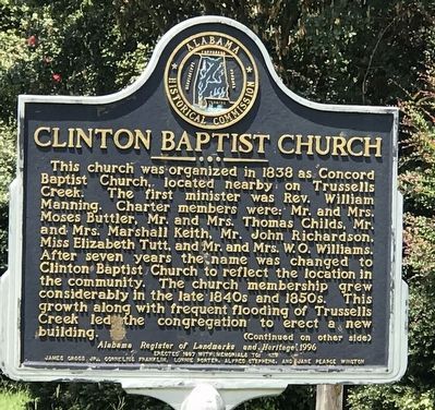
1. Clinton Baptist Church Marker (side A)
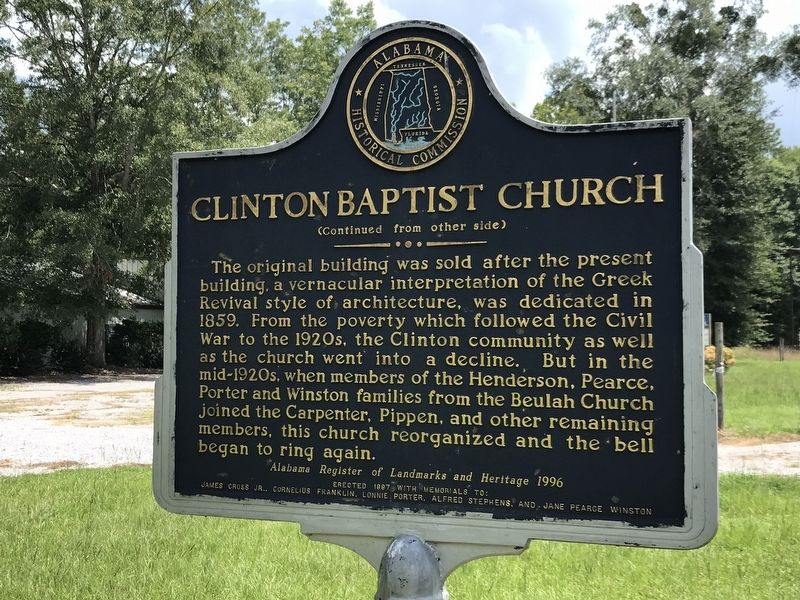
The original building was sold after the present building, a vernacular interpretation of the Greek Revival style of architecture, was dedicated in 1859. From the poverty which followed the Civil War to the 1920s, the Clinton community as well as the church went into a decline. But in the mid-1920s, when members of the Henderson, Pearce, Porter and Winston families from the Beulah Church joined the Carpenter, Pippen, and other remaining members, this church reorganized and the bell began to ring again.
Erected 1997
this page online
Topics and series. This historical marker is listed in this topic list: Religion & Religious Structures. In addition, it is included in the Alabama Historical Commission series list. A significant historical year for this entry is 1838.
Location. 32° 54.844′ N, 87° 59.698′ W. Marker is in Clinton, Alabama, in Greene County. It is on Alabama Route 39 0.1 miles west of Route 14, on the right when traveling west. Touch for map. Marker is at or near this postal address: 140 AL-39, Clinton AL 35448, United States of America. Touch for directions.

Regionally, this marker is in the American South, specifically in the Deep South, and in the Black Belt. Globally, it is in North America, a Gulf of Mexico state, the Western Hemisphere, the Western World, and the Anglosphere. Historically, it finds itself in what was once New Spain, the territory of the Mississippian Culture, one of the Confederate States of America, and the Antebellum South.
Other nearby markers. At least 8 other markers are within 9 miles of this marker, measured as the crow flies: Hardy Homeplace (approx. 6.7 miles away); First Presbyterian Church
Photographed by Duane and Tracy Marsteller, August 6, 2022
2. Clinton Baptist Church Marker (side B)
Photographed by Duane and Tracy Marsteller, August 6, 2022
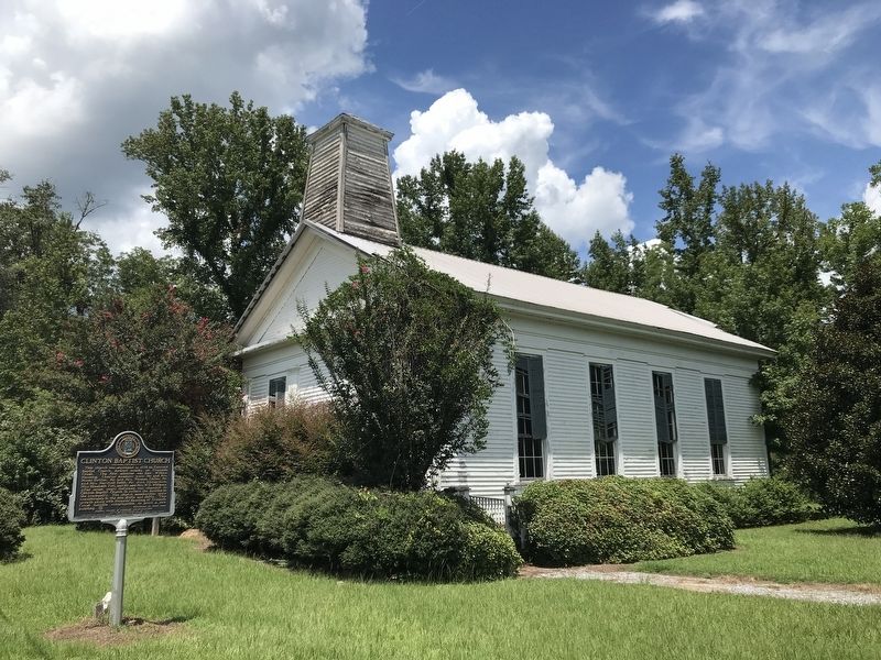
3. Clinton Baptist Church Marker
Credits. This page was last revised on August 11, 2022. It was originally submitted on August 11, 2022, by Duane and Tracy Marsteller of Murfreesboro, Tennessee. This page has been viewed 724 times since then and 65 times this year. Photos: 1, 2, 3. submitted on August 11, 2022, by Duane and Tracy Marsteller of Murfreesboro, Tennessee.
