West Greene in Greene County, Alabama — The American South (East South Central)
Hardy Homeplace
Greene County
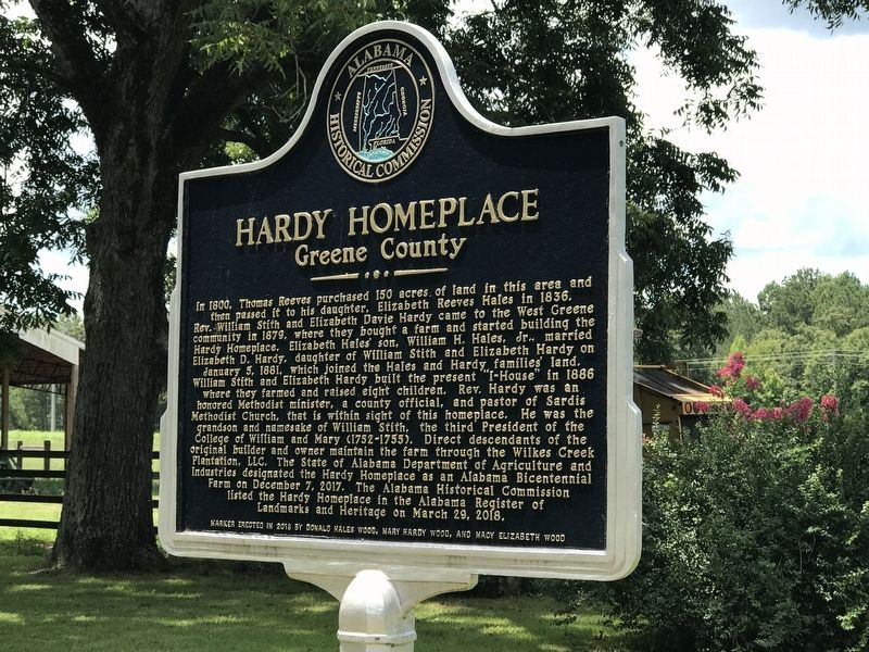
Photographed by Duane and Tracy Marsteller, August 6, 2022
1. Hardy Homeplace Marker
this page online
Erected 2018 by Alabama Historical Commission • Donald Wales Wood • Mary Hardy Wood • Macy Elizabeth Wood.
Topics and series. This historical marker is listed in these topic lists: Agriculture • Settlements & Settlers. In addition, it is included in the Alabama Historical Commission series list. A significant historical year for this entry is 1879.
Location. 32° 55.411′ N, 88° 6.594′ W. Marker is in West Greene, Alabama, in Greene County. It is on County Road 117 0.1 miles east of County Road 20, on the right when traveling east. Touch for map. Marker is in this post office area: Boligee AL 35443, United States of America. Touch for directions.

Regionally, this marker is in the American South, specifically in the Deep South, and in the Black Belt. Globally, it is in North America, a Gulf of Mexico state, the Western Hemisphere, the Western World, and the Anglosphere. Historically, it finds itself in what was once New Spain, the territory of the Mississippian Culture, one of the Confederate States of America, and the
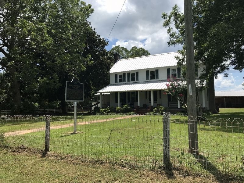
Photographed by Duane and Tracy Marsteller, August 6, 2022
2. Hardy Homeplace Marker
Other nearby markers. At least 8 other markers are within 14 miles of this marker, measured as the crow flies: Pleasant Ridge Presbyterian Church (approx. 6.3 miles away); Clinton Baptist Church (approx. 6.7 miles away); Town of Gainesville (approx. 7½ miles away); Woodbury (approx. 7½ miles away); In Memory of James McCrory (approx. 8.7 miles away); Old Bethany Cemetery (approx. 8.7 miles away); Boligee Presbyterian Church (approx. 12.6 miles away); George Downer Field (approx. 13.6 miles away).
Credits. This page was last revised on August 11, 2022. It was originally submitted on August 11, 2022, by Duane and Tracy Marsteller of Murfreesboro, Tennessee. This page has been viewed 900 times since then and 105 times this year. Photos: 1, 2. submitted on August 11, 2022, by Duane and Tracy Marsteller of Murfreesboro, Tennessee.
