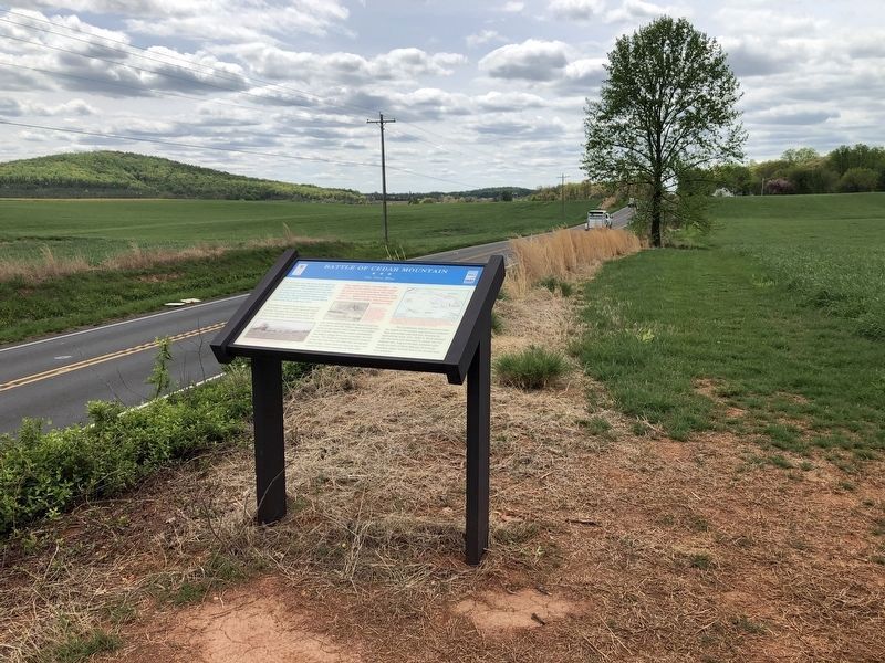
Near Rapidan in Culpeper County, Virginia — The American South (Mid-Atlantic)
Battle of Cedar Mountain
The First Blow
Inscription.
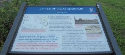
"As we came over the brow of the hill our men were fearfully mowed down, but not one faltered. … Our musketry was without any cessation, and theirs was the same. The balls came in perfect sheets around us, besides this, flank batteries played upon us with heavy shell." —Lt. Aron Bates, 102nd New York Infantry, USA
"Two mighty armies rush together … the smoke rises far above even us like indeed the smoke of a great furnace. The clash and roar of muskets and the thunder of the cannon … filled even the least sensitive with awe." —Pvt. Robert Miller, 14th Louisiana Infantry, CSA
Preceded by Regulars acting as skirmishers, Union Gen. Christopher C. Augur's eight regiments moved through this field, then in tall corn, under heavy fire. Deployed in two massive lines, one behind the other, they stretched from where you now stand across present-day Route 15 and into the fields to your left. Volleys ripped through their ranks as they came within range of the Confederate infantry. One Union soldier remembered the bullets cutting down the cornstalks "as with knives." The Federals pressed forward, trying to sweep their foes from the field. Each charge—there were as many as nine—was repulsed with severe casualties on both sides.
The Confederate infantry wavered under the weight of the assault, and soldiers fell from both heat stroke and enemy fire. Augur's attack, coupled with Crawford's berakthrough on the Confederate left, forced Jackson's line back. Gen. Jubal A. Early galloped onto the scene and halted the withdrawal, steadying the line. Augur was seriously wounded, and two of his brigade commanders were casualties as well—Gen. John Geary was wounded twice and Gen. Henry Prince was captured.
(captions)
Augur's men advanced into fire from three directions. Confederates along the Crittenden Lane poured in musketry and canister from the front combined with volleys from riflemen along the fence to your right. Cannons on the slopes of Cedar Mountain on your left raked the Union ranks.
This historic photograph shows the ground that Augur's men traversed on August 9. - Courtesy Library of Congress
To your right, Union Gen. Samuel Crawford's brigade advanced to the base of the hill, where a cabin stood. One soldier descibed the two lines "fighting with nothing to protect them save the hand of God." Courtesy Library of Congress
Erected 2022 by American Battlefield Trust.
Topics. This historical marker is listed in this topic list: War, US Civil. A significant historical date for this entry is August 9, 1862.
Location. 38° 24.283′ N, 78° 3.847′

Photographed By Devry Becker Jones (CC0), April 17, 2021
2. N James Madison Hwy & Dove Hill Rd
Original CWT marker has been replaced.
Other nearby markers. At least 8 other markers are within walking distance of this marker. A different marker also named Battle of Cedar Mountain (about 700 feet away, measured in a direct line); a different marker also named Battle of Cedar Mountain (about 700 feet away); a different marker also named Battle of Cedar Mountain (approx. 0.2 miles away); Tenth Maine (approx. 0.2 miles away); a different marker also named Battle of Cedar Mountain (approx. ¼ mile away); a different marker also named Battle of Cedar Mountain (approx. ¼ mile away); a different marker also named Battle of Cedar Mountain (approx. ¼ mile away); a different marker also named The Battle of Cedar Mountain (approx. ¼ mile away). Touch for a list and map of all markers in Rapidan.
Related marker. Click here for another marker that is related to this marker. Old Marker At This Location also titled "Battle of Cedar Mountain".
Also see . . . Friends of Cedar Mountain Battlefield. (Submitted on August 12, 2022.)
Credits. This page was last revised on August 12, 2022. It was originally submitted on August 12, 2022, by Benjamin Harrison Allen of Amissville, Virginia. This page has been viewed 114 times since then and 28 times this year. Photos: 1. submitted on August 11, 2022, by Benjamin Harrison Allen of Amissville, Virginia. 2. submitted on April 19, 2021, by Devry Becker Jones of Washington, District of Columbia. • Bernard Fisher was the editor who published this page.
