Chisholm in Saint Louis County, Minnesota — The American Midwest (Upper Plains)
Chisholm Fire Memorial
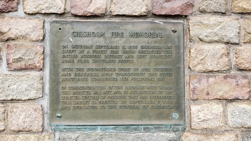
Photographed by J Kosluchar, August 7, 2022
1. Chisholm Fire Memorial
On Saturday September 5, 1908 Chisholm was swept by a forest fire which destroyed the entire business district and left homeless some four thousand people
With the indomitable spirit of our citizens and generous help throughout the state rebuilding commenced the following day
In commemoration of the courage with which this disaster was met and in recognition of the quarter century of progress that has intervened this tablet is erected on September 5, 1933 and dedicated to the pioneers of Chisholm
Erected 1933.
Topics. This historical marker and memorial is listed in this topic list: Disasters. A significant historical date for this entry is September 5, 1908.
Location. 47° 29.373′ N, 92° 53.25′ W. Marker is in Chisholm, Minnesota, in Saint Louis County. It is on West Lake Street 0.1 miles west of 4th Avenue West, in the median. The marker faces east and is mounted near the entrance to Memorial Park and the Museum of Mining. Touch for map. Marker is in this post office area: Chisholm MN 55719, United States of America. Touch for directions.

Regionally, this marker and memorial is in the Arrowhead Region and in the Iron Range.
this page online
Other nearby markers. At least 8 other markers are within 4 miles of this marker, measured as the crow flies: The Emergence of Man Through Steel (approx. 0.7 miles away); Miners' Lookout (approx. 0.9 miles away); Moving the Town (approx. 3.9 miles away); Business District (approx. 3.9 miles away); Frank Hibbing (approx. 3.9 miles away); Schools (approx. 3.9 miles away); Carnegie Library (approx. 3.9 miles away); Oliver Club (approx. 3.9 miles away). Touch for a list and map of all markers in Chisholm.
Regarding Chisholm Fire Memorial. There was a single fatality in the fire, but the city was largely destroyed by the fire. A score of buildings were left standing in the five year old town. The damage was estimated at $1,750,000 at the time. 4,000 people were homeless.
The City of Chisholm celebrates fire days annually.
Credits. This page was last revised on August 28, 2022. It was originally submitted on August 12, 2022, by J Kosluchar of Minneapolis, Minnesota. This page has been viewed 935 times since then and 66 times this year. Photo 1. submitted on August 12, 2022, by J Kosluchar of Minneapolis, Minnesota. • J. Makali Bruton was the editor who published this page.
Editor’s want-list for this marker. A wide view photo of the marker and the surrounding area together in context. • Can you help?
