Near Coffeeville in Clarke County, Alabama — The American South (East South Central)
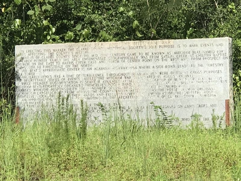
Mitcham Beat and the Mitcham War
Inscription.
In erecting this marker the Clarke County Historical Society's sole purpose is to mark events and areas affecting the county's history.
Beat 15 of Clarke County, since the mid 19th century, came to be known as Mitcham Beat, named for an early pioneer family. The area encompassed geographically was from Satilpa Creek at Chilton Baptist Church on the east to Harris Creek, east and north of Center Point on the west, and from Prospect on the south to Forestdale on the north.
The beat's approximate center is on Alabama Highway #154 where a side road leads to the forestry fire tower.
The early 1890's was a time of turbulence throughout Alabama. Men were often at cross purposes. The regrettable series of events labeled “The Mitcham War” culminated in August of 1893.
While reliable documentation is scant, if available at all, a small group of men in or near Beat 15 (Mitcham Beat), reportedly organized themselves into a band known as “Hell at the Breech.” This group was charged with the responsibility for a number of unlawful acts including murder.
A much larger group from across the county known afterward as the posse or mob, organized themselves, took the law in their hands and executed several members of the smaller group.
An appraisal of the forces contributing to this regrettable chapter in Clarke County's history would include:
(1) The Reconstruction period after the Civil War.
(2) The advancing or crop lien system with sometimes extortionate mortgages on land, crops and stock, obligating farmers to grow cotton, which was king.
(3) Politics – both county and state.
(4) Carpet-bagger land speculators.
(5) A few hot-heads, who disregarded or lost respect for law enforcement, or who took the law in their hands, assuming its prerogatives.
Erected 1981 by Clarke County Historical Society.
Topics. This historical marker is listed in this topic list: Notable Events. A significant historical month for this entry is August 1893.
Location. 31° 48.852′ N, 87° 55.501′ W. Marker is near Coffeeville, Alabama, in Clarke County. Marker is at the intersection of Alabama Route 154 and Fire Tower Road, on the right when traveling west on State Route 154. Touch for map. Marker is in this post office area: Coffeeville AL 36524, United States of America. Touch for directions.
Other nearby markers. At least 8 other markers are within 11 miles of this marker, measured as the crow flies. Clarke County Courthouse Site (approx. 6˝ miles away); Tallahatta Springs (approx. 7.6 miles away); King Institute (approx. 8.8 miles away); Ulcanush Baptist Church (approx. 9.1 miles away); Creek Indian War (approx. 9.2 miles away); Elijah & Isaac Pugh
(approx. 9.6 miles away); Fort Landrum Site (approx. 10.2 miles away); Clarke-Washington Electric Membership Corporation (approx. 10.2 miles away). Touch for a list and map of all markers in Coffeeville.
More about this marker. Complete inscription obtained from Clarke County Historical Society.
Also see . . . Mitcham War. The 1892 Alabama gubernatorial election added fuel to long-simmering tensions between rural farmers and the town-based merchant class in Clarke County, resulting in violence that claimed at least 10 lives. (Encyclopedia of Alabama, posted Feb. 8, 2012) (Submitted on August 12, 2022, by Duane and Tracy Marsteller of Murfreesboro, Tennessee.)
Credits. This page was last revised on August 12, 2022. It was originally submitted on August 12, 2022, by Duane and Tracy Marsteller of Murfreesboro, Tennessee. This page has been viewed 493 times since then and 83 times this year. Photos: 1, 2. submitted on August 12, 2022, by Duane and Tracy Marsteller of Murfreesboro, Tennessee.

