Near Jasper in Jasper National Park, Alberta — Canada’s Prairie Region (North America)
David Thompson
1770-1857
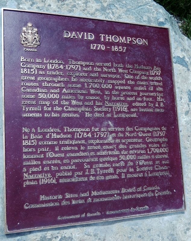
Born in London, Thompson served both the Hudson's Bay Company (1784-1797) and the North West Company (1797-1815) as trader, explorer and surveyor. One of the world’s great geographers, he accurately mapped the main travel routes through some 1,700,000 square miles of the Canadian and American West, in the process journeying some 50,000 miles by canoe, by horse and on foot. His great map of the West and his Narrative, edited by J.B. Tyrrell for the Champlain Society (1916), are lasting monuments to his genius. He died at Longueuil.
Né à Londres, Thompson fut au service des Compagnies de la Baie d'Hudson (1784-1797) et du Nord-Ouest (1797-1815) comme trafiquant, explorateur et arpenteur. Géographe hors pair, il releva le tracé exact des grandes voies sillonnant l'Ouest canadien et américain sur environ 1,700,000 milles carrés, en parcourant quelque 50,000 milles à cheval, à pied, et en canot. Sa grande carte de l'Ouest et son Narrative, publié par J.B. Tyrrell pour la Société Champlain (1916), témoignent de son génie. Il mourut à Longueuil.
Erected by Historic Sites and Monuments Board of Canada/Commission des lieux et monuments historiques du Canada.
Topics and series. This historical marker is listed in these topic lists: Exploration • Industry & Commerce • Waterways & Vessels. In addition, it is included in the Canada, Historic Sites and Monuments Board series list. A significant historical year for this entry is 1770.
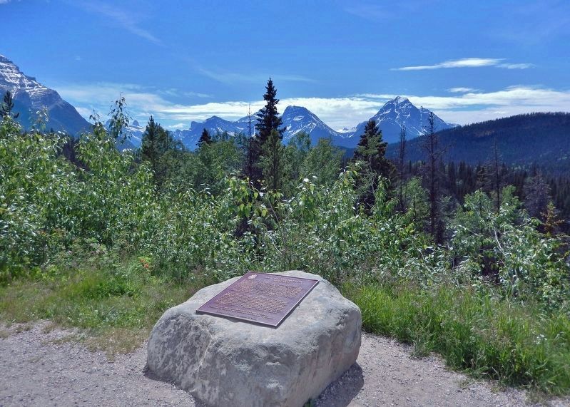
Location. 52° 43.039′ N, 117° 52.499′ W. Marker is near Jasper, Alberta, in Jasper National Park. Marker is on Icefields Parkway (Provincial Highway 93) 24 kilometers south of Yellowhead Highway (Provincial Highway 16), on the right when traveling south. Marker is located at the Athabasca Pass Lookout wayside. Touch for map. Marker is in this post office area: Jasper AB T0E 1E0, Canada. Touch for directions.
Other nearby markers. At least 1 other marker is within 23 kilometers of this marker, measured as the crow flies. Henry House (approx. 22.2 kilometers away).
More about this marker. Old photos of this marker show it mounted upright on a stone plinth, but now it is mounted horizontally at ground-level on a large flat rock.
Also see . . .
1. David Thompson.
David Thomson was called “the greatest land geographer who ever lived.” He walked or paddled 80,000 km or more in his life, mapping most of western Canada, parts of the east and the northwestern United States. Thompson learned astronomy and mathematics and spent so much time examining the sun and stars that he lost his sight in one eye. He broke his leg and it healed badly and he had a limp for the rest of his life. Yet this one-eyed, limping man mapped more territory than any other European. He surveyed the territory west of Lake Superior and the 49th parallel, which eventually became the dividing line between Canada and the United States. He mapped the north and paddled to the west coast.(Submitted on August 12, 2022, by Cosmos Mariner of Cape Canaveral, Florida.)
2. David Thompson and the Mapping of Canada.
In 1799, Thompson married a Métis woman named Charlotte Small. He was 29; she was 13. Their marriage lasted 58 years. They had 13 children, 5 of them while he was still exploring. Thompson often took those children and his wife on his trips, venturing into unknown, sometimes hostile territory. At the Hudson’s Bay Company, he was valued as a fur trader, but Thompson wanted to explore rather than trade. He left the HBC and joined the rival North West Company where he spent the next 15 years exploring. In all, he spent 27 years mapping the west. “The age of guessing is passed away,” he wrote. Thompson predicted the changes that would come to the west, that it would become farmland and Indigenous peoples would be pushed from their land.(Submitted on August 12, 2022, by Cosmos Mariner of Cape Canaveral, Florida.)
Credits. This page was last revised on August 12, 2022. It was originally submitted on August 12, 2022, by Cosmos Mariner of Cape Canaveral, Florida. This page has been viewed 130 times since then and 21 times this year. Photos: 1, 2. submitted on August 12, 2022, by Cosmos Mariner of Cape Canaveral, Florida.

