Lincoln Square in Manhattan in New York County, New York — The American Northeast (Mid-Atlantic)
Richard Tucker Park
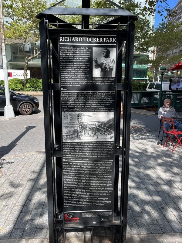
Richard Tucker Park is named after the renowned tenor, Richard Tucker (1913-1975). Born and raised in Brooklyn, NY, Richard Tucker worked as a cantor before making his debut with the Metropolitan Opera in 1945, where he enjoyed a 30-year career, specializing in Italian operatic works.
The park's bronze portrait bust of Tucker, created by Milton Hebald (1917-2015), sits on an inverted, tapered and polished granite pedestal on which are inscribed the titles of 31 operas in which Tucker performed. In 1979, the monument was unveiled and given as a gift by Tucker's wife, Sara, and the Richard Tucker Music Foundation, established in the tenor's memory to support young American opera singers. A similar bust was unveiled in Tel Aviv, Israel that same year. In 1980 the park was officially named Ricahrd Tucker Park.
History
For many years the site of Richard Tucker Park and the parcel to its south were both considered part of what was known as Empire Park, which was eventually separated into two parks: Empire Park North and Empire Park South. In 1811, the City Commissioners created the extraordinary grid plan, which extended to 155th Street. The design incorporated the meandering path of Bloomingdale Road (now called Broadway) and the points at this path crossed the new grid became "bowtie" intersections, which would develop as centers of activity and typically became small parks.
By 1880 the elevated train on Ninth Avenue (known as the "El") extended into the Upper West Side, greatly increasing access to the area and spurring a rush of businesses, theaters and hotels in the area. The El station was located at 66th Street, its iron stairways on the edge of the present-day Richard Tucker Park. By 1902 the Interborough Rapid Transit Company was excavating under Broadway for the subway and its station entrances, which were also located on 66th Street opposite the El. In 1906 the area surrounding the intersection of Broadway and Columbus Avenue was officially named Lincoln Square by the New York City Board of Aldermen. In 1940, after coexisting with the subway for 35 years, the El was demolished. Richard Tucker Park became a transportation hub for the entire district and retains this function today.
Nearby Parks (www.nyc.gov/parks)
Central Park, the first public park in America, encompasses 843 acres with a six-mile perimeter extending from Central Park West to Fifth Avenue and 59th Street to 110th Street. The park, designed by Frederick Law Olmsted and Calvert Vaux, was completed in 1873 and declared National Historic Landmark in 1965 and a New York City Landmark in 1974. Central Park has approximately 50 fountains, monuments and
Columbus Circle, completed in 1905, is located across from the Maine Monument at the southwest corner of Central park. The statue at the center, by Italian sculptor Gaetano Russo, is the point at which distances to and from New York City are officially measured. It was erected as part of New York's 1892 commemoration of the 400th anniversary of Columbus' first voyage to the Americas. In 2005 the circle was rebuilt by the City based on a design by the Olin Partnership of Philadelphia, PA, which was the recipient of the 2006 American Society of Landscape Architects' General Design Award of Honor.
Damrosch Park, at Amsterdam Avenue and West 62nd Street, was completed in 1969 and is an integral part of the Lincoln Center campus. The park is named for the Damrosch family, unrivaled musicians who contributed greatly to the musical heritage of New York City. The Daniel and Florence Guggenheim bandshell is the park's focal point with a concrete plaza that holds 3,000 people and serves as the main location for large events.
Dante Park, named for Italian poet Dante Alighieri, is located where Broadway, Columbus Avenue and West 64th Street meet. In 1921, a sculpture of Dante by Ettore Ximenes was dedicated to commemorate the 600th anniversary of
Erected by Lincoln Square Business Improvement District; NYC Parks.
Topics. This historical marker is listed in these topic lists: Architecture • Arts, Letters, Music • Parks & Recreational Areas. A significant historical year for this entry is 1945.
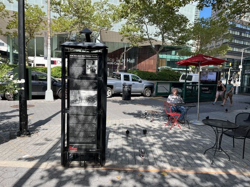
Location. 40° 46.403′ N, 73° 58.916′ W. Marker is in Manhattan, New York, in New York County. It is in Lincoln Square. Marker is at the intersection of Columbus Avenue and West 65th Street, on the right when traveling south on Columbus Avenue. Touch for map. Marker is at or near this postal address: 134 Columbus Ave, New York NY 10023, United States of America. Touch for directions.
Other nearby markers. At least 8 other markers are within walking distance of this marker. Lincoln Square (here, next to this marker); Richard Tucker (a few steps from this marker); Dante Park (about 600 feet away, measured in a direct line); Dante Alighieri (about 600 feet away); a different marker also named Dante Park (about 600 feet away); Edna Ferber (approx. 0.2 miles away); New York Society for Ethical Culture Building (approx. 0.2 miles away); Congregation Shearith Israel (approx. ¼ mile away). Touch for a list and map of all markers in Manhattan.
Credits. This page was last revised on January 31, 2023. It was originally submitted on August 14, 2022, by Devry Becker Jones of Washington, District of Columbia. This page has been viewed 997 times since then and 45 times this year. Photos: 1, 2, 3. submitted on August 14, 2022, by Devry Becker Jones of Washington, District of Columbia.


