Near Chester in Delaware County, Pennsylvania — The American Northeast (Mid-Atlantic)
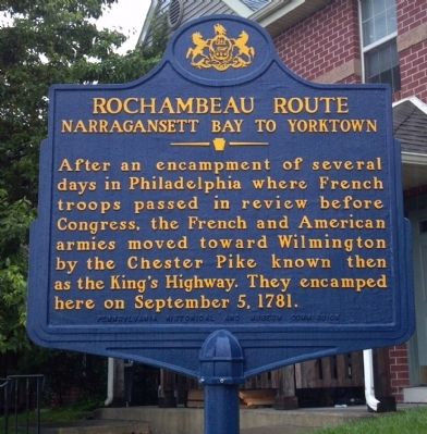
Rochambeau Route
Narragansett Bay to Yorktown
After an encampment of several days in Philadelphia where French troops passed in review before Congress, the French and American armies moved toward Wilmington [Delaware] by the Chester Pike known then as the King’s Highway. They encamped here on September 5, 1781.
Erected by Pennsylvania Historical and Museum Commission.
Topics and series. This historical marker is listed in this topic list: War, US Revolutionary. In addition, it is included in the Pennsylvania Historical and Museum Commission series list. A significant historical date for this entry is September 5, 1781.
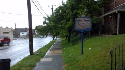
Location. 39° 51.517′ N, 75° 21.162′ W. Marker is near Chester, Pennsylvania, in Delaware County. Marker is on Morton Avenue (U.S. 13), on the right when traveling south. Touch for map. Marker is at or near this postal address: 1055 Morton Avenue, Chester PA 19013, United States of America. Touch for directions.
Other nearby markers. At least 8 other markers are within walking distance of this marker. Sun Village War Memorial (a few steps from this marker); Dr. Anna E. Broomall (approx. 0.2 miles away); Sun Shipbuilding and Dry Dock Company (approx. 0.4 miles away); Eddystone: A True Factory Town (approx. 0.6 miles away); Eddystone Rifle Plant (approx. 0.7 miles away); Viet Nam (approx. 0.8 miles away); Colonial Courthouse (approx. 0.8 miles away); Chester Fire Department (approx. 0.8 miles away). Touch for a list and map of all markers in Chester.
Also see . . . Revolutionary Route of Rochambeau. (Submitted on July 14, 2013, by Keith S Smith of West Chester, Pennsylvania.)
Credits. This page was last revised on August 15, 2022. It was originally submitted on July 14, 2013, by Keith S Smith of West Chester, Pennsylvania. This page has been viewed 849 times since then and 43 times this year. Last updated on August 15, 2022, by Carl Gordon Moore Jr. of North East, Maryland. Photos: 1, 2. submitted on July 14, 2013, by Keith S Smith of West Chester, Pennsylvania. • Bill Pfingsten was the editor who published this page.

