Roosevelt Island in Manhattan in New York County, New York — The American Northeast (Mid-Atlantic)
Queensboro Bridge Trolley Kiosk
The Roosevelt Island Historical Society Visitor Center
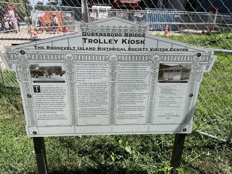
The kiosk at the Tram Plaza on Roosevelt Island is one of the five original kiosks that first identified the entrance to staircases at the trolley station at 59th Street and Second Avenue. These staircases led to the underground trolley car stations that were positioned at the Manhattan entrance to the Queensboro Bridge. The kiosk entrances date from the bridge's construction in 1909. The trolley system of five lines connected several Queens neighborhoods to Manhattan via the Queensboro Bridge.
One trolley was the "Bridge Local." It started at 59th Street and passed over Blackwell's Island (now Roosevelt Island), where it stopped to discharge and accept passengers from the roof of the Storehouse station. The nine-story elevator building was on the exact site where you are now standing. The trolley then proceeded to Vernon Avenue and Queens Plaza, where the carriages turned around for the return trip.
The Bridge Local trolley line rode on tracks located on the outer roadway of the lower level of the bridge. Queens-bound trolleys used the southern roadway, after exiting the underground station; Manhattan-bound trolleys
this page online
Of the five original kiosks, three were demolished. One remains at its original site at 59th Street and Second Avenue. It was restored by the City of New York Department of Transportation in 2005.
Our kiosk was transported in 1970 to the Brooklyn Children's Museum, where it served as the main entrance. In the late 1990's, the museum planned a new entrance and the kiosk faced demolition. Roosevelt Island Historical Society President Judith Berdy intervened and worked with the Museum and several city agencies to relocate this unique piece of New York City transportation history near its original home and extend its useful life with a new purpose: as the Roosevelt Island Historical Society Visitor Center.
In January 2005, the kiosk was transported by truck to Roosevelt Island, where it awaited a concrete foundation that would support its 68,000 pounds. In October

Photographed by Devry Becker Jones (CC0), August 13, 2022
2. Queensboro Bridge Trolley Kiosk Marker
The modern-day Roosevelt Island Tramway can be seen in the background. The tramway moves people in the air over the East River parallel to the Ed Koch Bridge, also known as the Queensboro Bridge or the 59th Street Bridge, of "Feelin' Groovy" fame. The tramway can be ridden using payment by Metrocard, similarly to the subway system.
The Roosevelt Island Historical Society Visitor Center kiosk opened in June 2007 and has welcomed thousands of visitors to the Island.
Erected by Roosevelt Island Historical Society.
Topics. This historical marker is listed in these topic lists: Bridges & Viaducts • Notable Buildings • Railroads & Streetcars. A significant historical month for this entry is January 2005.
Location. 40° 45.459′ N, 73° 57.27′ W. Marker is in Manhattan, New York, in New York County. It is on Roosevelt Island. It is on West Main Street east of West Road, on the right when traveling east. Touch for map. Marker is at or near this postal address: 300 E Main St, New York NY 10044, United States of America. Touch for directions.

Regionally, this marker is in New York City. It is also in the American Northeast, in the Mid-Atlantic, and on the Eastern Seaboard. Globally, it is in the North Atlantic Region, North America, the Western Hemisphere, the Western World, and the Anglosphere. Historically, it finds itself in what was once New Netherland and also one of the original Thirteen Colonies.
Other nearby markers. At least 8 other markers are within walking distance of this marker: Blackwell's Island (a few steps from this marker); Cornell Tech / Blackwell's Island Penitentiary / Goldwater Hospital / WPA-Era Murals (approx. 0.2 miles away); East River Roundabout (approx. 0.2 miles away); Dr. Alice Childress (approx. ¼ mile away); Designing for Nature (approx. ¼ mile away); Roosevelt Island and the Blackwell House (approx. ¼ mile away); Blackwell House (approx. ¼ mile away); Roosevelt Island (approx. 0.3 miles away). Touch for a list and map of all markers in Manhattan.
Another marker is no longer nearby. 24 Sycamores Playground (was approx. ¼ mile away but has been permanently removed).
Additional commentary.
1. About Roosevelt Island
Roosevelt Island is administratively part of the Borough of Manhattan, even though it is not directly on the Island of Manhattan.
— Submitted August 17, 2022, by Devry Becker Jones of Washington, District of Columbia.
Credits. This page was last revised on January 31, 2023. It was originally submitted on August 17, 2022, by Devry Becker Jones of Washington, District of Columbia. This page has been viewed 1,296 times since then and 107 times this year. Photos: 1, 2. submitted on August 17, 2022, by Devry Becker Jones of Washington, District of Columbia.
Editor’s want-list for this marker. A photo of the trolley kiosk • Can you help?
