Sentier in Paris in Département de Paris, Île-de-France, France — Western Europe
La rue du Croissant
— Histoire de Paris —
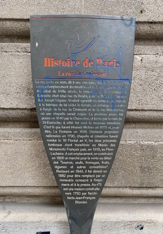
La rue porte ce nom, dû à une enseigne, depuis 1612. Le n°19 occupe l'emplacement du cimetière et de la chapelle St-Joseph Au début du XVIIe siècle, le cimetière de la paroisse St-Eustache était situé rue du Bouloi, près de l'hôtel du Chancelier Joseph Séguier. Voulant agrandir sa demeure, il proposa à la fabrique de lui céder le terrain, en échange d'un autre à l'angle de la rue du Croissant et de la rue Montmartre, où une chapelle serait érigée. La première pierre fut posée en 1640 par le Chancelier, et bénie par le curé de St-Eustache; à côté fut créé le nouveau cimetière. C'est là que furent inhumés Molière en 1673 et, peut- être, La Fontaine en 1695. Déclarés propriétés nationales en 1790, chapelle et cimetière furent vendus le 18 Floréal an V, les deux présumés tombeaux étant transférés au Musée des Monuments Français puis, en 1818, au Père- Lachaise. A cet emplacement, on construisit en 1806 un marché pour la vente au détail des "beurres, oeufs, fromages, fruits, légumes et autres comestibles". Restauré en 1843, il fut démoli en 1882 pour être remplacé par un immeuble consacré à l'imprimerie et à la presse. Au nº8 est une maison construite vers 1750 par l'architecte Jean-François Blondel.
The street bears this name, due to a sign, since 1612. No. 19 occupies the site of the cemetery and the chapel of St. Joseph. At the beginning of the 17th century, the cemetery of the parish of St. Eustache was located on the rue du Bouloi, near the mansion belonging to Chancellor Joseph Séguier. Wanting to enlarge his residence, he proposed to the factory to give him the land, in exchange for another lot at the corner of rue du Croissant and rue Montmartre, where a chapel would be erected. The first stone was laid in 1640 by the Chancellor, and blessed by the parish priest of St. Eustache; next to it the new cemetery was created. This is where Molière was buried in 1673 and, perhaps, La Fontaine in 1695. Declared national property in 1790, the chapel and cemetery were sold on 18 Floréal, year V, the two presumed tombs being transferred to the Museum of French Monuments then , in 1818, at the Père-Lachaise Cemetery. At this location, a market was built in 1806 for the retail sale of "butters, eggs, cheeses, fruits, vegetables and other edibles". Restored in 1843, it was demolished in 1882 to be replaced by a building devoted to printing and the press. At nº8 is a house built around 1750 by the architect Jean-François Blondel.
Erected by
Ville de Paris.
Topics and series. This historical marker is listed in this topic list: Roads & Vehicles. In addition, it is included in the Histoire de Paris series list. A significant historical year for this entry is 1612.
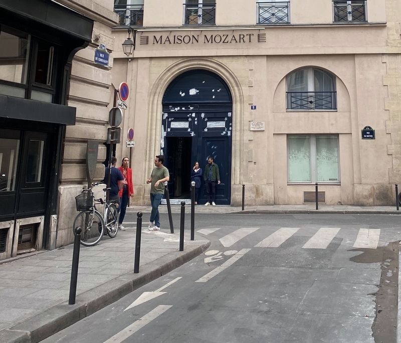
Location. 48° 52.118′ N, 2° 20.731′ E. Marker is in Paris, Île-de-France, in Département de Paris. It is in Sentier. Marker is at the intersection of Rue du Croissant and Rue du Sentier on Rue du Croissant. Touch for map. Marker is at or near this postal address: 15 Rue du Sentier, Paris, Île-de-France 75002, France. Touch for directions.
Other nearby markers. At least 8 other markers are within walking distance of this marker. W.A. Mozart (a few steps from this marker); Rue Montorgueil (approx. 0.3 kilometers away); François/Franz Liszt (approx. 0.3 kilometers away); Bruno Lenoir and Jean Diot (approx. 0.3 kilometers away); La rue Mandar (approx. 0.3 kilometers away); Admiral Tourville (approx. 0.3 kilometers away); La rue de la Jussienne (approx. 0.4 kilometers away); Middle School Public César Franck Jewish Children’s Deportation Memorial (approx. 0.4 kilometers away). Touch for a list and map of all markers in Paris.
Also see . . . Rue du Croissant (Paris) (Wikipedia, in French). (Submitted on August 17, 2022.)
Credits. This page was last revised on January 30, 2023. It was originally submitted on August 17, 2022, by Andrew Ruppenstein of Lamorinda, California. This page has been viewed 55 times since then and 11 times this year. Photos: 1, 2, 3. submitted on August 17, 2022, by Andrew Ruppenstein of Lamorinda, California.


