Near Custer in Custer County, South Dakota — The American Midwest (Upper Plains)
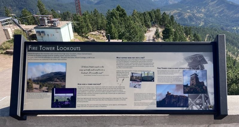
Fire Tower Lookouts
"It doesn't take much in the way of body and mind to be a lookout. It's mostly soul."
Norman Maclean "The Ranger the Cook and a Hole in the Sky”
HOW DOES A TOWER FUNCTION?
The typical fire lookout tower consists of a small room, known as a cab, located atop a large steel, or wooden tower. Historically, the tops of tall trees have also been used to mount permanent platorms. Sometmes natural rock may be used to create a lower plattorm. In some cases, the terrain makes it possible so there is no need for an additional tower and these are known as ground cabs. Ground cabs are called towers even if they don't sit on a tower.
Most have lightning rods that divert much of the energy from a lightning strike. The also have chairs in the middle of the room that often have insulators on the feet for extra protection.
In the beginning, fires were reported using telephones, carrer pigeons, and heliographs. Today most fires are relayed by radios or telephones.
WHAT HAPPENS WHEN THEY SPOT A FIRE?
Using mapping tools such as The Osborne Fire Finder or variations of it, the first objective is to pinpoint the exact location of the fire. The Osborne fire finder is used to obtain the direction (azimuth) and distances to a suspected fire. Once the location is identified the fire is reported to the local dispatcher with the location, relative size and any other crucial information.
Lookouts also report weather changes and plot the location lightning strikes during storms. The location of a strike is monitored for several days, just in case.
FIRES TOWERS COME IN MANY DIFFERENT SHAPES AND FORMS.
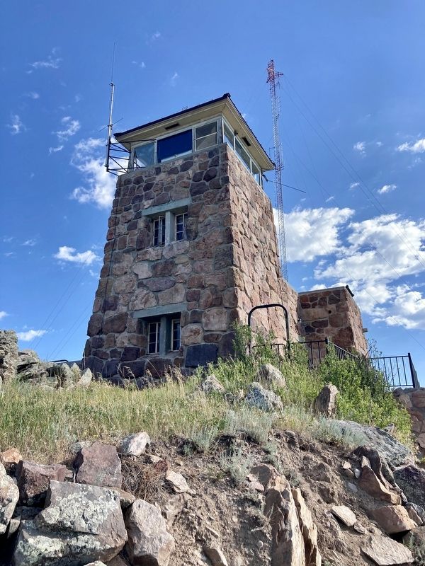
Mount Coolidge lookout tower is located in Custer State Park. Clarence Mann was the first lookout to live in the rock tower starting in 1941. He was later appointed Forest Supervisor for the State of South Dakota.
The first tower on the mountain was a log structure (pictured in the background) The current tower (pictured in the right) was one of the last projects completed by the Civilian Conservation Corps in the late 1930s. Built of local stone the tower rests atop a 6,023-foot peak and is still used today as a fire lookout and dispatch center.
Captions:
View of the Legion Lake Fire (2017) from atop Mt. Coolidge. This fire, one of the largest in Black Hills recorded history, burned over 54,000 acres. Much of the fire was in the same area of the 1988 Galena Fire which burned 16,000 acres in Custer State Park.
The summit of Black Elk Peak is the highest point in the Black Hills at 7,242 ft and has a commanding view of the Black Hills. Several lookouts were constructed on this mountain. The current stone fire tower constructed by the CCC in 1938 was specifically engineered for the granite summit. This fire tower was staffed until 1967.
The summit of Black Elk Peak and Harney Peak Fire Tower reside in the Black Elk Wilderness Area, and are only accessible by foot or horseback.
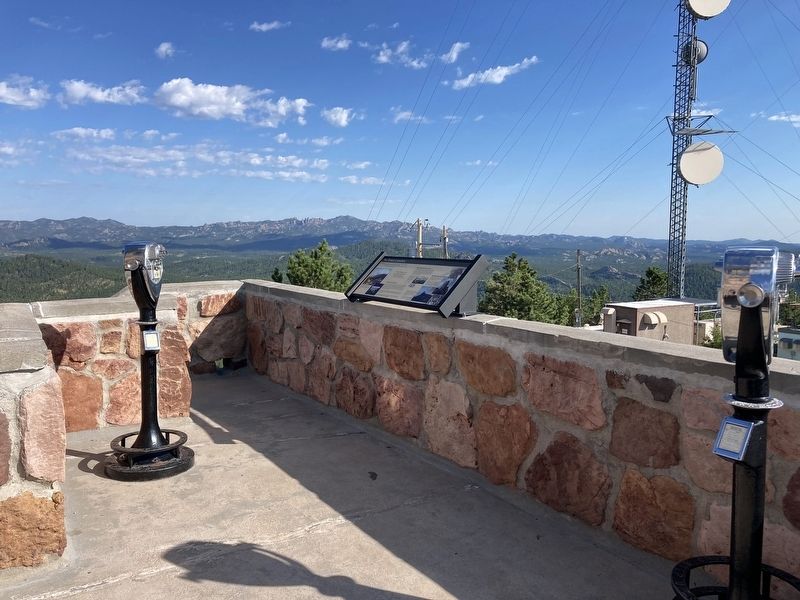
Erected by Custer State Park, South Dakota Department of Game, Fish and Parks.
Topics. This historical marker is listed in these topic lists: Charity & Public Work • Communications • Disasters • Environment. A significant historical year for this entry is 1938.
Location. 43° 44.688′ N, 103° 28.886′ W. Marker is near Custer, South Dakota, in Custer County. Marker can be reached from Mount Coolidge Lookout Road near State Highway 87. Touch for map. Marker is in this post office area: Custer SD 57730, United States of America. Touch for directions.
Other nearby markers. At least 8 other markers are within 2 miles of this marker, measured as the crow flies. A Cowboy Poet Lives Among the Pines (approx. 1.3 miles away); A Life of Peace and Solitude (approx. 1.4 miles away); The Good Life of a Poet Laureate (approx. 1.4 miles away); Life Has Its Ups and Downs (approx. 1.4 miles away); Leaving Prints on the Pages of History (approx. 1.4 miles away); Everyone has a Beginning (approx. 1½ miles away); “The Badger Hole” (approx. 1½ miles away); Civilian Conservation Corps Camp (approx. 1.9 miles away). Touch for a list and map of all markers in Custer.
Credits. This page was last revised on August 20, 2022. It was originally submitted on August 19, 2022, by Connor Olson of Kewaskum, Wisconsin. This page has been viewed 170 times since then and 26 times this year. Photos: 1, 2, 3. submitted on August 19, 2022, by Connor Olson of Kewaskum, Wisconsin. • Andrew Ruppenstein was the editor who published this page.


