West Newton in Westmoreland County, Pennsylvania — The American Northeast (Mid-Atlantic)
West Newton
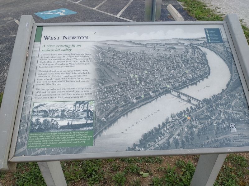
A river crossing in an industrial valley
The original settlement was named Simralls Ferry and later Robb's Ferry after Isaac Robb, who laid the town out in 1794 after Federal troops burned his fences when they quelled the Whiskey Insurrection. The town was first called Robbszown, and later was renamed West Newton.
The river opened to two-way steamboat navigation in 1850, and ten years later the railroad came to town Good transportation and coal from local mines turned West Newton into an ideal manufacturing center.
West Newton's first and biggest industry was the Markle paper mill, opened 1859 to supply western Pennsylvania with quality paper. Wood pulp came from a mill in Markleton Somerset County After both mills closed in 1893 because of water pollution, the West Newton mill was bought by the US Radiator Company, which made heating radiators here until 1955
Topics. This historical marker is listed in these topic lists: Settlements & Settlers • Waterways & Vessels. A significant historical year for this entry is 1772.
Location. 40° 12.734′ N, 79° 46.178′ W. Marker is in West Newton, Pennsylvania, in Westmoreland County. Marker is on Collinsburg Road, on the right when traveling south. Touch for map. Marker is at or near this postal address: 111 Collinsburg Rd, West Newton PA 15089, United States of America. Touch for directions.
Other nearby markers. At least 8 other markers are within 4 miles of this marker, measured as the crow flies. Pioneer Point Sculpture (about 400 feet away, measured in a direct line); a different marker also named West Newton (about 400 feet away); West Newton Town Map And Directory / Trail Map And Points Of Interest (about 400 feet away); West Newton Honor Roll (approx. ¼ mile away); Lowber Honor Roll (approx. 2.4 miles away); Mustard Veterans Honor Roll (approx. 2.9 miles away); George Adam Weddell (approx. 3.1 miles away); Darr Mine Disaster (approx. 4.1 miles away). Touch for a list and map of all markers in West Newton.
Credits. This page was last revised on August 23, 2022. It was originally submitted on August 19, 2022, by Craig Doda of Napoleon, Ohio. This page has been viewed 286 times since then and 64 times this year. Photos: 1, 2. submitted on August 19, 2022, by Craig Doda of Napoleon, Ohio. • Bill Pfingsten was the editor who published this page.

