Beaver in Beaver County, Pennsylvania — The American Northeast (Mid-Atlantic)
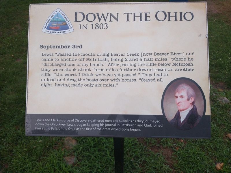
Down The Ohio
In 1803
| — | September 3rd | — |
Photographed by Craig Doda, July 24, 2022
1. Down The Ohio Marker
Lewis and Clark's Corps of Discovery gathered men and supplies as they journeyed down the Ohio River. Lewis began keeping his journal in Pittsburgh and Clark joined him at the Falls of the Ohio as the first of the great expeditions began.
Topics and series. This historical marker is listed in this topic list: Exploration. In addition, it is included in the Lewis & Clark Expedition series list.
Location. 40° 41.476′ N, 80° 18.189′ W. Marker is in Beaver, Pennsylvania, in Beaver County. It is on River Road, on the right when traveling east. Touch for map. Marker is at or near this postal address: 650 River Rd, Beaver PA 15009, United States of America.
this page online

Regionally, this marker is in Greater Pittsburgh. It is also in the American Northeast, in the Mid-Atlantic, and in the Ohio River Valley. Globally, it is in North America, the Western Hemisphere, the Western World, and the Anglosphere. Historically, it finds itself in what was once the Haudenosaunee (Iroquois) Confederacy and also one of the original Thirteen Colonies.
Other nearby markers. At least 8 other markers are within walking distance of this marker: Fort McIntosh (here, next to this marker); a different marker also named Fort McIntosh (a few steps from this marker); a different marker also named Fort McIntosh (within shouting distance of this marker); a different marker also named Fort McIntosh (within shouting distance of this marker); General Lachlan McIntosh (within shouting distance of this marker); a different marker also named Fort McIntosh (within shouting distance of this marker); Fort McIntosh 1978 The Site Restoration (within shouting distance of this marker); Commanding Officers (within shouting distance of this marker). Touch for a list and map of all markers in Beaver.
Photographed by Craig Doda, July 24, 2022
2. Down The Ohio Marker
Photographed by Craig Doda, July 24, 2022
3. Down The Ohio Marker
Credits. This page was last revised on August 23, 2022. It was originally submitted on August 19, 2022, by Craig Doda of Napoleon, Ohio. This page has been viewed 275 times since then and 21 times this year. Photos: 1, 2, 3. submitted on August 19, 2022, by Craig Doda of Napoleon, Ohio. • Bill Pfingsten was the editor who published this page.
