South Haven in Van Buren County, Michigan — The American Midwest (Great Lakes)
Michigan Central Railroad Yard
Photographed by Joel Seewald, August 13, 2022
1. Michigan Central Railroad Yard Marker
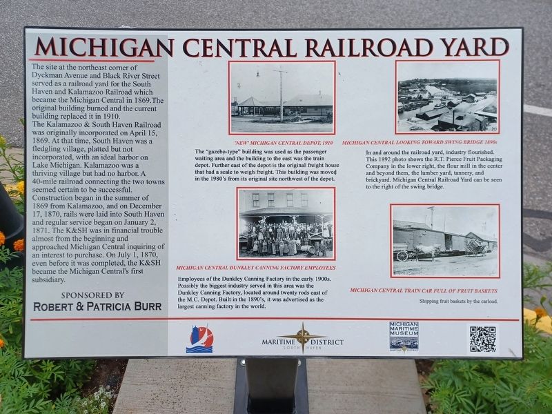
The site at the northeast corner of Dyckman Avenue and Black River Street served as a railroad yard for the South Haven and Kalamazoo Railroad which became the Michigan Central in 1869. The original building burned and the current building replaced it in 1910.
The Kalamazoo & South Haven Railroad was originally incorporated on April 15, 1869. At that time, South Haven was a fledgling village, platted but not incorporated, with an ideal harbor on Lake Michigan. Kalamazoo was a thriving village but had no harbor. A 40-mile railroad connecting the two towns seemed certain to be successful.
Construction began in the summer of 1869 from Kalamazoo, and on December 17, 1870, rails were laid into South Haven and regular service began on January 2, 1871. The K&SH was in financial trouble almost from the beginning and approached Michigan Central inquiring of an interest to purchase. On July1, 1870, even before it was completed, the K&SH became the Michigan Central's first subsidiary.
Erected by Robert & Patricia Burr, City of South Haven, & Michigan Maritime Museum.
Topics. This historical marker is listed in
this page online
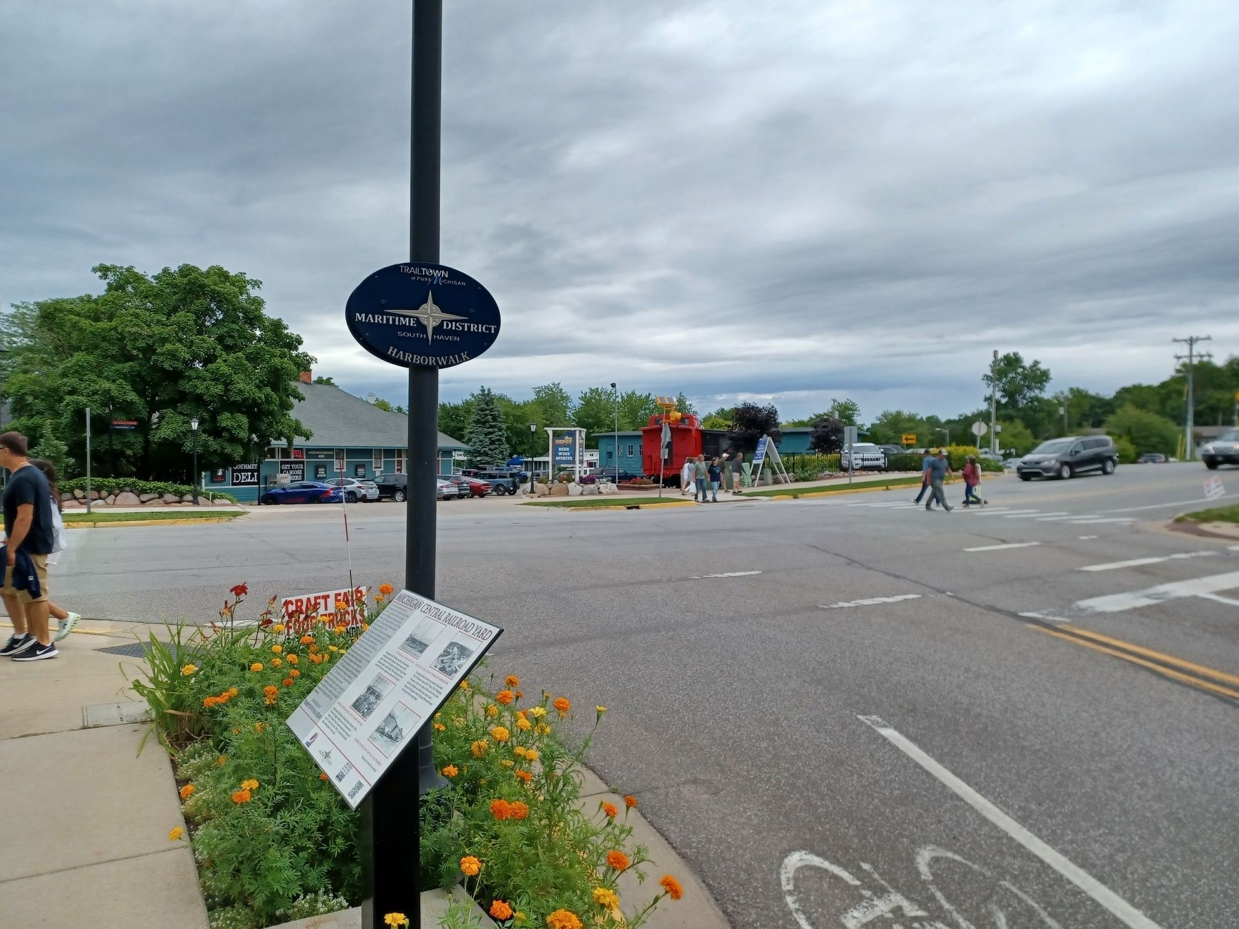
Location. 42° 24.37′ N, 86° 16.313′ W. Marker is in South Haven, Michigan, in Van Buren County. It is at the intersection of Williams Street and Dyckman Avenue, on the left when traveling south on Williams Street. Touch for map. Marker is at or near this postal address: 532 Dyckman Avenue, South Haven MI 49090, United States of America. Touch for directions.

Regionally, this marker is in Southwest Michigan and specifically in one of the Lake Michigan Shore counties. It is also in the American Midwest. Globally, it is in North America, on the Great Lakes, in the Western Hemisphere, in the Western World, and in the Anglosphere. Historically, it finds itself in what was once the Northwest Territory.
Other nearby markers. At least 8 other markers are within walking distance of this marker: Fruit Industry (within shouting distance of this marker); Conger House, Circa 1856 (about 500 feet away, measured in a direct line); Wilhelm Baum (about 600 feet away); Dyckman Avenue Bascule Bridge (about 600 feet away); Resort Industry (about 700 feet away);
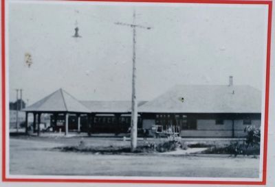
2. Marker detail: "New" Michigan Central Depot, 1910
The "gazebo-type" building was used as the passenger waiting area and the building to the east was the train depot. Further east of the depot is the original freight house that had a scale to weigh freight. This building was moved in the 1980's from its original site northwest of the depot.
More about this marker. Marker is part of South Haven's Harbor Walk series.
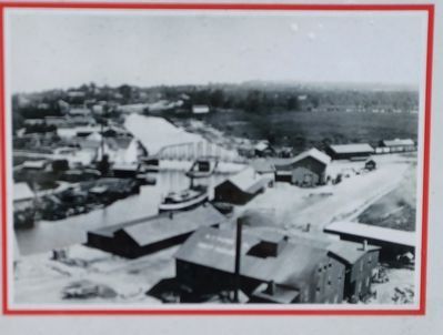
3. Marker detail: Michigan Central Looking Toward Swing Bridge 1890s
In and around the railroad yard, industry flourished. This 1892 photo shows the R.T. Pierce Fruit Packaging Company in the lower right, the flour mill in the center and beyond them, the lumber yard, tannery, and brickyard. Michigan Central Railroad Yard can be seen to the right of the swing bridge.
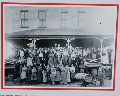
4. Marker detail: Michigan Central Dunkley Canning Factory Employees
Employees of the Dunkley Canning Factory in the early 1900s. Possibly the biggest industry served in this area was the Dunkley Canning Factory, located around twenty rods east of the M.C. Depot. Built in the 1890's, it was advertised as the largest canning factory in the world.
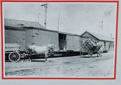
5. Marker detail: Michigan Central Train Car Full of Fruit Baskets
Shipping fruit baskets by the carload.
Photographed by Joel Seewald, August 13, 2022
6. Michigan Central Railroad Yard Marker
Credits. This page was last revised on August 23, 2022. It was originally submitted on August 22, 2022, by Joel Seewald of Madison Heights, Michigan. This page has been viewed 502 times since then and 50 times this year. Photos: 1, 2, 3, 4, 5, 6. submitted on August 22, 2022, by Joel Seewald of Madison Heights, Michigan.
