
Near Madison in Morgan County, Georgia — The American South (South Atlantic)
Brownwood-Centennial
Photographed by David Seibert, June 20, 2009
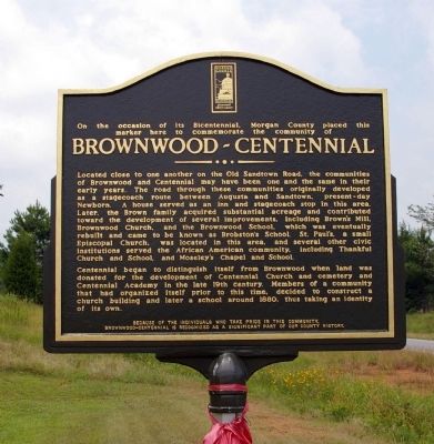
1. Brownwood-Centennial Marker
Located close to one another on the Old Sandtown Road, the communities of Brownwood and Centennial may have been one and the same in their early years. The road through these communities originally developed as a stagecoach route between Augusta and Sandtown, present-day Newborn. A house served as an inn and stagecoach stop in this area. Later, the Brown family acquired substantial acreage and contributed toward the development of several improvements, including Brown's Mill, Brownwood Church, and the Brownwood School, which was eventually rebuilt and came to be known as Brobstom's School. St. Paul's, a small Episcopal Church, was located in this area, and several other civic institutions served the African American community, including Thankful Church and School, and Moseley's Chapel and School.
Centennial began to distinguish itself from Brownwood when land was donated for the development of Centennial Church and cemetery and Centennial Academy in the late 19th century. Members
this page online
Because of the individuals who take pride in this community, Brownwood-Centennial is recognized as a significant part of our county history.
Erected 2009 by Morgan County Bicentennial Committee.
Topics. This historical marker is listed in these topic lists: African Americans • Education • Religion & Religious Structures • Roads & Vehicles • Settlements & Settlers. A significant historical year for this entry is 1880.
Location. 33° 33.698′ N, 83° 33.338′ W. Marker is near Madison, Georgia, in Morgan County. It is at the intersection of Brownwood Road and Thankful Road, on the right when traveling north on Brownwood Road. Touch for map. Marker is in this post office area: Madison GA 30650, United States of America. Touch for directions.

Regionally, this marker is in Georgia’s Antebellum Trail and in the Piedmont. It is also in the American South and specifically in the Deep South. Globally, it is in North America, the Western Hemisphere,
Photographed by David Seibert, June 20, 2009
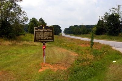
2. Brownwood-Centennial Marker
Looking south on Brownwood Road
Other nearby markers. At least 8 other markers are within 6 miles of this marker, measured as the crow flies: Dorsey (approx. 3 miles away); Antioch Baptist Church (approx. 4 miles away); Reese (approx. 4.2 miles away); Confederate Monument (approx. 5 miles away); Freedmen's Schooling (approx. 5.1 miles away); The Town Commons (approx. 5.2 miles away); Joshua Hill Home (approx. 5.2 miles away); Advanced Education Center (approx. 5.2 miles away). Touch for a list and map of all markers in Madison.
Photographed by David Seibert, June 20, 2009
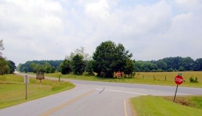
3. Brownwood-Centennial Marker
Looking west on Thankful Road at the intersection with Brownwood Road
Photographed by David Seibert, June 20, 2009
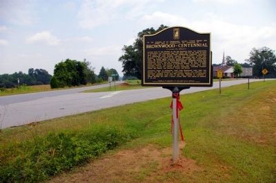
4. Brownwood-Centennial Marker
Looking north; Brownwood Road is to the left, and Thankful Road heads east. The Brownwood Baptist Church can be seen on Thankful Road.
Credits. This page was last revised on January 31, 2020. It was originally submitted on July 3, 2009, by David Seibert of Sandy Springs, Georgia. This page has been viewed 1,274 times since then and 62 times this year. Photos: 1, 2, 3, 4. submitted on July 3, 2009, by David Seibert of Sandy Springs, Georgia. • Craig Swain was the editor who published this page.
