Near Muscle Shoals in Colbert County, Alabama — The American South (East South Central)
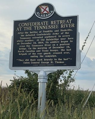
Confederate Retreat at the Tennessee River
"They did their work bravely to the last" —Union General George H. Thomas
Erected 2015 by Alabama Historical Association.
Topics and series. This historical marker is listed in this topic list: War, US Civil. In addition, it is included in the Alabama Historical Association series list. A significant historical date for this entry is December 26, 1864.
Location. 34° 47.449′ N, 87° 33.812′ W. Marker is near Muscle Shoals, Alabama, in Colbert County. Marker is on Bainbridge Road (County Road 83) 0.3 miles north of River Road (County Route 40), on the right when traveling north. Touch for map. Marker is in this post office area: Muscle Shoals AL 35661, United States of America. Touch for directions.
Other nearby markers. At least 8 other markers are within 4 miles of this marker, measured as the crow flies. Bainbridge (approx. one mile away); Clyde Carter House (approx. 2 miles away); The Old Brick Presbyterian Church (approx. 2.6 miles away); Wilson Dam and the TVA System (approx. 3˝ miles away); How Does Wilson Dam Work? (approx. 3˝ miles away); Origin of the Francis Turbine (approx. 3˝ miles away); Birds of North Alabama (approx. 3.6 miles away); TVA: Our Enduring Mission/Powering Prosperity (approx. 3.6 miles away). Touch for a list and map of all markers in Muscle Shoals.
Credits. This page was last revised on September 4, 2022. It was originally submitted on September 3, 2022, by Joel S Mize of Muscle Shoals AL, Alabama. This page has been viewed 295 times since then and 103 times this year. Photo 1. submitted on September 3, 2022, by Joel S Mize of Muscle Shoals AL, Alabama. • Bernard Fisher was the editor who published this page.
Editor’s want-list for this marker. Wide shot of marker and its surroundings. • Can you help?
