Crieve Hall in Nashville in Davidson County, Tennessee — The American South (East South Central)
Ellington Agricultural Center
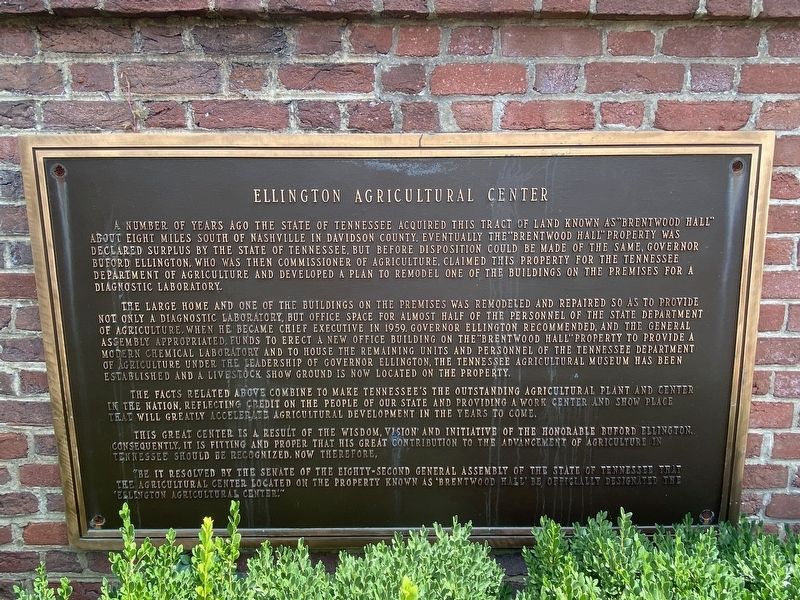
Photographed by Darren Jefferson Clay, August 25, 2022
1. Ellington Agricultural Center Marker
The large home and one of the buildings on the premises was remodeled and repaired so as to provide not only a diagnostic laboratory, but office space for almost half of the personnel of the State Department of Agriculture. When he became Chief Executive in 1959, Governor Buford Ellington recommended, and the General Assembly appropriated, funds to erect a new office building on the "Brentwood Hall" property to provide a modern chemical laboratory and to house the remaining units and personnel of the Tennessee Department of Agriculture under the leadership of Governor Ellington, the Tennessee Agricultural
this page online
The facts related above combine to make Tennessee's the outstanding agricultural plant and center in the nation, reflecting credit on the people of our state and providing a work center and show place that will greatly accelerate agricultural development in the years to come.
This great center is a result of the wisdom, vision, and initiative of the honorable Buford Ellington. Consequently, it is fitting and proper that his great contribution to the advancement of agriculture in Tennessee should be recognized, now therefore,
"Be it resolved by the Senate of the eighty-second General Assembly of the state of Tennessee that the agricultural center located on the property known as "Bentwood Hall" be officially designated the "Ellington Agricultural Center."
Topics. This historical marker is listed in this topic list: Agriculture.
Location. 36° 3.884′ N, 86° 44.951′ W. Marker is in Nashville, Tennessee, in Davidson County. It is in Crieve Hall. It is on Hogan Road. Touch for map. Marker is
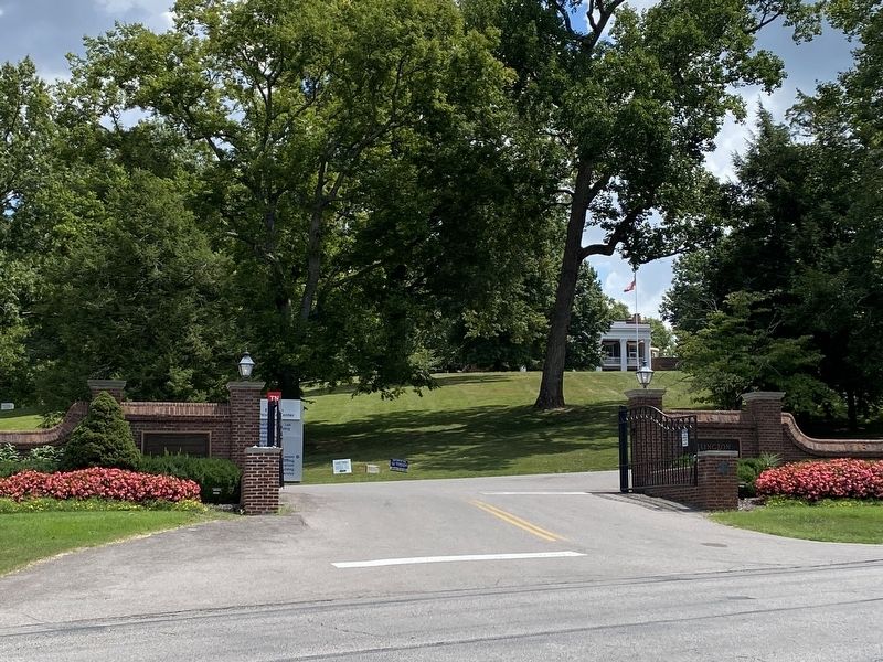
Photographed by Darren Jefferson Clay, August 25, 2022
2. Ellington Agricultural Center Marker

Regionally, this marker is in Middle Tennessee. It is also in the American South and specifically in the Upper South. Globally, it is in North America, the Western Hemisphere, the Western World, and the Anglosphere. Historically, it finds itself in what was once the territory of the Mississippian Culture, one of the Confederate States of America, and the Antebellum South.
Other nearby markers. At least 8 other markers are within 2 miles of this marker, measured as the crow flies: Caring for Historic Cabins (approx. 0.2 miles away); a different marker also named Ellington Agricultural Center (approx. 0.2 miles away); The Caldwell Years (approx. 0.2 miles away); Early History (approx. 0.2 miles away); Kitchen Garden History (approx. 0.2 miles away); Crieve Hall (approx. half a mile away); Smokehouse (approx. 1.2 miles away); Earliest Residents of Travellers Rest (approx. 1.2 miles away). Touch for a list and map of all markers in Nashville.
Credits. This page was last revised on February 7, 2023. It was originally submitted on September 3, 2022, by Darren Jefferson Clay of Duluth, Georgia. This page has been viewed 505 times since then and 56 times this year. Photos: 1, 2. submitted on September 3, 2022, by Darren Jefferson Clay of Duluth, Georgia. • Mark Hilton was the editor who published this page.
