Long Sault in Stormont, Dundas and Glengarry United Counties, Ontario — Central Canada (North America)
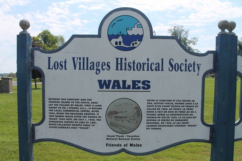
Wales
— Lost Villages Historical Society —
Entre le cimetière et l'Île Boisée au sud, existait Wales, nomme ainsi a la suite d'un court sejour du Prince de Galles en 1860. Au début, la couronne a fait un don de terre au Dr J. Stuart. Après la construction du chemin de fer en 1856, le village est devenu le centre de commerce règional. En 1958, le lac Saint- Laurent recouvrait l'unique "Wales" du Canada.
Topics. This historical marker is listed in these topic lists: Settlements & Settlers • Waterways & Vessels. A significant historical year for this entry is 1856.
Location. 45° 1.019′ N, 74° 55.546′ W. Marker is in Long Sault, Ontario, in Stormont, Dundas and Glengarry United Counties. Marker is on Stormont, Dundas and Glengarry County Road 2 (County Highway 2), on the left when traveling west. This marker is located outside the St. Lawrence Valley Cemetery. Touch for map. Marker is in this post office area: Long Sault ON K0C 1M0, Canada. Touch for directions.
Other nearby markers. At least 8 other markers are within 6 kilometers of this marker, measured as the crow flies. Dickinson's Landing (here, next to this marker); Lake St. Lawrence / Lac Saint-Laurent (approx. 2.7 kilometers away); Moulinette (approx. 5.6 kilometers away); Moulinette Station (approx. 6 kilometers away); Ernest (Ernie) McDonald Blacksmith Shop / Forgeron (approx. 6 kilometers away); Zina Hill Barber Shop / Le Salon de Barbier de Zina Hill (approx. 6 kilometers away); Corn Crib (approx. 6 kilometers away); Manson / LaPierre General Store (approx. 6 kilometers away). Touch for a list and map of all markers in Long Sault.
Credits. This page was last revised on September 9, 2022. It was originally submitted on September 4, 2022, by Robert Rusaw of Massena, New York. This page has been viewed 54 times since then and 3 times this year. Photo 1. submitted on September 4, 2022, by Robert Rusaw of Massena, New York. • Andrew Ruppenstein was the editor who published this page.
