Long Sault in Stormont, Dundas and Glengarry United Counties, Ontario — Central Canada (North America)
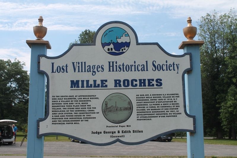
Mille Roches
Lost Villages Historical Society
Topics. This historical marker is listed in these topic lists: Industry & Commerce • Settlements & Settlers • Waterways & Vessels. A significant historical year for this entry is 1901.
Location. 45° 2.066′ N, 74° 50.146′ W. Marker is in Long Sault, Ontario, in Stormont, Dundas and Glengarry United Counties. Marker is on Waterfront Trail (County Highway 2), on the right when traveling east. Touch for map. Marker is in this post office area: Long Sault ON K0C 1P0, Canada. Touch for directions.
Other nearby markers. At least 8 other markers are within walking distance of this marker. The Stuart House / La Maison Stuart (approx. 1.2 kilometers away); Forbes Memorial Reading Room / Salle de Lecture Commémorative Forbes (approx. 1.2 kilometers away); Sandtown Advent Christian Church (approx. 1.2 kilometers away); S.S. #17 - Roxborough Township School / S.S. #17 - L'Ecole du Canton de Roxborough (approx. 1.2 kilometers away); MacLeod Log House / Maison en Bois MacLeod (approx. 1.3 kilometers away); Lost Villages of the St Lawrence (approx. 1.3 kilometers away); Manson / LaPierre General Store (approx. 1.3 kilometers away); Corn Crib (approx. 1.3 kilometers away). Touch for a list and map of all markers in Long Sault.
Credits. This page was last revised on September 26, 2022. It was originally submitted on August 31, 2022, by Robert Rusaw of Massena, New York. This page has been viewed 87 times since then and 15 times this year. Last updated on September 4, 2022, by Robert Rusaw of Massena, New York. Photo 1. submitted on August 31, 2022, by Robert Rusaw of Massena, New York. • Bill Pfingsten was the editor who published this page.
