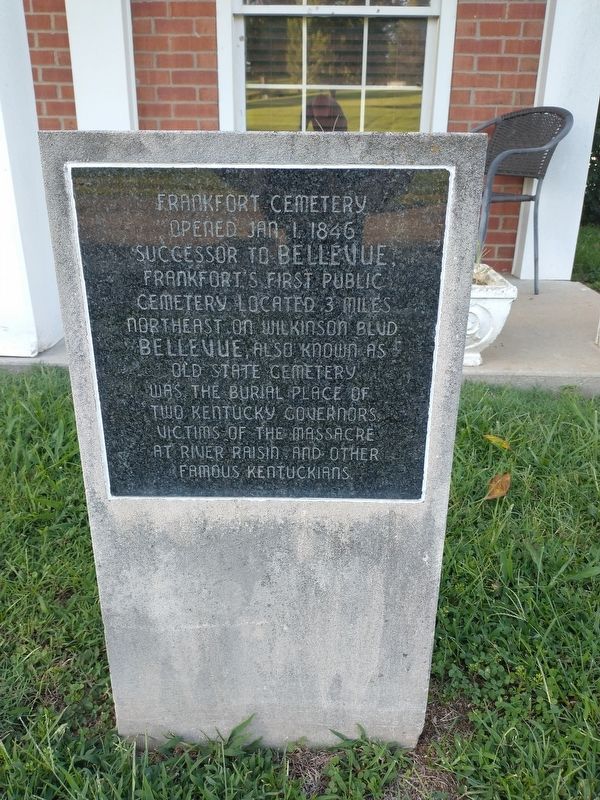
Frankfort in Franklin County, Kentucky — The American South (East South Central)
Frankfort Cemetery
Topics. This historical marker is listed in this topic list: Cemeteries & Burial Sites. A significant historical date for this entry is January 1, 1846.
Location. 38° 11.864′ N, 84° 52.025′ W. Marker is in Frankfort, Kentucky, in Franklin County. Marker is on East Main Street, on the right when traveling east. Touch for map. Marker is at or near this postal address: 214 E Main St, Frankfort KY 40601, United States of America. Touch for directions.
Other nearby markers. At least 8 other markers are within walking distance of this marker. Daniel Boone - Pioneer / Grave of Daniel Boone (about 400 feet away, measured in a direct line); Frankfort (about 400 feet away); Governor William Gobel (about 700 feet away); Our Confederate Dead (approx. 0.2 miles away); The Trabue Family Vault (approx. ¼ mile away); T-8 90mm Antitank Gun (approx. ¼ mile away); Daniel Boone's Grave (approx. ¼ mile away); Kentucky's State Mound (approx. 0.3 miles away). Touch for a list and map of all markers in Frankfort.
Credits. This page was last revised on September 10, 2022. It was originally submitted on September 8, 2022, by Craig Doda of Napoleon, Ohio. This page has been viewed 180 times since then and 45 times this year. Photos: 1, 2. submitted on September 8, 2022, by Craig Doda of Napoleon, Ohio. • Mark Hilton was the editor who published this page.

