Springettsbury Township near North York in York County, Pennsylvania — The American Northeast (Mid-Atlantic)
Codurus Creek Water Trail
A Tale of Two Creeks
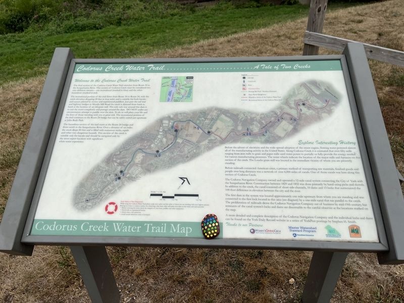
Welcome to the Codorus Creek Water Trail
The final section of the Codurus Creek Water Trail stretches from Route 30 to the Susquehanna River. This section of Codurus Creek must be considered two very different streams — one recreational (marked in blue) and the other hazardous (marked in red).
The recreational portion of the trail flows from Route 30 to Route 24, with the creek elevation dropping 20 feet in four miles and is suitable for both kayaks and canoes piloted by novice and experienced paddlers. Just past the rail trail and highway bridges at Mundis Mill Road the creek is damned from bank to bank at the location of an old grain mill. The only safe way around this dam is to exit the water completely and portage around the dam. Do not under any circumstances attempt to paddle over the dam. To do so will place your life and the lives of those traveling with you at great risk. The recreational portion of the trail continues to the Route 24 bridge but can be safely exited just upstream at John Rudy Park.
The hazardous section of the trail starts at the Route 24 bridge and flows north to the Susquehanna River. Over a distance of six miles the creek drops 80 feet and is filled with numerous rocks, rapids and other very dangerous hazards. This section of the creek is suitable only for kayaks and should be navigated only by the most expert kayakers with significant white-water experience.
Exploring Interesting History
Before the advent of electricity and the wide-spread adoption of the steam engine, flowing water powered almost all of the manufacturing activity in the United States. Along Codorus Creek it is estimated that over fifty mills ranging from iron mills to grain and paper mills used water power to partially or fully provide the energy needed for various manufacturing processes. The water wheels indicate the location of the major mills and furnaces on this section of the creek. The Loucks grain mill was located in the immediate vicinity of where you are presently standing.
Before railroads connected American cities, a primary method of transporting raw materials, finished goods and people over long distances was a network of over 4,000 miles of canals. One of those canals was here along this section of Codorus Creek.
The Codorus Navigation Company owned and operated a 12-mile canal system connecting the City of York with the Susquehanna River. Construction between 1829 and 1932 was done primarily by hand using picks and shovels. In addition to the creek, the canal consisted of short side-channels, 10 dams and 13 locks that surmounted the 100-foot difference in elevation
The first dam in the system was located approximately one mile upstream from where you are standing and was connected to the first lock located in this area (see diagram) by a one-mile canal that ran parallel to the creek. The proliferation of railroads drove the Codorus Navigation Company out of business by mid-19th century, but remnants of the canal system's locks and dams are discernible to the careful observer at the locations marked on the map.
A more detailed and complete description of the Codorus Navigation Company and the individual locks and dams can be found on the York Daily Record website in a series of YorkPast postings by Stephen H. Smith.
Erected by Women's Giving Circle, York County Community Foundation; Master Watershed Steward Program, PennState Extension; Natural Alliance of York; York County Parks.
Topics. This historical marker is listed in these topic lists: Industry & Commerce • Waterways & Vessels. A significant historical year for this entry is 1829.
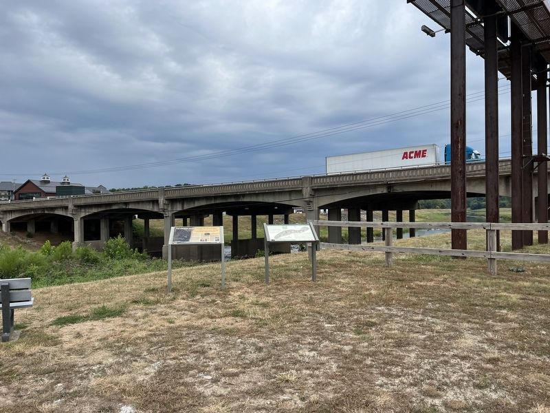
Location. 39° 59.005′ N, 76° 43.379′ W. Marker is near North York, Pennsylvania, in York County. It is in Springettsbury Township. Marker is on Loucks Mill Road just south of Arsenal Road (U.S. 30), on the right when traveling south. Touch for map. Marker is in this post office area: York PA 17406, United States of America. Touch for directions.
Other nearby markers. At least 8 other markers are within walking distance of this marker. Human Uses Through The Centuries (here, next to this marker); York (approx. 0.4 miles away); York City Cemetery (approx. 0.7 miles away); Margaret Duncan Beitzel / Jacob Horlebein (approx. 0.9 miles away); Henry Bayler / Sarah Ann Bayler (approx. 0.9 miles away); Prospect Hill Soldiers' Lot (approx. 0.9 miles away); Philip Livingston (approx. 0.9 miles away); Civil War Memorial (approx. 0.9 miles away). Touch for a list and map of all markers in North York.
Credits. This page was last revised on February 7, 2023. It was originally submitted on September 9, 2022, by Devry Becker Jones of Washington, District of Columbia. This page has been viewed 122 times since then and 40 times this year. Photos: 1, 2. submitted on September 9, 2022, by Devry Becker Jones of Washington, District of Columbia.

