Butte in Silver Bow County, Montana — The American West (Mountains)
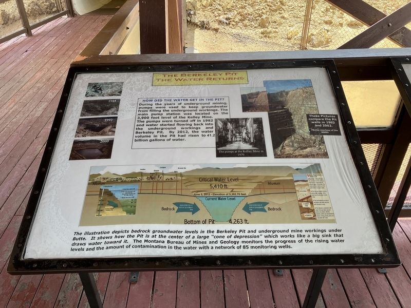
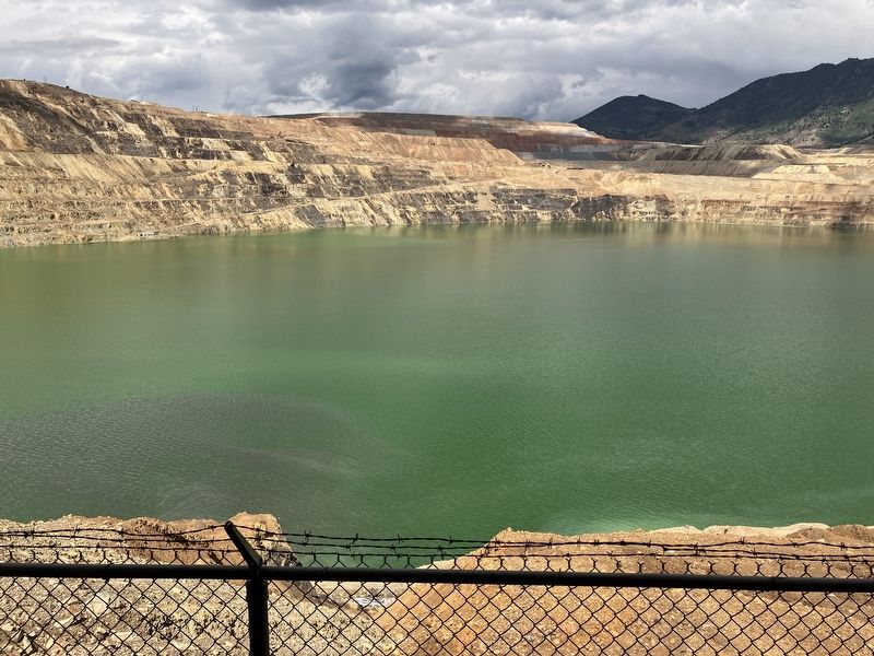
The Berkeley Pit: The Water Returns

Photographed By Barry Swackhamer, August 6, 2022
1. The Berkeley Pit: The Water Returns Marker
Captions: (upper left) The Berkeley Pit 1979, 1985, 1992, 2000.; (upper right) The pumps of the Kelley Mine in 1979. These Pictures compare the Pit walls in 1983 and 2002.; (Bottom graphic) The illustration depicts bedrock groundwater levels in the Berkeley Pit and underground mine workings under Butte. It shows how the Pit is at the center of a large "cone of depression" which works like a big sink that draws water toward it. The Montana Bureau of Mines and Geology monitors the progress of the rising water and levels the amount of contamination in the water with a network of 85 monitoring wells.
Topics. This historical marker is listed in these topic lists: Industry & Commerce • Man-Made Features • Natural Resources.
Location. 46° 0.705′ N, 112° 31.073′ W. Marker is in Butte, Montana, in Silver Bow County. Marker can be reached from Continental Drive near Madison Street, on the left when traveling south. The viewing platform is accessed through a tunnel from the ticket office. Touch for map. Marker is at or near this postal address: 300 Continental Drive, Butte MT 59701, United States of America. Touch for directions.
Other nearby markers. At least 8 other markers are within walking distance of this marker. Mining The Berkeley Pit 1955-1982 (here, next to this marker); The Berkeley Pit Threatens the Water (here, next to this marker); Butte Mining Through the Years (here, next to this marker); James Naughten Residence (approx. 0.6 miles away); Butte's Underground Mines (approx. 0.7 miles away); Butte (approx. 0.7 miles away); St. Joseph's Catholic Church (approx. ¾ mile away); Salvation Army Building (approx. ¾ mile away). Touch for a list and map of all markers in Butte.
Credits. This page was last revised on September 10, 2022. It was originally submitted on September 10, 2022, by Barry Swackhamer of Brentwood, California. This page has been viewed 193 times since then and 53 times this year. Photos: 1, 2. submitted on September 10, 2022, by Barry Swackhamer of Brentwood, California.
