Kingsville in Kleberg County, Texas — The American South (West South Central)
Chamberlain Cemetery
Photographed by Dave W, March 19, 2022
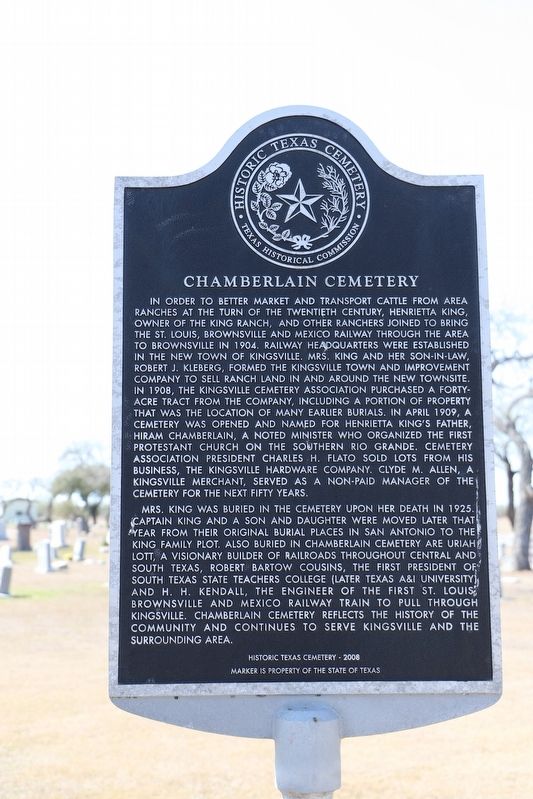
1. Chamberlain Cemetery Marker
In order to better market and transport cattle from area ranches at the turn of the twentieth century, Henrietta King, owner of the King Ranch, and other ranchers joined to bring the St. Louis, Brownsville and Mexico Railway through the area to Brownsville in 1904. Railway headquarters were established in the new town of Kingsville. Mrs. King and her son-in-law, Robert J. Kleberg, formed the Kingsville Town and Improvement Company to sell ranch land in and around the new townsite. In 1908, the Kingsville Cemetery Association purchased a forty-acre tract from the company, including a portion of property that was the location of many earlier burials. In April 1909, a cemetery was opened and named for Henrietta King's father, Hiram Chamberlain, a noted minister who organized the first Protestant church on the southern Rio Grande. Cemetery Association president Charles H. Flato sold lots from his business, the Kingsville Hardware Company. Clyde M. Allen, a Kingsville merchant, served as a non-paid manager of the cemetery for the next fifty years.
Mrs. King was buried in the cemetery upon her death in 1925. Captain King and a son and daughter were moved later that year from their original burial places in San Antonio to the King family plot. Also buried in Chamberlain Cemetery are Uriah Lott, a visionary builder of railroads throughout central and south Texas, Robert Bartow Cousins, the first president of South Texas State Teachers College (later Texas A&I University) and H. H. Kendall, the engineer of the first St. Louis, Brownsville and Mexico Railway train to pull through Kingsville. Chamberlain Cemetery reflects the history of the community and continues to serve Kingsville and the surrounding area.
Erected 2008 by Texas Historical commission. (Marker Number 15961.)
Topics. This historical marker
this page online
Location. 27° 30.361′ N, 97° 52.684′ W. Marker is in Kingsville, Texas, in Kleberg County. It is on West Hoffman Avenue. Touch for map. Marker is at or near this postal address: 700 W Hoffman Ave, Kingsville TX 78363, United States of America. Touch for directions.

Regionally, this marker is on the American Gulf Coast. Globally, it is in North America, a Gulf of Mexico state, the Western Hemisphere, the Western World, and the Anglosphere. Historically, it finds itself in what was once New Spain, the Republic of Texas, and one of the Confederate States of America.
Other nearby markers. At least 8 other markers are within walking distance of this marker: Dawson Richard Murchison (within shouting distance of this marker); King Star Baptist Church (approx. half a mile away); First Baptist Church of Kingsville (approx. ¾ mile away); Henrietta M. King High School (approx. 0.8 miles away); 9/11 Memorial (approx. 0.9 miles away); First Presbyterian Church of Kingsville
Photographed by Dave W, March 19, 2022
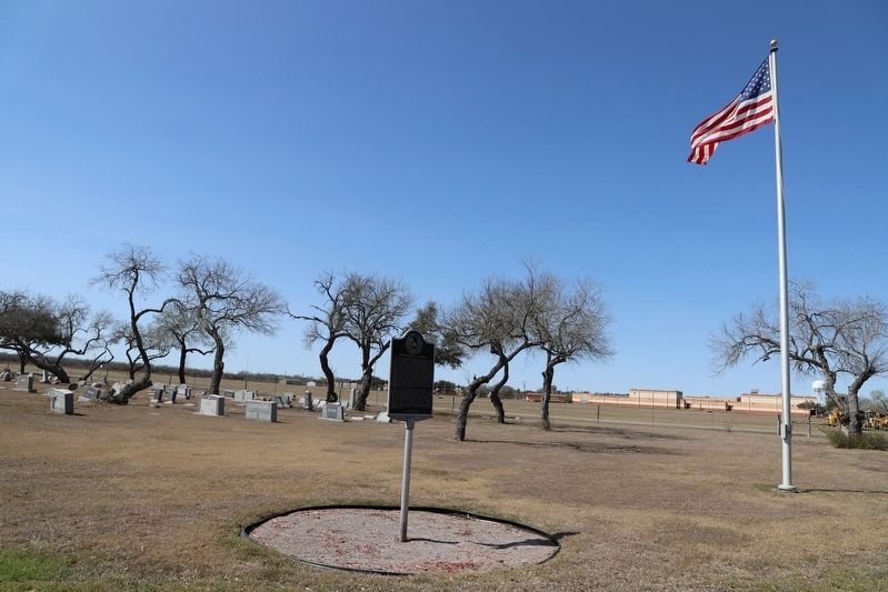
2. Chamberlain Cemetery Marker
Credits. This page was last revised on December 1, 2024. It was originally submitted on September 11, 2022, by Dave W of Co, Colorado. This page has been viewed 817 times since then and 127 times this year. Photos: 1, 2. submitted on September 11, 2022, by Dave W of Co, Colorado. • J. Makali Bruton was the editor who published this page.
