South Kansas City in Jackson County, Missouri — The American Midwest (Upper Plains)
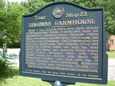
Thomas Farmhouse
About 4 p.m. Oct. 23, 1864 after their victory at Westport the Union leaders met here for consultation. Included were Generals Curtis, Blunt, Pleasonton and Dietzler; Gov. Carney and Sen. Jim Lane of Kansas. The Confederates had lost over 1,000 men and General Price was forced to retreat south but with his army intact. The Union also suffered heavy losses. Union leaders discussed their next step. Pursuit would be started with Blunt's and Pleasonton's Cavalry. Two days later two of Price's Divisions were practically destroyed at Mine Creek near Pleasanton, Kansas.
End of Tour. Start at Westport and Pennsylvania.
Erected 1964 by Civil War Round Table of Kansas City and Dr. Bert Maybee, Civil War Round Table founder. (Marker Number 23.)
Topics and series. This historical marker is listed in this topic list: War, US Civil. In addition, it is included in the Missouri – Battle of Westport series list. A significant historical year for this entry is 1864.
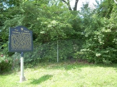
Location. 38° 57.209′ N, 94° 35.764′ W. Marker is in Kansas City, Missouri, in Jackson County. It is in South Kansas City. Marker is at the intersection of 96th Terrace and Wornall Road, on the right on 96th Terrace. This marker is on the Northwest corner of 96th Terrace and Wornall Road. Touch for map . Marker is in this post office area: Kansas City MO 64114, United States of America. Touch for directions.
Other nearby markers. At least 8 other markers are within 3 miles of this marker, measured as the crow flies. Remembrance of Trails Past (approx. 0.8 miles away); "The Boy Scout" (approx. one mile away); Frank S. Land Memorial (approx. 1˝ miles away); Alexander Majors House (approx. 1.9 miles away); Preservation and Restoration of Alexander Majors House (approx. 1.9 miles away); Russell's Ford (approx. 2.3 miles away); James Beckwourth (approx. 2.3 miles away); Trail Hazards (approx. 2.3 miles away). Touch for a list and map of all markers in Kansas City.
Also see . . . Battle of Westport. Civil War Muse website entry:
Stop 23 of the Battle of Westport (Submitted on July 6, 2009, by Thomas Onions of Olathe, Kansas.)
Credits. This page was last revised on February 10, 2023. It was originally submitted on July 6, 2009, by Thomas Onions of Olathe, Kansas. This page has been viewed 1,898 times since then and 39 times this year. Photos: 1, 2, 3, 4. submitted on July 6, 2009, by Thomas Onions of Olathe, Kansas. • Craig Swain was the editor who published this page.


