Stonycreek Township near Stoystown in Somerset County, Pennsylvania — The American Northeast (Mid-Atlantic)
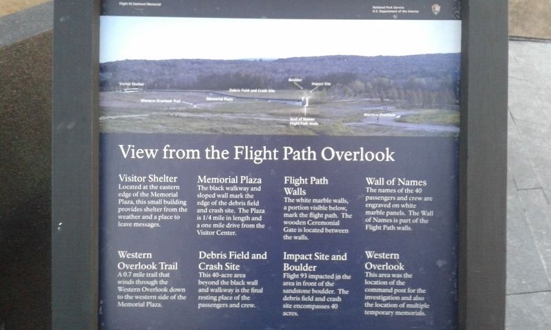
View from the Flight Path Overlook
Flight 93 National Memorial
| — | National Park Service, U.S. Department of the Interior | — |
Photographed by Craig Doda, November 11, 2018
1. View from the Flight Path Overlook Marker
Visitor Shelter
Located at the eastern edge of the Memorial Plaza, this small building provides shelter from the weather and a place to leave messages.
Memorial Plaza
The black walkway and sloped wall mark the edge of the debris field and crash site. The Plaza is 1/4 mile in length and a one mile drive from the Visitor Center.
Flight Path Walls
The white marble walls, a portion visible below, mark the flight path. The wooden Ceremonial Gate is located between the walls.
Wall of Names
The names of the 40 passengers and crew are engraved on white marble panels. The Wall of Names is part of the Flight Path walls.
Western Overlook Trail
A0.7 mile trail that winds through the Western Overlook down to the western side of the Memorial Plaza.
Debris Field and Crash Site
This 40-acre area beyond the black wall and walkway is the final resting place of the passengers and crew.
Impact Site and Boulder
Flight 93 impacted in the area in front of the sandstone boulder. The debris field and crash site encompasses 40 acres.
Western Overlook
This area was the location
this page online
Erected by National Park Service, U.S. Department of the Interior.
Topics. This historical marker is listed in these topic lists: 9/11 Attacks • Air & Space. A significant historical date for this entry is September 11, 2001.
Location. This marker has been replaced by another marker nearby. It was located near 40° 3.346′ N, 78° 54.365′ W. Marker was near Stoystown, Pennsylvania, in Somerset County. It was in Stonycreek Township. It was on Skyline Road, on the right when traveling north. On the grounds of the Flight 93 National Memorial. Touch for map. Marker was at or near this postal address: 415 Approach Rd, Stoystown PA 15563, United States of America. Touch for directions.

Regionally, this marker was in the Laurel Highlands. It was also in the American Northeast, in the Mid-Atlantic, in Appalachia, and specifically in Northern Appalachia. Globally, it was in North America, the Western Hemisphere, the Western World, and the Anglosphere. Historically, it found itself in what was once the Haudenosaunee (Iroquois) Confederacy

Photographed by Linda Walcroft
2. View from the Flight Path Overlook Marker
Other nearby markers. At least 8 other markers are within walking distance of this location: A different marker also named View from the Flight Path Overlook (a few steps from this marker); Welcome To Flight 93 National Memorial (a few steps from this marker); Flight 93 (within shouting distance of this marker); The Search for Evidence (within shouting distance of this marker); First View (about 400 feet away, measured in a direct line); Flight 93 Temporary Memorial (approx. ¼ mile away); Overlooking History (approx. 0.3 miles away); Flight 93 National Memorial (approx. 0.3 miles away). Touch for a list and map of all markers in Stoystown.
More about this marker. The marker was replaced with an updated sign with similar text sometime before April 2024.
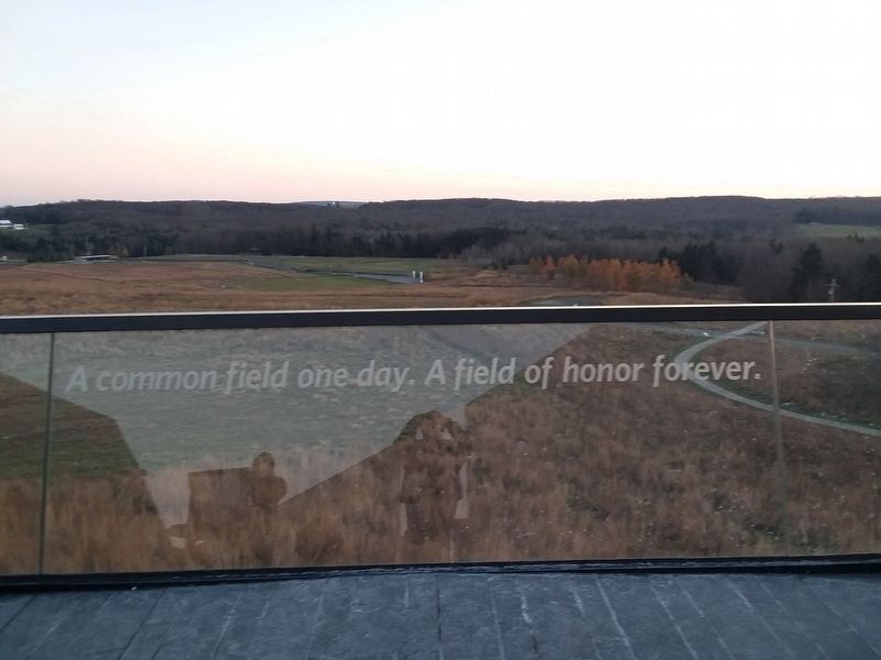
Photographed by Craig Doda, November 11, 2018
3. View from the Flight Path Overlook Marker
Credits. This page was last revised on October 6, 2026. It was originally submitted on December 29, 2020, by Craig Doda of Napoleon, Ohio. This page has been viewed 568 times since then and 52 times this year. Last updated on September 12, 2022, by Linda Walcroft of Woodstock, Virginia. Photos: 1. submitted on December 29, 2020, by Craig Doda of Napoleon, Ohio. 2. submitted on September 12, 2022, by Linda Walcroft of Woodstock, Virginia. 3. submitted on December 29, 2020, by Craig Doda of Napoleon, Ohio. • Bill Pfingsten was the editor who published this page.
