Radium Spring in Dougherty County, Georgia — The American South (South Atlantic)
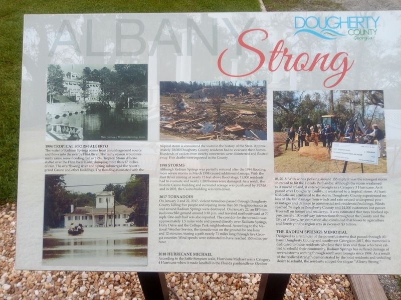
Albany Strong
Dougherty County Georgia
Inscription.
1994 Tropical Storm Alberto
The water of Radium Springs comes from an underground source and flows into the nearby Flint River. The rainy season would normally cause some flooding, but in 1994, Tropical Storm Alberto stalled over the Flint River basin, dumping more than 27 inches of rain. The overflowing river and spring submerged the resort's grand Casino and other buildings. The flooding associated with the tropical storm is considered the worst in the history of the State. Approximately 20,000 Dougherty County residents had to evacuate their homes. Hundreds of caskets from nearby cemeteries were disinterred and floated away. Five deaths were reported in the County.
1998 Storm
Although Radium Springs was partially restored after the 1994 flooding, more severe storms in March 1998 caused additional damage. With the Flint River cresting at nearly 15 feet above flood stage, 11,000 residents had to evacuate and nearly 1,200 homes were damaged. As a result, the historic Casino building and surround acreage was purchased by FEMA and in 2002, the Casino building was torn down.
2017 Tornadoes
On January 2 and 22, 2017, violent tornadoes passed through Dougherty County killing five people and injuring more than 50. Neighborhoods in and around Radium Springs were destroyed. On January 22, an EF3 tornado touched ground around 3:30 p.m. and traveled northeastward at 70 mph. One-inch hail was also reported. The corridor for the tornado was approximately 1.5 miles wide and passed directly over Radium Springs, Holly Drive and the College Park neighborhood. According to the National Weather Service, the tornado was on the ground for one hour and 12 minutes, tearing a path nearly 71 miles long through five Georgia counties. Wind speeds were estimated to have reached 150 miles per hour.
2018 Hurricane Michael
According to the Saffir-Simpson scale, Hurricane Michael was a Category 4 Hurricane when it made landfall in the Florida panhandle on October 10, 2018. With winds peaking around 155 mph, it was the strongest storm on record to hit the Florida Panhandle. Although the storm weakened as it moved inland, it entered Georgia as a Category 3 Hurricane. As it passed over Dougherty County, it weakened to a tropical storm. At least 60 deaths are attributed to the storm. Dougherty County experienced no loss of life, but damage from winds and rain caused widespread power outages and damage to commercial and residential buildings. Winds reached 74 mph in Dougherty County and 24,000 customers lost power. Trees fell on homes and roadways. It was estimated that trees blocked approximately 100 roadway intersections throughout the County and the City of Albany.
An estimation also concluded that losses to agriculture and forestry in the region was in excess of $3 billion.
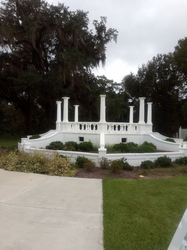
The Radium Springs Memorial
Designed as a reminder of the powerful storms that passed through Albany, Dougherty County and southwest Georgia in 2017, this memorial is dedicated to those residents who lost their lives and those who have rallied to rebuild their community. Radium Springs has suffered damage of several storms coming through southwest Georgia since 1994. As a result of the resilient strength demonstrated by the local residents and unfailing desire to rebuild, the residents adoped the slogan "Albany Strong." Photo Courtesy of Thronateeska Heritage Center
Photo Courtesy of WFXL-FOX31
Topics. This historical marker is listed in this topic list: Disasters.
Location. 31° 31.548′ N, 84° 8.167′ W. Marker is in Radium Spring, Georgia, in Dougherty County. Marker can be reached from the intersection of Radium Springs Road and Holly Drive, on the right when traveling south. Touch for map. Marker is at or near this postal address: 2505 Radium Springs Rd, Albany GA 31705, United States of America. Touch for directions.
Other nearby markers. At least 8 other markers are within 4 miles of this marker, measured as the crow flies. Radium Springs Resort (within shouting distance of this marker); Flint River Flood (approx. 3.1 miles away); Georgia Civil Rights Trail: The Albany Movement (approx. 3.4 miles away); Flood of July 7, 1994 (approx. 3.4 miles away); Ray Charles (approx. 3.6 miles away); Flint River Bridge World War I Memorial (approx. 3.6 miles away); The Bridge House (approx. 3.7 miles away); Nelson Tift Building (approx. 3.7 miles away).
Credits. This page was last revised on September 13, 2022. It was originally submitted on September 13, 2022, by James L.Whitman of Eufaula, Alabama. This page has been viewed 134 times since then and 18 times this year. Photos: 1, 2. submitted on September 13, 2022, by James L.Whitman of Eufaula, Alabama. • Bernard Fisher was the editor who published this page.

