South San Francisco in San Mateo County, California — The American West (Pacific Coastal)
Cut Stone Bridge
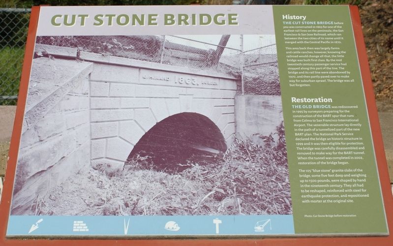
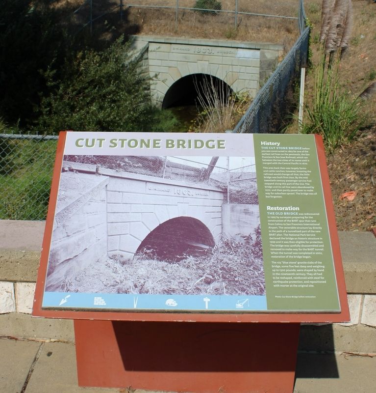
The Cut Stone Bridge before you was constructed in 1863 for one of the earliest rail lines on the peninsula, the San Francisco & San Jose Railroad, which ran between the two cities of its name until it merged with the Central Pacific in 1870.
This area back then was largely farms and cattle ranches; however, knowing the railroad would change all that, the little bridge was built first class. By the mid twentieth century passenger service had stopped along this part of the line. The bridge and its rail line were abandoned by 1970, and then partly paved over to make way for suburban sprawl. The bridge was all but forgotten.
Restoration
The Old Bridge was rediscovered in 1995 by surveyors preparing for the construction of the BART spur that runs from Colma to San Francisco International Airport. The venerable structure lay directly in the path of a tunnelized part of the new BART plan. The National Park Service declared the bridge an historic structure in 1999 and it was then eligible for protection. The bridge was carefully disassembled and removed to make way for the BART tunnel. When the tunnel was completed in 2002, restoration of the bridge began.
The 105 “blue stone” granite slabs of the bridge, some five feet deep and weighing up to 1500 pounds, were shaped by hand in the nineteenth century. They all had to be reshaped, reinforced with steel for earthquake protection, and repositioned with mortar at the original site.
Photo: Cut Stone Bridge before restoration
Topics. This historical marker is listed in these topic lists: Architecture • Bridges & Viaducts • Railroads & Streetcars. A significant historical year for this entry is 1863.
Location. 37° 38.756′ N, 122° 25.319′ W. Marker is in South San Francisco, California, in San Mateo County. Marker is at the intersection of Centennial Way Trail and Spruce Avenue, on the right when traveling north on Centennial Way Trail. The resin marker is mounted to a metal stand north of the intersection. Touch for map. Marker is in this post office area: South San Francisco CA 94080, United States of America. Touch for directions.
Other nearby markers. At least 8 other markers are within walking distance of this marker. Development of Industry in the Area (here, next to this marker); Transportation Evolution (a few steps from this marker); Tanforan Racetrack Japanese Assembly Center (approx. 0.7 miles away); First Shipboard Landing (approx. 0.7 miles away); Seabiscuit (approx. ¾ mile away); Tanforan Assembly Center Commemorative Garden (approx. ¾ mile away); Plymire-Schwarz House (approx. 0.8 miles away); South San Francisco General Hospital (approx. 0.8 miles away). Touch for a list and map of all markers in South San Francisco.
Also see . . . Cut Stone Bridge on BridgeHunter.com.
"The Cut Stone Bridge is significant in engineering history."(Submitted on September 18, 2022, by Joseph Alvarado of Livermore, California.)
Credits. This page was last revised on September 18, 2022. It was originally submitted on September 18, 2022, by Joseph Alvarado of Livermore, California. This page has been viewed 112 times since then and 9 times this year. Photos: 1, 2, 3, 4. submitted on September 18, 2022, by Joseph Alvarado of Livermore, California.


